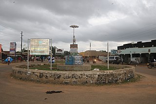
Adjumani is a town in the Northern Region of Uganda. It is the main municipal, administrative, and commercial centre of Adjumani District. The district is named after the town.
Colleen Bawn is a town in Zimbabwe.
Bugamba is an urban centre in the Western Region of Uganda. It is one of the trading centres in Mbarara District.
Mlimba is a town in central Tanzania on the plains.

Mindat Township is a township located in Mindat District in the Chin State of Myanmar. The township is located between latitude 21.19 and 21.47, longitude 93.23 and 94.29. The third highest peak in Myanmar, Nat Ma Taung at 3,053 metres (10,016 ft), is visible from here, though it is within Kanpetlet township boundary. Mindat was a part of Pakokku Hill Tracts District.
Kabanda is a village in the Bassar Prefecture in the Kara Region of north-western Togo. The village is located west the towns of Afoou and Kalia and east of Sante Bas.
Malioma is a village in the Manni Department of Gnagna Province in eastern Burkina Faso. The village has a population of 378. The climate of the village is a 'semi-arid steppe'.
Isingiro is a town in the Western Region of Uganda. It is the main municipal, administrative, and commercial center of Isingiro District and the site of the district's headquarters.

Amolatar is a town in Northern Uganda. It is the main municipal, administrative and commercial centre of Amolatar District. The district is named after the town.
Bukedea is a town in the Eastern Region of Uganda. It is the chief municipal, administrative, and commercial center of Bukedea District, and the district headquarters are located there.
Abim is a town in the Northern Region of Uganda. It is the chief municipal, administrative, and commercial center of Abim District. The district is named after the town.
Alebtong is a town in the Northern Region of Uganda. It is the chief municipal, administrative, and commercial centre of Alebtong District. The district is named after the town.

Melindwr is a community in the county of Ceredigion, Wales, to the east of Aberystwyth and is 71.6 miles (115.1 km) from Cardiff and 173.8 miles (279.7 km) from London. In 2011 the population of Melindwr was 1070 with 54.7% of them able to speak Welsh.
Libongue is a town and commune of Angola, located in the province of Huíla.
Cainde is a commune of Angola, located in the province of Namibe, Angola, Africa.
Zonkwa is the Zangon Kataf Local Government Area as well as the Bajju Chiefdom headquarters, in southern Kaduna state in the Middle Belt region of Nigeria.
Jaamac Liibaan is a village in Burao District, in the Togdheer region of Somaliland.
Xagal is a town in Berbera District, in the Sahil Region of Somaliland.


