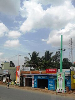
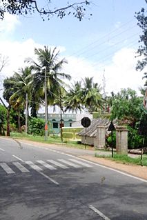
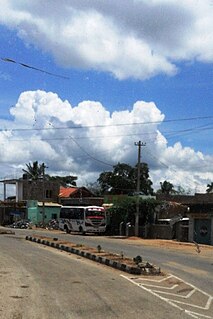
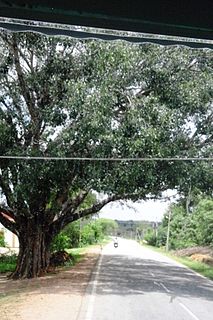
Alambur (also Alamburu) is a village in Mysore district of Karnataka, India.
Contents


Coordinates: 12°07′06″N76°43′30″E / 12.118446°N 76.724994°E
Alambur (also Alamburu) is a village in Mysore district of Karnataka, India.
Coordinates: 12°07′06″N76°43′30″E / 12.118446°N 76.724994°E
Alambur is located on the road from Nanjangud to Tirumakudal Narsipur. [1]
The Government Higher Primary School was established in 1946. The school has six teachers handling classes from one to eight. [2]
Alambur has a population of 2,073, with a total of 488 families. Literacy is 51%. [3]
Alambur village is administered by the village council called a Panchayath. It comes under Nanjangod Taluk. [4]

Mysuru District is an administrative district located in the southern part of the state of Karnataka, India. It is the administrative headquarters of Mysore Division.Chamarajanagar District was carved out of the original larger Mysore District in the year 1998. The district is bounded by Chamrajanagar district to the southeast, Mandya district to the east and northeast, Kerala state to the south, Kodagu district to the west, and Hassan district to the north.

Nanjangud, officially known as Nanjanagudu, is a city in the Mysuru district of Indian state of Karnataka. Nanjangud lies on the banks of the river Kapila, 23 km from the city of Mysore. Nanjangud is famous for the Srikanteshwara Temple located here. Nanjangud is also called Dakshina Kashi. This city is also famous for a type of banana grown in the region called the Nanjanagoodu rasabale. Nanjangud's local administrative unit was designated as a Municipal Committee in 2015 by including Devirammanahalli and Kallahalli village.

Mysore division, officially Mysuru division, is an administrative division in the southern Indian state of Karnataka. It is one of four administrative divisions in Karnataka, with others being Bangalore division, Belgaum division, Gulbarga division. Mysore division comprises eight districts of Karnataka, namely, Chamarajanagar, Chikmagalur, Dakshina Kannada, Hassan, Kodagu, Mandya, Mysore and Udupi district. The city of Mysore is the administrative headquarters of the division. Mysore division covers parts of historical Old Mysore region and southern part of Coastal Karnataka.The total area of the division is 43,503 sq.km. The total population as of 2011 census is 12,563,598.

Hedathale is a village in the southern state of Karnataka, India. It is located in the Nanjangud taluk of Mysore district in Karnataka.

Hullahalli is a village in the southern state of Karnataka, India. It is located in the Nanjangud taluk of Mysore district in Karnataka.
Kadakola is a Town and a suburb of Mysuru metropolitan area in the southern state of Karnataka, India. It is located in the Mysore taluk of Mysore district. In November 2020, Kadakola was upgraded from a Gram Panchayat to a Town Panchayat and a gazetted notification was passed on November 26, 2020. The notification combines Kadakola and Mandakalli villages coming under Kadakola GP, Badipalya, Gudumadanahalli, S. Uttanahalli and Hosahundi villages coming under Hosahundi GP, Marase and Madaragalli villages coming under Devalapura GP, K.M. Hundi, K.N. Hundi, Gejjagalli and Yeligehundi villages, covering a total area of 34.71 km2. The combined population of the newly formed town is 19,969.

Thandavapura is a village in the southern state of Karnataka, India. It is located in the Nanjangud taluk of Mysore district in Karnataka.

Sutturu is a village on the banks of river Kabini, in the state of Karnataka, India. It is located in the Nanjangud taluk in the district of Mysore. It is famous for the Suttur Mutt which is one of most prominent spiritual centers of India.
Varuna is a village in Mysore district of Karnataka state, India.
Saragooru Nanjangud is a small village in Mysore district of Karnataka state, India.
Nagarle is a village in Mysore district of Karnataka state, India.
Kahalli is a small village in Mysore district of Karnataka state, India.

Sujathapuram is a village in Mysore district of Karnataka state, India.

Kavalande is a village in Nanjangud taluk, Mysore district of Karnataka state, India.

Chinnadagudihundi is a village in Mysore district, Karnataka, India.

Konanur or Paduvalamarahalli is a village in Nanjangud taluk of Mysore district, Karnataka state, India.

Kellamballi is a small village in Chamarajanagar district of Karnataka state, India.
Uthanahalli is a small village on Ooty Road near Mysore, Karnataka, India.

Golur is a small village in Mysore district of Karnataka state, India. It is located 2 kilometres (1.2 mi) east of Nanjangud town and forms a part of H. D. Kote Taluk.
Nanjangud Legislative Assembly constituency is one of the 224 Legislative Assembly constituencies of Karnataka state in India.