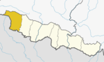
Narayani was one of the fourteen zones of Nepal until the restructuring of zones to Provinces, located in the central south of the country. The headquarter of Narayani zone was Hetauda. Narayani Zone is named after the Narayani River which is on the western border of the zone, separating it from the Gandaki and Lumbini zones. Narayani means beloved of Narayan which is Parvati his sister, and Narayan refers to Lord Vishnu in the Hindu religion.

Chitwan District is one of 77 districts of Nepal, and takes up the southwestern corner of Bagmati Province. Bharatpur, largest city of Nepal after Kathmandu, is its administrative centre. It covers 2,238.39 km2 (864.25 sq mi), and in 2011 had a population of 579,984 people. Bharatpur is the commercial and service centre of South Central Nepal and a major destination for higher education, health care and transportation in the region. Chitwan lies in the Terai region of Nepal. It is in the drainage basin of the Gandaki River and is roughly triangular, taking that river as its meandering northwestern border, and a modest watershed border, with India, as the basis of its southern limit.

Parsa District (Nepali: पर्सा जिल्लाListen , a part of Province No. 2 in Terai plain, is one of the seventy-seven districts of Nepal. The district, with Birgunj as its district headquarters, covers an area of 1,353 km2 and has a population of 497,219. According to the locals, Parsa is named after Parsagadhi temple situated in the district.

Birgunj is a metropolitan city in Parsa District in Province No. 2 of southern Nepal. It lies 135 km (84 mi) south of the capital Kathmandu, attached in the north to Raxaul in the border of the Indian state of Bihar. As an entry point to Nepal from Patna and Kolkata, Birgunj is known as the "Gateway to Nepal". It is also called "Commercial capital of Nepal". The town has significant economic importance for Nepal as most of the trade with India is via Birgunj and the Indian town of Raxaul. Tribhuvan Highway links Birgunj to Nepal's capital, Kathmandu. Birgunj was one of the first three municipalities formed during the rule of Prime Minister Mohan Shumsher Jang Bahadur Rana. It was declared a Metropolitan City on 22 May 2017 along with Biratnagar and Pokhara. Birgunj is one of the largest city in Nepal and largest in Province no. 2. Birgunj is the sixth most populated metropolis of the nation.
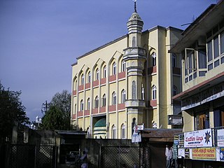
Islam is a minority religion in Nepal. According to the 2011 Nepal census, Nepal has 1 million Muslims comprising 4.4% of the population of Nepal.

Parsa is a rural municipality in Sarlahi District, a part of Province No. 2 in Nepal. It is situated 10 km East from Malangwa which is headquarter of Sarlahi. It was formed in 2016 occupying current 6 sections (wards) from previous 6 former VDCs. It occupies an area of 23.12 km2 with a total population of 21,650. The major language spoken in the rural municipality are Maithili and Bajjika.
Bindyabasini is a rural municipality in Parsa District in Province No. 2 of Nepal. It was formed in 2016 occupying current 5 sections (wards) from previous 5 former VDCs. It occupies an area of 26.04 km2 with a total population of 24,468.
Gardi is a village development committee in Parsa District in the Narayani Zone of southern Nepal. At the time of the 2011 Nepal census it had a population of 4358 people living in 782 individual households. There were 2,201 males and 2,157 females at the time of census.
Mahuwan is a village development committee in Parsa District in the Narayani Zone of southern Nepal. The village is surrounded by Ramnagari in South, Lakhanpur in West, Vouratar in East and Kauwaban Kataiya in North. At the time of the 2011 Nepal census it had a population of 4,837 people living in 761 individual households. There were 2,472 males and 2,365 females at the time of census. peoples are Hindu by relion besides two or more family of Muslim. Bhojpuri is the language commonly used. Parasnath is a historical temple of god shiva located at the centre of the village of the name of which the district Parsa was named.
Sakhuwa Prasauni is a rural municipality in Parsa District in Province No. 2 of Nepal. It was formed in 2016 occupying current 6 sections (wards) from previous 6 former VDCs. It occupies an area of 74.27 km2 with a total population of 32,448.
Sabaithawa is a village development committee in Parsa District in the Narayani Zone of southern Nepal. At the time of the 2011 Nepal census it had a population of 4,487 people living in 680 individual households. There were 2,273 males and 2,214 females at the time of census. There is an Arya Samaj Temple in the middle of the village. The land for the temple is donated by the then Pradhan Panch Bachan Prasad Chaurasiya. He is also the first president of Arya Samaj, Sabaithawa.He was the founder chairman of Parsa Bara Rautahat Cane Growers Association. He is initiator and core personality of the construction of 28 km road from Tihuki to Alau. When Panchayati System was promulgated by the then Royal government of Nepal, he became the first Pradhan Panch of Sabaithawa village Panchayat and continued for more 25 years except a few terms.There is also a primary school and a health post to the west of the village. A dharmashala besides the road is under construction.One temple is ready and another is under construction.
Nirmal Basti is a Village Development Committee in Parsa District in the Narayani Zone of southern Nepal. At the time of the 2011 Nepal census, it had a population of 9772 people living in 2055 individual households. The sex ratio is 95.48, meaning there are slightly more females than males. For comparison, the Parsa District has an average sex ratio of 108.21
Pokhariya is a municipality in Parsa District in the Narayani Zone of southern Nepal. At the time of the 2011 Nepal census it had a population of 6,995 people living in 1,015 individual households.
Bhauratar is a village development committee in Parsa District in the Narayani Zone of southern Nepal. At the time of the 2011 Nepal census it had a population of 9,233 people living in 1,333 individual households. There were 4,863 males and 4,370 females at the time of census. The neighbouring villages are Gamariya, Bishrampur, Chhapkaiya and Phoolkawal belongs to Bahudarmai nagarpalika. The chhapkaiya tola and Phoolkawal previously belongs to Bhauratar village development committee. After occurrence of municipalities, these villages are now belong to Bahudarmai Municipalities.
Thori is a rural municipality in Parsa District in Province No. 2 of Nepal. It was formed in 2016 occupying current 5 sections (wards) from previous 5 former VDCs. It occupies an area of 128.67 km2 with a total population of 20,296.

Parsa National Park is a protected area in the Inner Terai lowlands of south-central Nepal. It covers an area of 627.39 km2 (242.24 sq mi) in the Parsa, Makwanpur and Bara districts and ranges in altitude from 435 m (1,427 ft) to 950 m (3,120 ft) in the Siwalik Hills. It was established as a wildlife reserve in 1984. A bufferzone declared in 2005 comprises 285.3 km2 (110.2 sq mi). In 2015, the protected area has been extended by 128 km2 (49 sq mi). Since 2017, it has the status of a National Park.
Chhipahrmai is a rural municipality in Parsa District in Province No. 2 of Nepal. It was formed in 2016 occupying current 5 sections (wards) from previous 5 former VDCs. It occupies an area of 24.90 km2 with a total population of 26,671.
Bahudarmai is a municipality in Parsa District in Province No. 2 of Nepal. It was formed in 2016 occupying current 9 sections (wards) from previous 9 former VDCs. It occupies an area of 31.55 km2 with a total population of 39,763.
Bindyabasini is a rural municipality in Parsa District in Province No. 2 of Nepal. It was formed in 2016 occupying current 6 sections (wards) from previous 6 former VDCs. It occupies an area of 45.29 km2 with a total population of 31,591.
Jirabhawani is a rural municipality in Parsa District in Province No. 2 of Nepal. It was formed in 2016 occupying current 5 sections (wards) from previous 5 former VDCs. It occupies an area of 55.39 km2 with a total population of 22,765.