Wieszczyce is a village in the administrative district of Gmina Strzelce, within Kutno County, Łódź Voivodeship, in central Poland. It lies approximately 9 kilometres (6 mi) north of Kutno and 59 km (37 mi) north of the regional capital Łódź.

Nowy Reczków is a village in the administrative district of Gmina Aleksandrów, within Piotrków County, Łódź Voivodeship, in central Poland. It lies approximately 7 kilometres (4 mi) south-west of Aleksandrów, 28 km (17 mi) south-east of Piotrków Trybunalski, and 72 km (45 mi) south-east of the regional capital Łódź.

Klimontów is a village in the administrative district of Gmina Proszowice, within Proszowice County, Lesser Poland Voivodeship, in southern Poland. It lies approximately 3 kilometres (2 mi) north of Proszowice and 32 km (20 mi) north-east of the regional capital Kraków.

Ruda Zajączkowska is a village in the administrative district of Gmina Łopuszno, within Kielce County, Świętokrzyskie Voivodeship, in south-central Poland. It lies approximately 10 kilometres (6 mi) south-east of Łopuszno and 22 km (14 mi) west of the regional capital Kielce.

Stary Sokołów is a village in the administrative district of Gmina Końskie, within Końskie County, Świętokrzyskie Voivodeship, in south-central Poland. It lies approximately 11 kilometres (7 mi) south-west of Końskie and 36 km (22 mi) north-west of the regional capital Kielce.

Dzierzgów is a village in the administrative district of Gmina Radków, within Włoszczowa County, Świętokrzyskie Voivodeship, in south-central Poland. It lies approximately 3 kilometres (2 mi) south-west of Radków, 17 km (11 mi) south of Włoszczowa, and 51 km (32 mi) south-west of the regional capital Kielce.
Gatka is a village in the administrative district of Gmina Winnica, within Pułtusk County, Masovian Voivodeship, in east-central Poland.

Mościbrody is a village in the administrative district of Gmina Wiśniew, within Siedlce County, Masovian Voivodeship, in east-central Poland. It lies approximately 4 kilometres (2 mi) north of Wiśniew, 8 km (5 mi) south of Siedlce, and 91 km (57 mi) east of Warsaw.

Mościbrody-Kolonia is a village in the administrative district of Gmina Wiśniew, within Siedlce County, Masovian Voivodeship, in east-central Poland. It lies approximately 4 kilometres (2 mi) north of Wiśniew, 8 km (5 mi) south of Siedlce, and 91 km (57 mi) east of Warsaw.
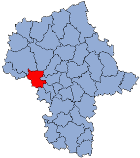
Brochocin is a village in the administrative district of Gmina Brochów, within Sochaczew County, Masovian Voivodeship, in east-central Poland.
Roztropna is a village in the administrative district of Gmina Nowa Sucha, within Sochaczew County, Masovian Voivodeship, in east-central Poland.
Dmochy-Rogale is a village in the administrative district of Gmina Bielany, within Sokołów County, Masovian Voivodeship, in east-central Poland.

Łekno is a village in the administrative district of Gmina Wągrowiec, within Wągrowiec County, Greater Poland Voivodeship, in west-central Poland. It lies approximately 9 kilometres (6 mi) north-east of Wągrowiec and 56 km (35 mi) north-east of the regional capital Poznań.

Gądków Mały is a village in the administrative district of Gmina Torzym, within Sulęcin County, Lubusz Voivodeship, in western Poland. It lies approximately 11 kilometres (7 mi) southwest of Torzym, 25 km (16 mi) southwest of Sulęcin, 52 km (32 mi) northwest of Zielona Góra, and 57 km (35 mi) south of Gorzów Wielkopolski.

Szotowo is a village in the administrative district of Gmina Kartuzy, within Kartuzy County, Pomeranian Voivodeship, in northern Poland. It lies approximately 5 kilometres (3 mi) south-west of Kartuzy and 33 km (21 mi) west of the regional capital Gdańsk.

Zawistowo is a settlement in the administrative district of Gmina Kępice, within Słupsk County, Pomeranian Voivodeship, in northern Poland. It lies approximately 8 kilometres (5 mi) north of Kępice, 21 km (13 mi) south-west of Słupsk, and 115 km (71 mi) west of the regional capital Gdańsk.

Twardy Dół is a settlement in the administrative district of Gmina Zblewo, within Starogard County, Pomeranian Voivodeship, in northern Poland. It lies approximately 5 kilometres (3 mi) south of Zblewo, 17 km (11 mi) south-west of Starogard Gdański, and 57 km (35 mi) south of the regional capital Gdańsk.
Kiermuszyny Wielkie is a settlement in the administrative district of Gmina Banie Mazurskie, within Gołdap County, Warmian-Masurian Voivodeship, in northern Poland, close to the border with the Kaliningrad Oblast of Russia.
Krosino is a village in the administrative district of Gmina Grzmiąca, within Szczecinek County, West Pomeranian Voivodeship, in north-western Poland.
The Chemawawin Cree Nation is located next to Easterville, Manitoba in Central Manitoba. The population of this First Nation is identified as Swampy Cree and also Rocky Cree (Asinīskāwiyiniwak). The main reserve, Chemawawin 2, is located on the south shore of Cedar Lake in Census Division No. 21, whereas the larger but less populous Chemawawin 3 lies directly south on the northeast shores of Lake Winnipegosis in Census Division No. 19.


