Norrmalmstorg is a square in central Stockholm, Sweden. The square connects shopping streets Hamngatan and Biblioteksgatan and is the starting point for tram travellers with the Djurgården line. Close to the southwest is the park Kungsträdgården.

Viktoria-Luise-Platz is a Berlin U-Bahn station located on the U 4. 1910 Schöneberg, a part of Berlin, built its own subway line the U4. This station was built by E.Deneke and consists of green and white tiles on the walls and green columns. The square and subway station are subject to a preservation order.

Ivatsevichy (Ivacevičy) District is an administrative subdivision, a raion of Brest Region, in Belarus.

Wittenbergplatz is a square in the central Schöneberg district of Berlin, Germany. One of the main plazas in the "City West" area, it is known for the large Kaufhaus des Westens (KaDeWe) department store on its southwestern side.

Morzęcin Mały is a village in the administrative district of Gmina Oborniki Śląskie, within Trzebnica County, Lower Silesian Voivodeship, in south-western Poland. Prior to 1945 it was in Germany. It lies approximately 6 kilometres (4 mi) north-west of Oborniki Śląskie, 15 km (9 mi) west of Trzebnica, and 28 km (17 mi) north-west of the regional capital Wrocław.

The Pelotas Microregion is a microregion in the southeastern part of the state of Rio Grande do Sul, Brazil. The area is 10,306.601 km².

Wereszcze Duże is a village in the administrative district of Gmina Rejowiec, within Chełm County, Lublin Voivodeship, in eastern Poland. It lies approximately 10 kilometres (6 mi) west of Chełm and 56 km (35 mi) east of the regional capital Lublin.

Hektary is a village in the administrative district of Gmina Świnice Warckie, within Łęczyca County, Łódź Voivodeship, in central Poland. It lies approximately 5 kilometres (3 mi) north of Świnice Warckie, 18 km (11 mi) west of Łęczyca, and 49 km (30 mi) north-west of the regional capital Łódź.

Gledzianówek is a village in the administrative district of Gmina Witonia, within Łęczyca County, Łódź Voivodeship, in central Poland. It lies approximately 4 kilometres (2 mi) south-east of Witonia, 14 km (9 mi) north-east of Łęczyca, and 40 km (25 mi) north of the regional capital Łódź.
Madera is a settlement in the administrative district of Gmina Nowa Brzeźnica, within Pajęczno County, Łódź Voivodeship, in central Poland.

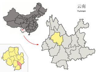
Midu County is a county in the Dali Bai Autonomous Prefecture located in west-central Yunnan province, China.

Kuczki-Wieś is a village in the administrative district of Gmina Gózd, within Radom County, Masovian Voivodeship, in east-central Poland. It lies approximately 6 kilometres (4 mi) west of Gózd, 13 km (8 mi) east of Radom, and 98 km (61 mi) south of Warsaw.
Tokarki Pierwsze is a settlement in the administrative district of Gmina Kazimierz Biskupi, within Konin County, Greater Poland Voivodeship, in west-central Poland.

Barłogi is a village in the administrative district of Gmina Rzgów, within Konin County, Greater Poland Voivodeship, in west-central Poland. It lies approximately 14 kilometres (9 mi) west of Konin and 83 km (52 mi) east of the regional capital Poznań.

Czyżkówko is a village in the administrative district of Gmina Lipka, within Złotów County, Greater Poland Voivodeship, in west-central Poland. It lies approximately 7 kilometres (4 mi) south-east of Lipka, 24 km (15 mi) north-east of Złotów, and 123 km (76 mi) north of the regional capital Poznań.
Dębiniec is a village in the administrative district of Gmina Murów, within Opole County, Opole Voivodeship, in south-western Poland.

Kolonia Jaryszów is a village in the administrative district of Gmina Ujazd, within Strzelce County, Opole Voivodeship, in south-western Poland. It lies approximately 6 kilometres (4 mi) north of Ujazd, 8 km (5 mi) south-east of Strzelce Opolskie, and 39 km (24 mi) south-east of the regional capital Opole.

Rēzekne Municipality is a municipality in Latgale, Latvia. The municipality was formed in 2009 by merging Audriņi parish, Bērzgale parish, Čornaja parish, Dricāni parish, Feimaņi parish, Gaigalava parish, Griškāni parish, Ilzeskalns parish, Kantinieki parish, Kaunata parish, Lendži parish, Lūznava parish, Mākoņkalns parish, Malta parish, Nagļi parish, Nautrēni parish, Ozolaine parish, Ozolmuiža parish, Puša parish, Rikava parish, Sakstagals parish, Silmala parish, Stoļerova parish, Strūžāni parish and Vērēmi parish. The administrative center is located in Rēzekne city, which is not included in the territory of the municipality.
Timba is a small unincorporated town in Stanislaus County, California, United States, about 1 mile (1.6 km) north of Newman. Timba is located at 37°20′34″N121°01′52″W.orestimba is a native American word meaning "meeting place"
Võlla is a village in Muhu Parish, Saare County in western Estonia.


