
Biləsuvar is a city in and the capital of Bilasuvar Rayon in Azerbaijan. The area's considerable agricultural potential depends on irrigation.
Żuków is a village in the administrative district of Gmina Polkowice, within Polkowice County, Lower Silesian Voivodeship, in south-western Poland. Prior to 1945 it was in Germany.
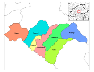
Ipelce is a department or commune of Bazèga Province in central Burkina Faso. Its capital lies at the town of Ipelce. According to the 1996 census, the department has a total population of 12,802.
Łopatki is a village in the administrative district of Gmina Choceń, within Włocławek County, Kuyavian-Pomeranian Voivodeship, in north-central Poland.

Stare Niewino is a village in the administrative district of Gmina Wyszki, within Bielsk County, Podlaskie Voivodeship, in north-eastern Poland. It lies approximately 11 kilometres (7 mi) north-west of Bielsk Podlaski and 35 km (22 mi) south of the regional capital Białystok.
Bronowice is a village in the administrative district of Gmina Brzeziny, within Brzeziny County, Łódź Voivodeship, in central Poland. It lies approximately 5 kilometres (3 mi) east of Brzeziny and 25 km (16 mi) east of the regional capital Łódź.
Rudnik is a village in the administrative district of Gmina Będków, within Tomaszów Mazowiecki County, Łódź Voivodeship, in central Poland. It lies approximately 5 kilometres (3 mi) east of Będków, 16 km (10 mi) north-west of Tomaszów Mazowiecki, and 33 km (21 mi) south-east of the regional capital Łódź.
Łukawka is a village in the administrative district of Gmina Wojciechowice, within Opatów County, Świętokrzyskie Voivodeship, in south-central Poland. It lies approximately 5 kilometres (3 mi) south-west of Wojciechowice, 9 km (6 mi) east of Opatów, and 66 km (41 mi) east of the regional capital Kielce.
Podgrodzie is a village in the administrative district of Gmina Ćmielów, within Ostrowiec County, Świętokrzyskie Voivodeship, in south-central Poland. It lies approximately 3 kilometres (2 mi) north-east of Ćmielów, 11 km (7 mi) east of Ostrowiec Świętokrzyski, and 66 km (41 mi) east of the regional capital Kielce.
Płowce is a village in the administrative district of Gmina Sanok, within Sanok County, Subcarpathian Voivodeship, in south-eastern Poland. It lies approximately 4 kilometres (2 mi) west of Sanok and 56 km (35 mi) south of the regional capital Rzeszów.
Bardonki is a village in the administrative district of Gmina Ciechanów, within Ciechanów County, Masovian Voivodeship, in east-central Poland.
Kamieniec is a village in the administrative district of Gmina Trzemeszno, within Gniezno County, Greater Poland Voivodeship, in west-central Poland.
Święte is a settlement in the administrative district of Gmina Trzemeszno, within Gniezno County, Greater Poland Voivodeship, in west-central Poland.
Bronisławowo is a village in the administrative district of Gmina Sadlinki, within Kwidzyn County, Pomeranian Voivodeship, in northern Poland. It lies approximately 6 kilometres (4 mi) south-west of Sadlinki, 13 km (8 mi) south-west of Kwidzyn, and 82 km (51 mi) south of the regional capital Gdańsk.
Pogorzele is a settlement in the administrative district of Gmina Nowa Wieś Lęborska, within Lębork County, Pomeranian Voivodeship, in northern Poland. It lies approximately 6 kilometres (4 mi) east of Nowa Wieś Lęborska, 5 km (3 mi) east of Lębork, and 57 km (35 mi) west of the regional capital Gdańsk.
Białogóra is a village in the administrative district of Gmina Krokowa, within Puck County, Pomeranian Voivodeship, in northern Poland. It lies approximately 14 kilometres (9 mi) west of Krokowa, 32 km (20 mi) north-west of Puck, and 67 km (42 mi) north-west of the regional capital Gdańsk.
Stare Siedlisko is a village in the administrative district of Gmina Wilczęta, within Braniewo County, Warmian-Masurian Voivodeship, in northern Poland. It lies approximately 8 kilometres (5 mi) north-west of Wilczęta, 19 km (12 mi) south of Braniewo, and 66 km (41 mi) north-west of the regional capital Olsztyn.
Oko is a settlement in the administrative district of Gmina Ruciane-Nida, within Pisz County, Warmian-Masurian Voivodeship, in northern Poland.
Vô Tranh is a commune (xã) and village in Lục Nam District, Bắc Giang Province, in northeastern Vietnam.

Crnčići is a village in the municipality of Višegrad, Bosnia and Herzegovina.


