Baba Vida is a medieval fortress in Vidin in northwestern Bulgaria and the town's primary landmark. It consists of two concentric curtain walls and about nine towers of which three are preserved to their full medieval height, including the original battlements, and is said to be the only entirely preserved medieval castle in the country. Baba Vida is 39 metres (128 ft) above sea level.

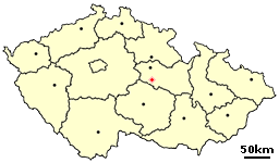
Mladoňovice is a village in the Pardubice Region of the Czech Republic. It has around 350 inhabitants.
Csincse is a village in Borsod-Abaúj-Zemplén county, Hungary.

Natchiboura is a village in the Bassar Prefecture in the Kara Region of north-western Togo.
Pasieki is a village in the administrative district of Gmina Narewka, within Hajnówka County, Podlaskie Voivodeship, in north-eastern Poland, close to the border with Belarus.

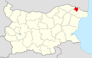
Tervel is a town in northeastern Bulgaria, part of Dobrich Province. It is the administrative centre of Tervel Municipality, which lies in the westernmost part of the province. As of December 2009, the town has a population of 6,667 inhabitants.

Valchi Dol is a town in northeastern Bulgaria, part of Varna Province. It is the administrative centre of Valchi Dol Municipality, which lies in the northwestern part of the Province. In December 2009 the town had 3,460 inhabitants.

Kolonia Gałkowice is a village in the administrative district of Gmina Dwikozy, within Sandomierz County, Świętokrzyskie Voivodeship, in south-central Poland. It lies approximately 6 kilometres (4 mi) west of Dwikozy, 8 km (5 mi) north of Sandomierz, and 79 km (49 mi) east of the regional capital Kielce.

Oparić is a village in Central Serbia, in the municipality of Rekovac. The village has around 1260 residents. It lies at 43°45′00″N21°07′11″E, at the altitude of 295 m. The Oparić is well known as birthplace of naive artist Janko Brašić.
Charbin is a village in the administrative district of Gmina Powidz, within Słupca County, Greater Poland Voivodeship, in west-central Poland.

Kawczyn (Kawcze-Młyn) is a village in Gmina Miastko, Bytów County, Pomeranian Voivodeship, in northern Poland. It lies approximately 40 kilometres (25 mi) south-west of Bytów and 118 km (73 mi) south-west of Gdańsk.

Orzechów is a village in the administrative district of Gmina Cedynia, within Gryfino County, West Pomeranian Voivodeship, in north-western Poland, close to the German border. It lies approximately 6 kilometres (4 mi) east of Cedynia, 43 km (27 mi) south of Gryfino, and 63 km (39 mi) south of the regional capital Szczecin.
Altsek (village) is a village in the municipality of Dobrichka, in Dobrich Province, in northeastern Bulgaria.
Karapelit is a village in the municipality of Dobrichka, in Dobrich Province, in northeastern Bulgaria.
Sokolnik, Bulgaria is a village in the municipality of Dobrichka, in Dobrich Province, in northeastern Bulgaria.
Karali is a village in Gabrovo Municipality, in Gabrovo Province, in northern central Bulgaria.

Batkovica is a village in the municipality of Višegrad, Bosnia and Herzegovina.

Blace is a village in the municipality of Višegrad, Bosnia and Herzegovina.

Đurevići is a village in the municipality of Višegrad, Bosnia and Herzegovina.

Kupusovići is a village in the municipality of Višegrad, Bosnia and Herzegovina.


