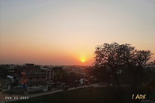
Gaya is a city, municipal corporation and the administrative headquarters of Gaya district and Magadh division of the Indian state of Bihar. Gaya is 116 kilometres (72 mi) south of Patna and is the state's second-largest city, with a population of 470,839. The city is surrounded on three sides by small, rocky hills, with the Phalgu River on its eastern side.

Nawada district is one of the thirty-eight districts of the Indian state of Bihar. Nawada is its administrative headquarters. The district is the easternmost district of the Magadh division, one of the nine administrative divisions of Bihar. The area of the modern district was historically part of the Magadha, Shunga and Gupta empires. Koderma and Giridih districts of the state of Jharkhand lie on the southern border of the district; it also shares borders with the Gaya, Nalanda, Sheikhpura, and Jamui districts of Bihar.

Kaimur district is one of the 38 districts of Bihar, India. The district headquarters are at Bhabua. Before 1991, it was part of Rohtas District. Till 1764 the region was a part of Ghazipur District and was a part of Kamsaar Raj and later it was a part of Chainpur Estate till 1837.

Rafiganj is a town and a notified area in Aurangabad district in the Indian state of Bihar. It is the district's second-largest town in population after Aurangabad, and also the second-largest town in area. Rafiganj is located 25 km away from the District Administration.
Warisaliganj is a Community Development block and a Municipal Council in Nawada district in the Indian state of Bihar.
Konch is a community development block of Gaya district in Bihar, India. Konch(Konch Village/Konch Panchayat/Konch Thana-Police Station) is a typical village market area slowly taking shape of a sub-urban settlement and centre of small business. Konch has very important temple known as Koncheswar Mahadev belonging to the later Gupta period which now has been taken under the protection of Archaeological Survey of India (ASI).
Lodipur is a small village in Tekari subdivision of Gaya District in the state of Bihar, India. It is about 6 km from Tekari, located on a state highway.
Rakasiya is an old village in the Gaya district in the Indian state of Bihar. Located northwest of Manpur, it is approximately 3 km from the town of Tekari, towards Nimsar Dam. Rakasiya is on the bank of the Morhar river, and has a population of around 1500.
Sheonagar is a large village 3 km south of Tekari in the Gaya district of Bihar state, India. Its population is about 5000. It is now the largest panchayat in terms of area as well as population.
Mohania is a city and corresponding community development block in Kaimur district of Bihar, India. It serves as headquarters for the Mohania sub-division in Kaimur district. It is 17 km (11 mi) by road north of the city of Bhabua, at the intersection of National Highway 19, National Highway 219, and National Highway 319. The bank of the Durgavati River is just to the south of Mohania. The total block population was 218,479, in 32,198 households.
Khatangi is a prominent village in Bihar, India. It is situated in Sonbhadra-Bansi-Surajpur Block in Arwal district of the State of Bihar. It is located at 96.1 km distance from Arwal and at 114 km distance from the state capital Patna. It is a very old village with a population of about 5,000 people. The literacy rate is 45.56%, comprising a female literacy rate of 27.3% and a male literacy rate of 62.98%. The people here are very friendly and hospitable. The economy of this village is agro-based and agriculture remains the main source of income.

The Tekari Raj was a zamindari estate of the Bhumihar community in South Bihar. They controlled 2,046 villages on their estate, which covered a 7,500 square kilometres (2,900 sq mi) area, near to the town of Gaya.

Rajauli is a tehsil, block and subdivision (sub–district) in Nawada district of Magadh division of the Indian state of Bihar. The tehsil of Rajauli is located at a distance of about 30 kilometres (19 mi) from Nawada city on National Highway 20 and is situated on the bank of Dhanarjay river. Rajauli, a Scheduled Caste (SC) reserved Assembly Constituency (AC) seat, had a total of 302900 electors during the 2015 Bihar Legislative Assembly election. Rajauli subdivision consists of 95 panchayats and 688 revenue villages while Rajauli block consists of 17 panchayats and 169 revenue villages.
Jalalpur is a village in Gaya district, Bihar, India. Jalalpur Village is located in Paluhar panchayat of Tekari block. This village has total 100+ families residing. The population was 2,441 as of the 2011 Indian census. It is only 0.5–1 km from Tekari, a city also in Gaya district.
Aryapur Khera is the village. Mainpuri city is an administrative headquarters of this village. Mainpuri is located to the north-east of Agra.
Panchanpur, Gaya, in the Indian state of Bihar, is situated on the state highway which connects Gaya to Tekari and Goh, Daudnagarvia. It is 6 km from Tekari sub-divisional office and 18 km from Gaya.
Nardiganj is a small market in the Nawada district, in the state of Bihar, India. The population is about 18,000.

Adapur is a block in East Champaran district of Bihar, India. Adapur railway station is located 40 kilometres (25 mi) north of Motihari, the district headquarters. The state capital Patna is 175 kilometres (109 mi) in south. Adapur is located on the India - Nepal border. There are many villagers Near Adapur town peoples come to buy their daily essential things.

Naromurar is a Village in Warisaliganj Tehsil, located 10 km (6.2 mi) from National Highway 31 and 8 km (5.0 mi) from State Highway 59, making it the only village of the area well connected to both Nawada and Nalanda districts of Bihar.
Literally the word Nar means water and Murar means Lord Krishna who appeared as the 8th avatara of Lord Vishnu in Dvapara Yuga as mentioned in Garuda Purana, that is the word Naromurar means the house of lord Vishnu -Kshirsagar.
Naromurar is a village of great traditions. It is one of the ancient villages of India having a four hundred year older Thakur Wadi dedicated to Maryada Purushottam Ram and Lord Shiva.
Along with the Rajkiyakrit Madhya Vidyalay having established in 1920 AD, 27 years before the freedom of India, a Janta Pustakalay the Public Library is also started in the year of 1956 AD which was inaugurated by the Education Minister of Bihar during the time of Krishna Singh.

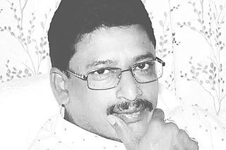
Abhay Kushwaha alias Abhay Kumar Sinha is a former Member of Legislative Assembly for Tikari in the Gaya district of Bihar. He is a member of Janata Dal (United); he won the 2015 Legislative Assembly election to the Tekari constituency by defeating Anil Kumar of Hindustani Awam Morcha, a political party headed by erstwhile member of Janata Dal (United), Jitan Ram Manjhi. In the 2015 election he defeated Anil Kumar, who joined Hindustani Awami Morcha leaving his former party Janata Dal (United) by a huge margin of votes. While Abhay secured 86975 votes, Anil managed to get 55162 votes only.


