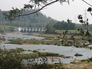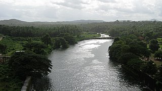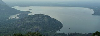
The Kaveri is a major river flowing across Southern India. It is the third largest river in the region after Godavari and Krishna. The catchment area of the Kaveri basin is estimated to be 81,155 km2 (31,334 sq mi) and encompasses the states of Tamil Nadu, Karnataka, Kerala, and the union territory of Puducherry.

Palar is a river of southern India. It rises in the Nandi Hills in Chikkaballapura district of Karnataka state, and flows 93 kilometres (58 mi) in Karnataka, 33 kilometres (21 mi) in Andhra Pradesh and 222 kilometres (138 mi) in Tamil Nadu before reaching its confluence into the Bay of Bengal at Vayalur about 75 kilometres (47 mi) south of Chennai. It flows as an underground river for a long distance only to emerge near Bethamangala town, from where, gathering water and speed, it flows eastward down the Deccan Plateau. The Towns of Bethamangala, Santhipuram, Kuppam, Mottur, Ramanaickenpet, Vaniyambadi, Ambur, Melpatti, Gudiyatham, Pallikonda, Anpoondi, Melmonavoor, Vellore, Katpadi, Melvisharam, Arcot, Ranipet, Walajapet, Kanchipuram, Walajabad, Chengalpattu, Kalpakkam, and Lattur are located on the banks of the Palar River. Of the seven tributaries, the chief tributary is the Cheyyar River.

The Bhavani is an interstate Indian river which flows through Indian states of Kerala and Tamil Nadu, India. It originates from the Western Ghats and is one among the three rivers of Kerala which flows in eastward direction.

Stanley Reservoir located in Salem District of Tamil Nadu is one of largest fishing reservoirs in South India. It was completed in 1934 and was named after Lieutenant Colonel Sir George Frederick Stanley GCSI GCIE CMG, who served as the Governor of Madras from 1929 to 1934. Its main source of water is the River Kaveri (Cauvery). Three minor tributaries – Palar, Chennar and Thoppar – enter the Kaveri on its course above Stanley Reservoir. The water is retained by the Mettur Dam, Tamil Nadu.

Periyar, is the longest river and the river with the largest discharge potential in the Indian state of Kerala. It is one of the few perennial rivers in the region and provides drinking water for several major towns. The Periyar is of utmost significance to the economy of Kerala. It generates a significant proportion of Kerala's electrical power via the Idukki Dam and flows along a region of industrial and commercial activity. The river also provides water for irrigation and domestic use throughout its course besides supporting a rich fishery. Due to these reasons, the river has been named the "Lifeline of Kerala". Kochi city, in the vicinity of the river mouth, draws its water supply from Aluva, an upstream site sufficiently free of seawater intrusion. Twenty five percent of Kerala's industries are along the banks of the Periyar. These are mostly crowded within a stretch of 5 kilometres (3 mi) in the Eloor-Edayar region (Udhyogamandal), about 10 kilometres (6 mi) north of Kochi harbor.

Gayathripuzha River is one of the main tributaries of the Bharathapuzha River, the second-longest river in Kerala, south India. It originates from Nelliyampathi hills, passes through Kollengode, Nenmara (Nemmara), Alathur, Padur and Pazhayannur before joining the Bharathapuzha at Mayannur. It is the second largest tributary of the Bharathapuzha, by both length and discharge. The Gayathripuzha flows mainly through Palakkad district, except for the last few kilometres. The river is non-perennial like its parent river, and is also prone of sand mining. There is a dam built across this river at Cherakkuzhy near Pazhayannur.
Kannadipuzha River is one of the main tributaries of the Bharathapuzha River, the second-longest river in Kerala, south India.

Kanjirappuzha River is one of the tributaries of the river Thuthapuzha. The Thuthapuzha is one of the main tributaries of the Bharathapuzha River, the second-longest river in Kerala, South India.
Thuppanadupuzha River is a river in India. It is one of the tributaries of the river Thuthapuzha. The Thuthapuzha is one of the main tributaries of the Bharathapuzha River, the second-longest river in Kerala, south India.

Mangalam River is the main tributary of the river Gayathripuzha, which in turn is a tributary of Bharathapuzha, the second longest river in Kerala, India. It is around 30 km long in length, with its source in Nelliyampathi forests, and passing through Vadakkencherry, Kannambra, Puthucode, Padur, etc. and joining Gayathripuzha at Plazhi in the border of Thrissur and Palakkad districts.
Vandazhippuzha River is one of the tributaries of the river Gayathripuzha. It gets its name since it flows through the village of Vandazhi in Palakkad district. It has its origin in Nelliyampathy hills and joins Gayathri river near Alathur. Gayathripuzha is one of the main tributaries of the Bharathapuzha River, the second-longest river in Kerala, south India.
Korayar River is one of the tributaries of the river Kalpathipuzha, which in turn is a main tributary of the Bharathapuzha River, the second-longest river in Kerala, south India. It originates from Anamalai, Tamilnadu and merges with the Walayar which later converges with the Bharathapuzha at Pattambi.
Varattar River is one of the tributaries of the river Kalpathipuzha. The Kalpathipuzha is one of the main tributaries of the Bharathapuzha River, the second-longest river in Kerala, south India.
Malampuzha River is one of the tributaries of the river Kalpathipuzha. Malampuzha Dam is built across the river at Malampuzha about 8 km from the Palakkad city in the Indian state of Kerala. The reservoir formed by the Malampuzha Dam is 23.13 square kilometres in area and is the second largest reservoir in Kerala after the Idukki reservoir. The construction of Malampuzha dam started in the year 1949 and was completed in the year 1955. The project is estimated to have cost around Rs. 53 million. Malampuzha river joins the Kalpathipuzha, a tributary of the Bharathapuzha at Palakkad. Kalpathipuzha then flows westward to join Kannadipuzha at Parali to form Bharathapuzha, which ultimately flows until Ponnani, passing through towns and villages Mankara, Pathirippala, Lakkidi, Thiruvilwamala, Ottapalam, Mayannur, Shoranur, Cheruthuruthy, Thirumittakode, Pattambi, Thrithala, Kudallur, Kuttippuram, Thirunavaya and Chamravattom.
Chittar River and its five tributaries and numerous other contributing streams originate in the Courtallam hills of Tenkasi district in the state of Tamil Nadu in southern India. Together with its tributaries and streams, the Chittar River serves as an important source of irrigation for the region and is a major tributary of the Tambaraparani River along with the Manimuthar River.

Parambikulam Dam is an embankment dam on the Parambikulam River, located in the Palakkad district in the Western Ghats of Kerala, India, ranks number one in India as well as in the top ten embankment dams in the world in volume in the year 2000.

Aliyar Reservoir is a 6.48 km2 (2.5 sq mi) reservoir located in Aliyar village near Pollachi town in Coimbatore District, Tamil Nadu, South India. The dam is located in the foothills of Valparai, in the Anaimalai Hills of the Western Ghats. It is about 65 kilometres (40 mi) from Coimbatore. The dam offers some ideal getaways including a park, garden, aquarium, play area and a mini Theme-Park maintained by Tamil Nadu Fisheries Corporation for visitors enjoyment. The scenery is beautiful, with mountains surrounding three quarters of the reservoir. Boating is also available.

Solaiyar Dam, Upper Solaiyar Dam or Upper Sholayar Dam is located 20 km (12 mi) from Valparai, a hill station in the Anaimalai Hills of the Coimbatore district, Tamil Nadu India. As it is a part of the hydroelectric project of Tamil Nadu, special permission is required to visit the dam.

The Bharathappuzha, also known as the Nila or Ponnani River, is a river in the Indian states of Tamil Nadu and Kerala. With a length of 209 km, it is the second longest river that flows through Kerala after the Periyar. It flows through Palakkad Gap, which is also the largest opening in the Kerala portion of Western Ghats. The Nila has groomed the culture and life of South Malabar part of Kerala. It is also referred to as the "Peraar" in ancient scripts and documents. River Bharathapuzha is an interstate river and lifeline water source for a population residing in four administrative districts, namely Malappuram and Palakkad districts, and parts of Palakkad-Thrissur district border of Kerala and Coimbatore, and Tiruppur of Tamil Nadu. The fertile Thrissur-Ponnani Kole Wetlands lie on its bank.

Thunakkadavu Dam is situated in Parambikulam Wildlife Sanctuary, Kerala across Thoonakkadavu River, which is a tributary of Parambikulam River, in Palakkad district of Kerala, India. It is part of the Parambikulam-Aliyar Irrigation Project. It is in the Parambikulam Wildlife Sanctuary in the Muthalamada panchayath.


