Related Research Articles

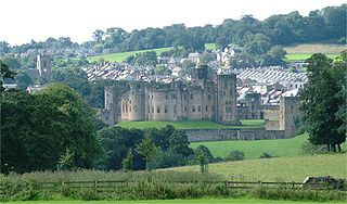
Alnwick is a market town in Northumberland, England, of which it is the traditional county town. The population at the 2011 Census was 8,116.

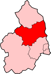
Alnwick was a local government district of Northumberland, England. Its council was based in the town of Alnwick and the district had a population of 31,029 according to the 2001 census.

Berwick-upon-Tweed is a parliamentary constituency in Northumberland represented in the House of Commons of the UK Parliament since 2015 by Anne-Marie Trevelyan, a Conservative.
Benfleet Urban District was an urban district in the county of Essex, England. It was created on 1 October 1929 from the parts of Rochford Rural District containing the civil parishes of Hadleigh, South Benfleet and Thundersley.

Barnet was a local government district in south Hertfordshire from 1863 to 1965 around the town of Barnet.

Wembley was an urban district and later a municipal borough in Middlesex, England from 1894 to 1965.

Feltham was an urban district in the former county of Middlesex, England from 1904 to 1965. As Middlesex was disbanded is 1965, Feltham now is a part of Greater London.

Lionheart Radio is a community radio station in the north east of England which broadcasts to Northumberland from Fenkle Street in Alnwick. It conducted three and a half months of successful RSL broadcasts and was awarded a Community Licence by Ofcom in November 2005.

Merton Urban District (1907–1913) and Merton and Morden Urban District (1913–1965) was an urban district in Surrey, England. It was formed in 1907 from the parish of Merton and was expanded in 1913 to take in Morden. The district was abolished in 1965 and its former area now forms part of the London Borough of Merton in Greater London.

Chiswick was a local government district in the county of Middlesex, England from 1858 to 1927. It was part of the London postal district and the Metropolitan Police District.

The A1068 is a road in northern England that runs from Seaton Burn in North Tyneside to Alnwick in Northumberland. The section between Ellington and Alnmouth is signposted as part of the Northumberland Coastal Route.
Huyton with Roby Urban District was a local government district in Lancashire, England from 1894 to 1974. It consisted of the civil parish of Huyton with Roby which comprised the settlements of Huyton and Roby. It replaced the Huyton with Roby urban sanitary district.
Mindrum railway station was a stone built railway station serving the hamlet of Mindrum and the surrounding villages in Northumberland. It was on the Alnwick to Cornhill Branch which ran from Alnwick to Cornhill Junction on the Kelso line near Coldstream.
The Cornhill Branch was a 35.5-mile (57 km) single track branch railway line in Northumberland, England, that ran from Alnwick on the terminus of the three mile long Alnmouth to Alnwick line via ten intermediate stations to a junction on the Tweedmouth to Kelso Branch line at Cornhill-on-Tweed.
Wooler railway station was a stone-built railway station serving the town of Wooler in Northumberland. It was on the Alnwick to Cornhill Branch which ran from Alnwick to Cornhill Junction on the Kelso line near Coldstream.
Coldstream railway station served the town of Coldstream in Berwickshire, Scotland although the station was across the River Tweed in Northumberland, England. The station was on both the Alnwick to Cornhill Branch which ran from Alnwick to Cornhill Junction on the Kelso line near Coldstream and the Kelso to Tweedmouth line.

Alnwick's town walls are a 15th-century defensive structure built around the town of Alnwick in England.
The Warminster and Westbury Rural District was a rural district in Wiltshire, England from 1935 to 1974.

Alnwick Infirmary is a community hospital in Alnwick, Northumberland, England. It is managed by Northumbria Healthcare NHS Foundation Trust.

Alnwick Town Hall is a municipal building in the Market Place, Alnwick, Northumberland, England. The structure, which was the meeting place of the common council, is a Grade I listed building.
References
- ↑ "Alnwick UD: Relationships and changes". Vision of Britain through Time. GB Historical GIS / University of Portsmouth. Retrieved 3 February 2015.