
The Jasper Ridge Biological Preserve is a 483 hectares nature preserve and biological field station formally established as a reserve in 1973. owned by Stanford University, located at 37.408°N 122.2275°W south of Sand Hill Road and west of Interstate 280 in Portola Valley, California. It is used by students, researchers, and docents to conduct biology research, and teach the community about the importance of that research. The preserve encompasses Jasper Ridge and Searsville Lake and the upper reaches of San Francisquito Creek, along with the latter's Corte Madera Creek and Bear Creek tributaries.

Formed in 1972 by voter initiative, the Midpeninsula Regional Open Space District (MROSD) is a non-enterprise special district in the San Francisco Bay Area. It has acquired and preserved a regional green belt of open space land and provides opportunities for ecologically-sensitive public enjoyment and education.
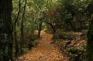
Los Trancos Open Space Preserve is a 274-acre open space preserve, located in San Mateo and Santa Clara Counties, California, near Los Altos Hills, California. The preserve contains about 5 miles of hiking trails, of which 2.1 miles are open to equestrians, and none are open to bicycles.
Fluvius Innominatus or Central Creek is a creek in Richmond and El Cerrito, California in western Contra Costa County. There is one main source and a secondary unnamed tributary. The creek drains into Hoffman Marsh and then flows into the bay through Point Isabel Regional Shoreline's Hoffman Channel. However, before the area was developed and as early as 1899 the creek had 11 sources which stretched far higher into the Berkeley Hills.

San Gregorio Creek is a river in San Mateo County, California. Its tributaries originate on the western ridges of the Santa Cruz Mountains whence it courses southwest through steep forested canyons. The San Gregorio Creek mainstem begins at the confluence of Alpine and La Honda Creeks, whence it flows 12 miles (19 km) through rolling grasslands and pasturelands until it meets the Pacific Ocean at San Gregorio State Beach. It traverses the small unincorporated communities of La Honda, San Gregorio, Redwood Terrace and Sky Londa.
Rodgers Gulch is a valley in San Mateo County, California. It contains a small stream which is a tributary of San Gregorio Creek. The stream flows about 1.5 miles (2 km) from its source on Mindego Hill to its confluence with Alpine Creek, just east (upstream) of the boundary of the Heritage Grove Redwood Preserve.
Woodhams Creek is a small river in San Mateo County, California and is a tributary of San Gregorio Creek. It flows about 2 miles (3 km) from its source on Langley Hill to its confluence with La Honda Creek, in the town of La Honda.
Langley Creek is a small river in San Mateo County, California and tributary to La Honda Creek, which in turn is tributary to San Gregorio Creek. It flows about 2 miles (3 km) from its source on Langley Hill to its confluence with La Honda Creek, a short distance upstream from the town of La Honda.
Woodruff Creek is a small river in San Mateo County, California and is a tributary to La Honda Creek, which in turn is tributary to San Gregorio Creek.
Spanish Ranch Creek is a small river in San Mateo County, California. It flows about 1 mile (2 km) west from its source to its confluence with Weeks Creek, which in turn joins La Honda Creek in the La Honda Creek Regional Open Space, about 2 miles north of the town of La Honda.
Pine Tree Gulch is a valley in San Mateo County, California. It contains a small stream which is a tributary of San Gregorio Creek. The stream flows about 0.5 miles (1 km) from its source to its confluence with El Corte de Madera Creek.
El Corte de Madera Creek is a small river in the Santa Cruz Mountains, San Mateo County, northern California. It is a tributary of San Gregorio Creek.
Shaw Gulch is a valley in San Mateo County, California. It contains a stream which flows about 1.5 miles (2 km) from its source. The stream's waters drain into Bradley Creek about 1.5 miles (2 km) north of the town of Pescadero.

Peters Creek is a 7.3-mile-long (11.7 km) stream in San Mateo County, California, and is a tributary of Pescadero Creek. It flows southwestwards through a small canyon to join Pescadero Creek in Portola Redwoods State Park, near La Honda.
Iverson Creek is a small river in San Mateo County, California and is a tributary of Pescadero Creek. It flows about 0.6 miles (1 km) from its source on Butano Ridge in Pescadero Creek County Park to its mouth in Portola Redwoods State Park.
Bellvale is a populated place in San Mateo County, located at 37°18′43″N122°19′12″W. The small community is on Highway 84 between San Gregorio and La Honda. Bellvale has an elevation of 240 feet above sea level. Although Bellvale once had a post office, the community is now only sparsely settled with homes and farms. The Bellvale post office, located 2.25 miles west of La Honda, opened in 1897 and was discontinued in 1922. U.S. Geological Survey maps show oil wells in the area, tapping a relatively small pool of petroleum that was first identified in the nineteenth century.
San Vicente Creek is a 9.3-mile-long (15.0 km) northern California coastal stream which flows entirely within Santa Cruz County and discharges to the Pacific Ocean. Its waters rise on the west facing slopes of the Santa Cruz Mountains, and its mouth is at the unincorporated community of Davenport.
The Marin Municipal Water District is the government agency that provides drinking water to southern and central Marin County, California. Chartered in 1912, it became California's first municipal water district. It serves 195,000 people in a 147-square-mile (380 km2) area that includes ten towns and cities.

The Palo Alto Baylands Nature Preserve, known officially as the Baylands Nature Preserve, is the largest tract of undisturbed marshland remaining in the San Francisco Bay. Fifteen miles of multi-use trails provide access to a unique mixture of tidal and fresh water habitats. The preserve encompasses 1,940 acres in both Palo Alto and East Palo Alto, and is owned by the city of Palo Alto, California, United States. It is an important habitat for migratory shorebirds and is considered one of the best birdwatching spots on the West Coast.


