
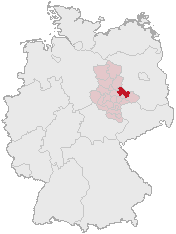
Saxony-Anhalt is a state of Germany, bordering the states of Brandenburg, Saxony, Thuringia and Lower Saxony. It covers an area of 20,447.7 square kilometres (7,894.9 sq mi) and has a population of 2.19 million inhabitants, making it the 8th-largest state in Germany by area and the 11th-largest by population. Its capital is Magdeburg and its largest city is Halle (Saale).

The Elbe, historically in English also Elve, is one of the major rivers of Central Europe. It rises in the Giant Mountains of the northern Czech Republic before traversing much of Bohemia, then Germany and flowing into the North Sea at Cuxhaven, 110 kilometres northwest of Hamburg. Its total length is 1,094 km (680 mi).

The Altmark is a historic region in Germany, comprising the northern third of Saxony-Anhalt. As the initial territory of the March of Brandenburg, it is sometimes referred to as the "Cradle of Prussia", as by Otto von Bismarck, a native from Schönhausen near Stendal.

The Duchy of Anhalt was a historical German duchy. The duchy was located between the Harz Mountains in the west and the river Elbe and beyond to the Fläming Heath in the east. The territory was once ruled by the House of Ascania, and is now part of the federal state of Saxony-Anhalt.
Anhalt-Zerbst was a district in Saxony-Anhalt, Germany. It is bounded by the districts Potsdam-Mittelmark (Brandenburg) and Wittenberg, the city of Dessau and the districts of Köthen, Schönebeck and Jerichower Land.

The Mulde is a river in Saxony and Saxony-Anhalt, Germany. It is a left tributary of the Elbe and is 124 kilometres (77 mi) long.
Wittenberg is a district in the east of Saxony-Anhalt, Germany. Neighboring districts are Anhalt-Bitterfeld, the district-free city of Dessau-Roßlau, the districts of Potsdam-Mittelmark, Teltow-Fläming and Elbe-Elster in Brandenburg, and the district of Nordsachsen in the Free State of Saxony. Capital and largest city is Wittenberg, a UNESCO world heritage.
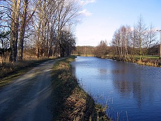
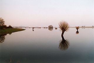
A reaction ferry is a cable ferry that uses the reaction of the current of a river against a fixed tether to propel the vessel across the water. Such ferries operate faster and more effectively in rivers with strong currents.
The Ohre is a river in northern Germany, left tributary to the Elbe. Its total length is 103 kilometres (64 mi). Its source is north of Wolfsburg, in Lower Saxony. It flows generally south-east, at first following the border of Lower Saxony and Saxony-Anhalt. After Buchhorst it flows completely through Saxony-Anhalt, along the Mittellandkanal. It flows into the Elbe in Rogätz, north of Magdeburg. The towns Brome, Calvörde, Haldensleben and Wolmirstedt lie along the river. The upper course of the Ohre is in the Drömling nature reserve.

The Aland is a river in the German states of Lower Saxony and Saxony-Anhalt, left tributary of the Elbe. It is the continuation of the river Biese, which is the continuation of the river Milde. The Aland is 27 kilometres (17 mi) long, whereas the total Milde-Biese-Aland system is 97 kilometres (60 mi) long. The Aland flows into the Elbe in Schnackenburg.
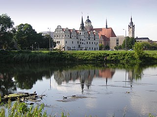
Dessau-Roßlau is a kreisfreie Stadt in the German state of Saxony-Anhalt. It is situated at the confluence of the rivers Elbe and Mulde. The town was formed by merger of the towns of Dessau and Roßlau in the course of the "Kreisreform Sachsen-Anhalt" (Sachsen-Anhalt Regional Boundary Reforms) on 1 July 2007. The reform involved a reduction in the number of rural districts in Sachsen-Anhalt from 21 to 11 and reflected an expected continuation of the significant population decline being experienced.
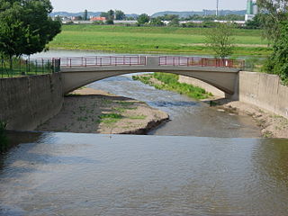
The Weißeritz is a river of Saxony, Germany. It is 13.7 km [8.5 mi] long and a left tiburary of the Elbe.
The river Jeetzel, which begins in the Altmark under the name Jeetze, flows from Saxony-Anhalt through Lower Saxony, in Germany. From its source near the village of Dönitz, it flows north through Beetzendorf, Salzwedel, Wustrow, Lüchow and Dannenberg, before joining the Elbe in Hitzacker. Its total length is 73 kilometres (45 mi).

The Sandau Ferry, also known as the Sandau Büttnershof Ferry, is a cable ferry across the Elbe river between Sandau and Büttnershof in Saxony-Anhalt, Germany.

The Barby Ferry, also known as the Ronney Barby Ferry, is a cable ferry across the Elbe river between Barby and Walternienburg in Saxony-Anhalt, Germany.

The Ferchland Grieben Ferry is a Diesel engine ferry across the Elbe river between Ferchland and Grieben in Saxony-Anhalt, Germany.

Lühe is a river in northern Germany in the district of Stade in Lower Saxony, Germany.

Neue Luppe is an artificial river of Saxony and Saxony-Anhalt, Germany.
The Milde is a river in the German state of Saxony-Anhalt, source river of the Biese. It is 36 kilometres (22 mi) long, whereas the total Milde-Biese-Aland system is 97 kilometres (60 mi) long. The Milde flows into the Biese near Meßdorf.

Alte Hehlenriede is a river of Lower Saxony, Germany.