The regions of Burkina Faso are divided into 45 administrative provinces. These 45 provinces are currently sub-divided into 351 departments or communes.

In geography, statistics and archaeology, a settlement, locality or populated place is a community in which people live. The complexity of a settlement can range from a small number of dwellings grouped together to the largest of cities with surrounding urbanized areas. Settlements may include hamlets, villages, towns and cities. A settlement may have known historical properties such as the date or era in which it was first settled, or first settled by particular people.
Highway 925 is a provincial highway in the far north region of the Canadian province of Saskatchewan. It begins about ten kilometres south of Buffalo Narrows on Highway 155 and ends in Michel Village. Highway 925 is about 76 km (47 mi) long.

Iborfia is a village in Zala County, Hungary.

Assis-sur-Serre is a commune in the department of Aisne in the Hauts-de-France region of northern France.

Attilly is a commune in the department of Aisne in the Hauts-de-France region of northern France.
Barenton-sur-Serre is a commune in the department of Aisne in the Hauts-de-France region of northern France.

Bassoles-Aulers is a commune in the department of Aisne in the Hauts-de-France region of northern France.

Ramapur village and post, or Rama Pur as it is known for postal purposes is a village-gram panchayat in Pawai Block, Phulpur, Azamgarh, Uttar Pradesh.
Mekalmaradi is a village in Belgaum district of Karnataka, India.

Kandla is a village in Saaremaa Parish, Saare County in western Estonia. It is located 21.4 kilometres (13.3 mi) by road northwest of Kuressaare, just to the northwest of Jõempa.

Maungkan is a village on the Chindwin River in Homalin Township, Hkamti District, in the Sagaing Region of northwestern Burma. It is located next to Chaungson and south of Tason. Gardens were planted in Maungkan and other nearby villages around 1700 and the village has been documented as producing pickled tea, known as "letpet".
Kawya is a village on the Chindwin River in Homalin Township, Hkamti District, in the Sagaing Region of northwestern Burma. It is located north of the town of Homalin and south of Maungkan, about half way. Gardens were planted in Kawya and other nearby villages around 1700 and the village has been documented as producing pickled tea, known as "letpet".
Onbet is a village on the Chindwin River in Homalin Township, Hkamti District, in the Sagaing Region of northwestern Burma. It is located north of Tason. Gardens were planted in Onbet and other nearby villages around 1700 and the village has been documented as producing pickled tea, known as "letpet".
Maingwe is a village on the Chindwin River in Homalin Township, Hkamti District, in the Sagaing Region of northwestern Burma. It is located north of Tonmalaw. Gardens were planted in Maingwe and other nearby villages around 1700 and the village has been documented as producing pickled tea, known as "letpet".
Malin is a village on the Chindwin River in Homalin Township, Hkamti District, in the Sagaing Region of northwestern Burma. Gardens were planted in Malin and other nearby villages around 1700 and the village has been documented as producing pickled tea, known as "letpet".

Hanchinala is a village in the Saundatti taluka of Belgaum district in Karnataka. In 2001, it had a population of 6232 with 3189 males and 3043 females.

This is a list of the National Register of Historic Places listings in southern Westchester County, New York, excluding the cities of New Rochelle and Yonkers, which have separate lists of their own.

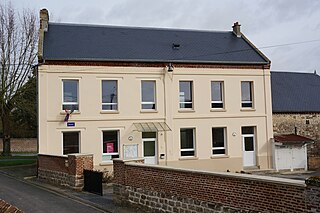
Barisis-aux-Bois, formerly called Barisis until 3 December 2014, is a French commune in the department of Aisne in the Hauts-de-France region of northern France.