Amakhton Bay

Last updated

Amakhton Bay (Russian: Амахтонский залив; Zaliv Amakhtonsky) is a small bay on the north coast of the Sea of Okhotsk in Magadan Oblast. It forms the northwestern portion of Taui Bay. The bay is entered between the mouth of the Arman River to the northeast and Cape Amakhton to the southwest. It is 48.3 km (about 30 mi) wide. Shelikan lies on the south side of the bay. Tidal currents can reach 2 to 2.5 knots in the bay. [1]

Russian language East Slavic language

Russian is an East Slavic language, which is official in the Russian Federation, Belarus, Kazakhstan and Kyrgyzstan, as well as being widely used throughout Eastern Europe, the Baltic states, the Caucasus and Central Asia. It was the de facto language of the Soviet Union until its dissolution on 25 December 1991. Although, nowadays, nearly three decades after the breakup of the Soviet Union, Russian is used in official capacity or in public life in all the post-Soviet nation-states, as well as in Israel and Mongolia, the rise of state-specific varieties of this language tends to be strongly denied in Russia, in line with the Russian World ideology.

Sea of Okhotsk A marginal sea of the western Pacific Ocean, between the Kamchatka Peninsula, the Kuril Islands, the island of Hokkaido, the island of Sakhalin, and eastern Siberian coast

The Sea of Okhotsk is a marginal sea of the western Pacific Ocean, between the Kamchatka Peninsula on the east, the Kuril Islands on the southeast, the island of Hokkaido to the south, the island of Sakhalin along the west, and a long stretch of eastern Siberian coast along the west and north. The northeast corner is the Shelikhov Gulf. The sea is named after Okhotsk, the first Russian settlement in the Far East.

Magadan Oblast First-level administrative division of Russia

Magadan Oblast is a federal subject of Russia. It is geographically located in the Far East region of the country, and is administratively part of the Far Eastern Federal District. Magadan Oblast has a population of 156,996, making it the least populated oblast and the third-least populated federal subject in Russia.

History

American whaleships cruised for bowhead whales in the bay in the 1850s and 1860s. They also traded with the native settlements for milk and fish. [2]

United States federal republic in North America

The United States of America (USA), commonly known as the United States or America, is a country composed of 50 states, a federal district, five major self-governing territories, and various possessions. At 3.8 million square miles, the United States is the world's third or fourth largest country by total area and is slightly smaller than the entire continent of Europe's 3.9 million square miles. With a population of over 327 million people, the U.S. is the third most populous country. The capital is Washington, D.C., and the largest city by population is New York City. Forty-eight states and the capital's federal district are contiguous in North America between Canada and Mexico. The State of Alaska is in the northwest corner of North America, bordered by Canada to the east and across the Bering Strait from Russia to the west. The State of Hawaii is an archipelago in the mid-Pacific Ocean. The U.S. territories are scattered about the Pacific Ocean and the Caribbean Sea, stretching across nine official time zones. The extremely diverse geography, climate, and wildlife of the United States make it one of the world's 17 megadiverse countries.

Whaler specialized ship designed for whaling

A whaler or whaling ship is a specialized ship, designed, or adapted, for whaling: the catching or processing of whales. The former includes the whale catcher – a steam or diesel-driven vessel with a harpoon gun mounted at its bow. The latter includes such vessels as the sail or steam-driven whaleship of the 16th to early 20th centuries and the floating factory or factory ship of the modern era. There have also been vessels which combined the two activities, such as the bottlenose whalers of the late 19th and early 20th century, and catcher/factory ships of the modern era.

Bowhead whale Species of mammal

The bowhead whale is a species of the family Balaenidae, in parvorder Mysticeti, and genus Balaena, which once included the right whale.

Related Research Articles

Shelikhov Gulf bay

Shelikhov Gulf is a large gulf off the northwestern coast of Kamchatka, Russia. It is located in the northeastern corner of the Sea of Okhotsk and it branches into two main arms, Gizhigin Bay to the west and Penzhina Bay to the east. Its southwest corner is formed by the P'yagin Peninsula, Yam Gulf and the Yamsky Islands.

Penzhina Bay bay

Penzhina Bay is a long and narrow bay off the northwestern coast of Kamchatka, Russia.

Sakhalin Gulf is a gulf in the Sea of Okhotsk between continental Russia and the northern tip of Sakhalin Island. The width of the gulf reaches up to 160 km. It is covered with ice from mid-November until late April, but north winds can leave the bay blocked with ice until July.

Minina Skerries island in Russia

The Minina Skerries are located in the Kara Sea, in the northwestern shores of Siberia. They stretch between the Mikhailov Peninsula and the mouths of the river Pyasina. Their latitude is between 74° and 75° N, and their longitude between 84° and 87° 30' E.

Bellsund sound on the west coast of Spitsbergen

Bellsund is a 20-kilometer (12 mi) long sound on the west coast of Spitsbergen, part of the Svalbard archipelago of Norway. It is separated from Van Mijenfjorden by the islands of Akseløya and Mariaholmen. Bellsund is located south of Nordenskiöld Land and north of Wedel Jarlsberg Land.

Zavyalov Island island in Russia

Zavyalov Island, formerly Ola Island, is a relatively large island in the Sea of Okhotsk, northwestern Pacific. It is located on the eastern side of Taui Bay, 20 km west of Cape Taran, Koni Peninsula, about 50 km south of the city of Magadan.

Spafaryev Islands Island group in Far Eastern Federal District, Russian Federation

The Spafaryev Islands, or Spafaryev Island, a relatively large double island, are located in the Sea of Okhotsk. It was formerly known as Korovi Island. It lies 7 km east of the Antamlan Peninsula, the southernmost peninsula enclosing the Taui Bay from its western side.

Nedorazumeniya Island island in Russia

Nedorazumeniya Island is an island on the north coast of the Sea of Okhotsk. It lies on the north side of Taui Bay, between Amakhton Bay to the west and Nagaev Bay to the east. It is about 20 kilometres (12 mi) west of the city of Magadan.

Taui Bay Bay in Far Eastern Federal District, Russian Federation

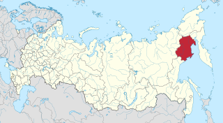
Taui Bay is a body of water in the Sea of Okhotsk off the coast of the Magadan Oblast in Russia. The bay opens to the south.

Gizhigin Bay bay

Gizhigin Bay is a wide bay northwest of Kamchatka, Russia. It is the northwest arm of Shelikhov Bay in the northeast corner of the Sea of Okhotsk. The settlements of Evensk and Gizhiga are located at the head of the bay.

Onega Peninsula peninsula

The Onega Peninsula is located in Arkhangelsk Oblast, Russia. It protrudes into the White Sea, with Onega Bay to the south-west, and Dvina Bay to the north-east. The length of the peninsula is about 150 kilometres (93 mi), and the width varies between 60 kilometres (37 mi) and 75 kilometres (47 mi).

Shelikan Island in Far Eastern Federal District, Russian Federation

Shelikan, also Ostrovok Shelikan, is a coastal islet in the Sea of Okhotsk near Magadan. It lies on the south side of Amakhton Bay.

Abrek Bay is a small bay on the southeast coast of Maly Shantar Island, one of the Shantar Islands, in the western Sea of Okhotsk. It is 2.4 km (1.5 mi) wide at its entrance and about 1.6 km (1 mi) deep. Spring tides rise about 4.5 m (15 ft) and neaps about 2.7 m (9 ft).

Severo-Vostochnaya Gavan' is a small bay on the north side of Uda Gulf, in the western Sea of Okhotsk. It lies 2.4 km (1.5 mi) west of Cape Nosorog. It offers shelter from northeast gales.

Bussol Strait is a wide strait that separates the islands of Broutona and Chirpoy to the west from Simushir to the east. It is nearly 58 km wide, making it the largest channel in the Kuril Islands.

Shelting Bay is a wide bay on the northern coast of the Sea of Okhotsk. It lies just west of Taui Bay. It is entered between Capes Moskvitin and Dal'ny and is about 32 km wide. Its shores are primarily high and rocky, with the exception of a sandy beach at its northwest end. Sheltered anchorages from southerly winds may be obtained in the northwestern and eastern parts of the bay.

Luzhin Bay

Luzhin Bay is a bay in Magadan Oblast, Russian Federation. It is named after Russian cartographer Fyodor Luzhin.

Yam Gulf is a large bay in the northeastern Sea of Okhotsk. It forms the southwestern portion of Shelikhov Gulf. To its southeast lie the Yam Islands.

Yakshin Bay is a small bight in the western Sea of Okhotsk. It is 29 km wide and indents the southwest side of Bolshoy Shantar Island. The bay is entered between Capes Raduzhnyy to the west and Filippa to the east. The Yakshin River flows into the head of the bay. There is ice in the bay from December to July. Tides rise 4.9 m at springs, with the flood current flowing in a counterclockwise direction round the bay and the ebb in the reverse direction. These tidal currents may reach 3.5 to 4 knots near the entrance of the bay but are less than 2 knots at its head.

References

  1. National Geospatial-Intelligence Agency. (2014). Sailing Directions (Enroute): East Coast of Russia. U.S. Government, Springfield, Virginia.
  2. Betsey Williams, of Stonington, Sep. 14, 1853, Nicholson Whaling Collection; Florida, of Fairhaven, July 6, 1860. In Williams, H. (1964). One whaling family. Boston, Houghton Mifflin.

Coordinates: 59°40′N149°37′E / 59.667°N 149.617°E / 59.667; 149.617

Geographic coordinate system Coordinate system

A geographic coordinate system is a coordinate system that enables every location on Earth to be specified by a set of numbers, letters or symbols. The coordinates are often chosen such that one of the numbers represents a vertical position and two or three of the numbers represent a horizontal position; alternatively, a geographic position may be expressed in a combined three-dimensional Cartesian vector. A common choice of coordinates is latitude, longitude and elevation. To specify a location on a plane requires a map projection.