
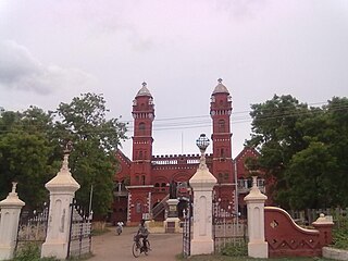
Attur or Aathur is a town, municipality and headquarters of Attur taluk in the Salem district in the state of Tamil Nadu, India. As of the 2011 census, the town had a population of 61,793. Attur is growing economically.

Tenkasi is a town and headquarters of the Tenkasi district in Indian state of Tamil Nadu.

Vandavasi, earlier called Wandiwash is a major town and a municipality in the Tiruvannamalai district of the Indian state of Tamil Nadu. The town is well known in the Carnatic history for the Battle of Wandiwash. Vandavasi town is also the largest manufacturer of kora artefacts including mats, shawls and vessels. As of 2011, the town had a population 74,320.

Rajapalayam is a town in the Indian state of Tamil Nadu. It is the largest municipality in the Virudhunagar district. Rajapalayam is located on the Madurai to Quilon National Highway at a distance of 562 km south of the state capital Chennai. The economy is primarily industrial with several mills for spinning and weaving. The town is known for its mango and the Rajapalayam breed of dogs.

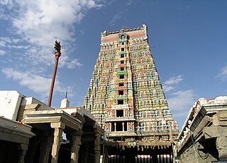
Madurai district is one of the 38 districts of the state of Tamil Nadu in southeastern India. The city of Madurai serves as the district headquarters. It houses the famous Sri Meenakshi Sundareshwarar temple and is situated on the banks of the river Vaigai. Thiruparankundram is one of the major tourist place in the district. As of 2011, the district had a population of 3,038,252 with a sex-ratio of 990 females for every 1,000 males. Aside from the city of Madurai, the larger towns are Melur, Vadipatti, Thirumangalam, Thirupparankundram, Peraiyur, and Usilampatti. It is an important hub for various film shootings. Alanganallur is a popular spot in the district for Jallikattu, as are Palamedu and Avaniyapuram.
Alandur is a zone of Chennai corporation, and an urban node in Chennai district in Guindy division in the state of Tamil Nadu, India. It is Surrounded by Guindy in the North and East, Adambakkam in the South, Pazhavanthangal in the South-West and St Thomas Mount in the North-West. As of 2011, Alandur had a population of 164,430. The town agglomeration of Alandur will have an estimated population of 300,000 by 2030. Alandur neighbours the St. Thomas Mount Cantontment, the Officers Training Academy of the Indian army and the nearby towns of Guindy and Adambakkam. M. G. Ramachandran, a former chief minister of Tamil Nadu started his political career by winning his first legislative election from Alandur in 1967. Alandur also holds famous landmarks of Chennai namely Nehru Statue and Kathipara Junction.
Pudukkottai District is one of the 38 districts of Tamil Nadu state in southern India. The city of Pudukkottai is the district headquarters. It is also known colloquially as Pudhugai.

Dindigul District is one of the 38 districts in the state of Tamil Nadu in India. Dindigul District is the second largest district in Tamil Nadu by area after Thiruvannamalai District. The district was carved out of Madurai District in 1985. It has an area of 6266.64 km2 and comprises 3 revenue divisions, 10 taluks, and 14 panchayat unions. The district is bound by Tiruppur district in the northwest, Karur district in the north, Tiruchirappalli district in the northeast, Madurai and Theni districts in the south, and Idukki district of Kerala to the west. As of 2011, the district had a population of 2,159,775 with a sex-ratio of 998 females for every 1,000 males.
Virudhunagar District is a district of Tamil Nadu state in south India. Virudhunagar is the district headquarters of Virudhunagar district. Virudhunagar district was formed by the separation of Old Ramanathapuram District in 1987 into Ramanathapuram District, Sivagangai District and the west part as Virudhunagar District. Virudhunagar District was formerly called Karmavirer Kamarajar District. As of 2011, Virudhunagar district had a population of 1,942,288 with a sex-ratio of 1,007 females for every 1,000 males. Sivakasi is the most populous and largest city in the district.
Ambasamudram is the principal town of the Ambasamudram taluk in Tirunelveli district in the state of Tamil Nadu, India. The entire taluk had a population of 392,226 as of 2001, with 42.5% classified as rural. The town of Ambasamudram had a population 35,645 as of 2011.

Bodinayakanur is a Town and a municipality in Theni district in the state of Tamil Nadu, India.

Kallakurichi is a Municipality in the Indian state of Tamil Nadu and the administrative headquarters of Kallakurichi district in Tamil Nadu. As of 2019, the town had a population of 73528.
Katthivakkam is an residential and industrial area located in the northern part of Chennai. It is a part of zone 1 in Greater Chennai Corporation. It is under Thiruvottiyur taluk in Chennai district. It is a part of Thiruvottiyur(state assembly constituency) and Chennai North. Formerly a town and a municipality of Thiruvallur district in the Indian state of Tamil Nadu, it has now been absorbed by Chennai city in September 2011 and within Chennai District limit since January 2018. The neighbourhood is served by Katthivakkam railway station. As of 2011, the town had a population of 36,617.

Pallipalayam is a Municipality in Namakkal district in Komarapalayam taluk in the Indian state of Tamil Nadu. It is the headquarter of the Pallipalayam block

Viluppuram, Villupuram or Vizhuppuram is one of the 38 districts that make up the state of Tamil Nadu, India. It was founded on 30 September 1993, prior to which it was part of the Cuddalore district. Vizhuppuram district lies in the way of the national highway connecting Tiruchirappalli and Chennai, and contains historical landmarks like the 500 year-old Gingee Fort.
Narasingapuram is a Municipality in Attur taluk, Salem district in the Indian state of Tamil Nadu. As of 2011, the town had a population of 23,084.

Thiruvarur district is one of the 38 districts in the Tamil Nadu state of India. As of 2011, the district had a population of 1,264,277 with a sex-ratio of 1,017 females for every 1,000 males.
Mathur is a residential area located north of Chennai, a metropolitan city in Tamil Nadu, India. Mathur is administered by the Greater Chennai Corporation and belongs to Madhavaram taluk of Chennai district.

Mayiladuthurai district is one of the 38 districts of the state of Tamil Nadu in India. The district headquarters is located at Mayiladuthurai.
Kolathur is a neighborhood located in the northwestern region of Chennai, India.

