Morondava is a city located in Menabe Region, of which it is the capital, in Madagascar. It is located in the delta of the Morondava River at 20°17′5″S44°19′3″E. Its population as of the 2018 census, was 53,510.

Amoron'i Mania is a region in central Madagascar bordering Vakinankaratra Region in north, Atsinanana in northeast, Fitovinany in southeast, Haute Matsiatra in south, Atsimo-Andrefana in southwest and Menabe in west.
Malaimbandy is a municipality in Madagascar. It belongs to the district of Mahabo, which is a part of Menabe Region. The population of the commune was estimated to be approximately 26,000 in 2001 commune census.
Anjoma is a rural municipality in Madagascar. It belongs to the district of Ambalavao, which is a part of Haute Matsiatra Region. The population of the commune was estimated to be approximately 13,000 in 2001 commune census.

Soatanana is a rural municipality in Madagascar. It belongs to the district of Fianarantsoa II, which is a part of Haute Matsiatra Region. The population of the commune was estimated to be approximately 10,000 in 2001 commune census.
Ivato is a town and commune in Madagascar. It belongs to the district of Vohipeno, which is a part of the region of Fitovinany. The population of the commune was 2,698 in 2018.

Amborompotsy is a rural municipality in Madagascar. It belongs to the district of Ambatofinandrahana, which is a part of Amoron'i Mania Region. The population of the commune was estimated to be approximately 10,000 in 2001 commune census.
Fenoarivo is a town and commune in Madagascar. It belongs to the district of Ambatofinandrahana, which is a part of Amoron'i Mania Region. The population of the commune was estimated to be approximately 16,000 in 2001 commune census.
Itremo is a town and commune in Madagascar. It belongs to the district of Ambatofinandrahana, which is a part of Amoron'i Mania Region. The population of the commune was estimated to be approximately 7,000 in 2001 commune census.
Mandrosonoro is a town and commune in Madagascar. It belongs to the district of Ambatofinandrahana, which is a part of Amoron'i Mania Region. The population of the commune was estimated to be approximately 16,000 in 2001 commune census.
Mangataboahangy is a town and commune in Madagascar. It belongs to the district of Ambatofinandrahana, which is a part of Amoron'i Mania Region. The population of the commune was estimated to be approximately 8,000 in 2001 commune census.
Soavina is a town and commune in Madagascar. It belongs to the district of Ambatofinandrahana, which is a part of Amoron'i Mania Region. The population of the commune was 4,871 in 2018.
Ivato or Ivato Centre is a rural commune (town) in Madagascar. It belongs to the Ambositra District, which is a part of the Amoron'i Mania region.
Sahatsiho Ambohimanjaka is a rural municipality in Madagascar. It belongs to the district of Ambositra, which is a part of Amoron'i Mania Region. The population of the commune was estimated to be approximately 9,000 in 2001 commune census.
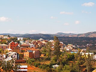
Ambositra District is a district in central Madagascar. It is part of Amoron'i Mania Region. Its capital is Ambositra. The district has an area of 2,914 km2 (1,125 sq mi), and the estimated population in 2020 was 314,968.

Ambatofinandrahana District is a district in central Madagascar. It is part of Amoron'i Mania Region. It coverts an area of 10,321.48 km2, and in 2020 its population was estimated at 237,262. Its capital is Ambatofinandrahana.

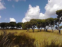
Route nationale 35 is a primary highway in Madagascar of 456 km, running from Ivato, Ambositra to Morondava. It crosses the regions of Menabe and Amoron'i Mania.

Ambohidratrimo is a district of Analamanga in Madagascar. The district has an area of 1,415 km2 (546 sq mi), and the estimated population in 2020 was 470,221.
Vohipeno is a district of Vohipeno, which is a part of the region of Fitovinany, which is part of Madagascar. The population of the town was 14,751 in 2018, the population of the district was 292,880.

Ivato is a town and commune in Madagascar. It belongs to the district of Ambohidratrimo (district), which is a part of Analamanga Region.