Sandrandahy Sandradahy | |
|---|---|
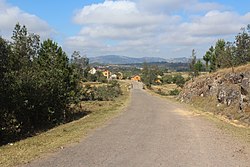 shortly before Sandrandahy | |
 Sandrandahy Location in Madagascar | |
| Coordinates: 20°21′S47°18′E / 20.350°S 47.300°E | |
| Country | |
| Region | Amoron'i Mania |
| District | Fandriana |
| Elevation | 1,322 m (4,337 ft) |
| Population (2001) [2] | |
• Total | 28,000 |
| Time zone | UTC3 (EAT) |
| Postal code | 308 |
Sandrandahy is a rural municipality in Madagascar. It belongs to the district of Fandriana, which is a part of Amoron'i Mania Region. The population of the commune was estimated to be approximately 28,000 in 2001 commune census. [2]
Contents
Primary and junior level secondary education are available in town. The majority 64% of the population of the commune are farmers, while an additional 30% receives their livelihood from raising livestock. The most important crop is rice, while other important products are maize, cassava and sweet potatoes. Industry and services provide employment for 0.5% and 5.5% of the population, respectively. [2]
