Related Research Articles

Hydrology is the scientific study of the movement, distribution, and management of water on Earth and other planets, including the water cycle, water resources, and drainage basin sustainability. A practitioner of hydrology is called a hydrologist. Hydrologists are scientists studying earth or environmental science, civil or environmental engineering, and physical geography. Using various analytical methods and scientific techniques, they collect and analyze data to help solve water related problems such as environmental preservation, natural disasters, and water management.

A flood is an overflow of water that submerges land that is usually dry. In the sense of "flowing water", the word may also be applied to the inflow of the tide. Floods are an area of study of the discipline hydrology and are of significant concern in agriculture, civil engineering and public health. Human changes to the environment often increase the intensity and frequency of flooding, for example land use changes such as deforestation and removal of wetlands, changes in waterway course or flood controls such as with levees, and larger environmental issues such as climate change and sea level rise. In particular climate change's increased rainfall and extreme weather events increases the severity of other causes for flooding, resulting in more intense floods and increased flood risk.
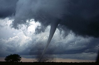
Extreme weather includes unexpected, unusual, severe, or unseasonal weather; weather at the extremes of the historical distribution—the range that has been seen in the past. Extreme events are based on a location's recorded weather history. They are defined as lying in the most unusual ten percent. The main types of extreme weather include heat waves, cold waves and heavy precipitation or storm events, such as tropical cyclones. The effects of extreme weather events are economic costs, loss of human lives, droughts, floods, landslides. Severe weather is a particular type of extreme weather which poses risks to life and property.
Robert Elmer Horton was an American hydrologist, geomorphologist, civil engineer, and soil scientist, considered by many to be the father of modern American hydrology. An eponymous medal is awarded by the American Geophysical Union (AGU) to recognize outstanding contributions to the field of hydrological geophysics. The AGU Hydrology section was formed largely due to his personal property that was bequeathed to AGU.

Rafael Luis Bras is a Puerto Rican civil engineer best known for his contributions in surface hydrology and hydrometeorology, including his work in soil-vegetation-atmosphere system modeling.

Climate change in California has resulted in higher than average temperatures, leading to increased occurrences of drought and wildfires. During the next few decades in California, climate change is likely to further reduce water availability, increase wildfire risk, decrease agricultural productivity, and threaten coastal ecosystems. The state will also be impacted economically due to the rising cost of providing water to its residents along with revenue and job loss in the agricultural sector. California has taken a number of steps to mitigate impacts of climate change in the state.

The aim of water security is to make the most of water's benefits for humans and ecosystems. The second aim is to limit the risks of destructive impacts of water to an acceptable level. These risks include for example too much water (flood), too little water or poor quality (polluted) water. People who live with a high level of water security always have access to "an acceptable quantity and quality of water for health, livelihoods and production". For example, access to water, sanitation and hygiene services is one part of water security. Some organizations use the term water security more narrowly for water supply aspects only.
The following outline is provided as an overview of and topical guide to hydrology:

Climate change in Africa is an increasingly serious threat as Africa is among the most vulnerable continents to the effects of climate change. Some sources even classify Africa as "the most vulnerable continent on Earth". This vulnerability is driven by a range of factors that include weak adaptive capacity, high dependence on ecosystem goods for livelihoods, and less developed agricultural production systems. The risks of climate change on agricultural production, food security, water resources and ecosystem services will likely have increasingly severe consequences on lives and sustainable development prospects in Africa. With high confidence, it was projected by the IPCC in 2007 that in many African countries and regions, agricultural production and food security would probably be severely compromised by climate change and climate variability. Managing this risk requires an integration of mitigation and adaptation strategies in the management of ecosystem goods and services, and the agriculture production systems in Africa.
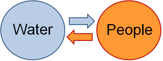
Socio-hydrology; socio and hydrology is an interdisciplinary field studying the dynamic interactions and feedbacks between water and people. Areas of research in socio-hydrology include the historical study of the interplay between hydrological and social processes, comparative analysis of the co-evolution and self-organization of human and water systems in different cultures, and process-based modelling of coupled human-water systems. The first approach to socio-hydrology was the term "hydro-sociology", which arises from a concern about the scale of impact of human activities on the hydrological cycle. Socio-hydrology is defined as the humans-water interaction and later as “the science of people and water”, which introduces bidirectional feedbacks between human–water systems, differentiating it from other related disciplines that deal with water. Furthermore, socio-hydrology has been presented as one of the most relevant challenges for the Anthropocene, in relationship with its aims at unraveling dynamic cross-scale interactions and feedbacks between natural and human processes that give rise to many water sustainability challenges. Socio‐hydrology is also predicted to be an important license for modellers.
PERSIANN, "Precipitation Estimation from Remotely Sensed Information using Artificial Neural Networks", is a satellite-based precipitation retrieval algorithm that provides near real-time rainfall information. The algorithm uses infrared (IR) satellite data from global geosynchronous satellites as the primary source of precipitation information. Precipitation from IR images is based on statistical relationship between cloud top temperature and precipitation rates. The IR-based precipitation estimates are then calibrated using satellite microwave data available from low Earth orbit satellites. The calibration technique relies on an adaptive training algorithm that updates the retrieval parameters when microwave observations become available.
The 2016 Indian heat wave was a major heat wave in April and May of that year. A national record high temperature of 51.0 °C (123.8 °F) was set in the town of Phalodi, in the state of Rajasthan. Over 160 people died with 330 million affected to some degree. There were also water shortages with drought worsening the impact of the heat wave.
Ana Paula Barros is an African-born American civil and environmental engineer currently the Donald Biggar Willett Chair of Engineering and Department Head of Civil and Environmental Engineering at the University of Illinois at Urbana-Champaign and an Elected Fellow of the American Association for the Advancement of Science and an Elected Fellow of the American Meteorological Society. In 2019 she was elected to the National Academy of Engineering for "contributions to understanding and prediction of precipitation dynamics and flood hazards in mountainous terrains". Prior to joining the University of Illinois, Professor Barros was the James L. Meriam Professor of Civil and Environmental Engineering at Duke University.
Hayley J. Fowler is a Professor of Climate Change Impacts in the School of Engineering at Newcastle University.
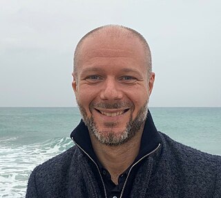
Giuliano Di Baldassarre is a professor of hydrology at Uppsala University and the Director of the Centre of Natural Hazards and Disaster Science, Sweden. He was awarded the American Geophysical Union Whiterspoon Lecture in 2020 and the European Geosciences Union Plinius Medal in 2021.
World Weather Attribution is an academic collaboration studying extreme event attribution, calculations of the impact of climate change on extreme meteorological events such as heat waves, droughts, and storms. When an extreme event occurs, the project computes the likelihood that the occurrence, intensity, and duration of the event was due to climate change. The project specializes in producing reports rapidly, while news of the event is still fresh.
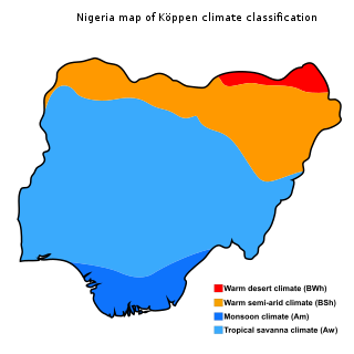
The climate of Nigeria is mostly tropical. Nigeria has three distinct climatic zones, two seasons, and an average temperature ranging between 21 °C and 35 °C. Two major elements determine the temperature in Nigeria: the altitude of the sun and the atmosphere's transparency. Its rainfall is mediated by three distinct conditions including convectional, frontal, and orographical determinants. Statistics from the World Bank Group showed Nigeria's annual temperature and rainfall variations, the nation's highest average annual mean temperature was 28.1 °C in 1938, while its wettest year was 1957 with an annual mean rainfall of 1,441.45mm.
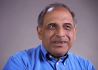
Upmanu Lall is an Indian-American engineer and the Alan and Carol Silberstein Professor of Engineering at Columbia University. He serves as Director of the Columbia Water Center. Lall studies water scarcity and how to predict and mitigate floods. He was named an American Geophysical Union Fellow in 2017 and their Walter Langbein Lecturer in 2022. He was elected a fellow of the American Association for the Advancement of Science in 2018, and has received the Arid Lands Hydrology and the Ven Te Chow Awards from the American Society of Civil Engineers. In April 2021 he was named to the “Hot List of the world’s 1,000 top climate scientists” by Reuters.
Georgiy L. Stenchikov is an applied mathematician and climate scientist focusing on studies of physical processes that govern the Earth's climate. He is a professor in the Department of Earth Science and Engineering at the King Abdullah University of Science and Technology in Saudi Arabia.
References
- 1 2 3 "Amir AghaKouchak - Home". amir.eng.uci.edu.
- ↑ "Amir AghaKouchak". scholar.google.com.
- 1 2 "AGU - American Geophysical Union". www.agu.org.
- ↑ "Board of Directors | Governance | About | CUAHSI - Universities Allied for Water Research". www.cuahsi.org.
- ↑ "Earth's Future". AGU Journals.
- ↑ "CHRS Directory".
- ↑ Aghakouchak, Amir; Cheng, Linyin; Mazdiyasni, Omid; Farahmand, Alireza (2014). "Global warming and changes in risk of concurrent climate extremes: Insights from the 2014 California drought". Geophysical Research Letters. 41 (24): 8847–8852. doi: 10.1002/2014GL062308 . S2CID 36275524.
- ↑ Cheng, Linyin; Aghakouchak, Amir; Gilleland, Eric; Katz, Richard W. (2014). "Non-stationary extreme value analysis in a changing climate". Climatic Change. 127 (2): 353–369. Bibcode:2014ClCh..127..353C. doi:10.1007/s10584-014-1254-5. hdl: 10.1007/s10584-014-1254-5 . S2CID 15339624.
- ↑ Hao, Zengchao; AghaKouchak, Amir; Nakhjiri, Navid; Farahmand, Alireza (March 11, 2014). "Global integrated drought monitoring and prediction system". Scientific Data. 1 (1): 140001. doi: 10.1038/sdata.2014.1 . PMC 4322588 . PMID 25977759.
- ↑ AghaKouchak, Amir; Feldman, David; Hoerling, Martin; Huxman, Travis; Lund, Jay (August 27, 2015). "Water and climate: Recognize anthropogenic drought". Nature News. 524 (7566): 409–11. doi: 10.1038/524409a . PMID 26310750. S2CID 4410474.
- ↑ "Anthropogenic Drought: How Humans Affect the Global Ecosystem". Eos. 31 October 2016.
- ↑ Mazdiyasni, Omid; AghaKouchak, Amir (September 15, 2015). "Substantial increase in concurrent droughts and heatwaves in the United States". Proceedings of the National Academy of Sciences. 112 (37): 11484–11489. doi: 10.1073/pnas.1422945112 . PMC 4577202 . PMID 26324927.
- ↑ Lima, Carlos H. R.; AghaKouchak, Amir; Lall, Upmanu (December 1, 2017). "Classification of mechanisms, climatic context, areal scaling, and synchronization of floods: the hydroclimatology of floods in the Upper Paraná River basin, Brazil". Earth System Dynamics. 8 (4): 1071–1091. doi: 10.5194/esd-8-1071-2017 – via esd.copernicus.org.
- ↑ Raei, Ehsan; Nikoo, Mohammad Reza; AghaKouchak, Amir; Mazdiyasni, Omid; Sadegh, Mojtaba (October 30, 2018). "GHWR, a multi-method global heatwave and warm-spell record and toolbox". Scientific Data. 5 (1): 180206. doi: 10.1038/sdata.2018.206 . PMC 6207177 . PMID 30376556.
- ↑ Mazdiyasni, Omid; AghaKouchak, Amir; Davis, Steven J.; Madadgar, Shahrbanou; Mehran, Ali; Ragno, Elisa; Sadegh, Mojtaba; Sengupta, Ashmita; Ghosh, Subimal; Dhanya, C. T.; Niknejad, Mohsen (June 8, 2017). "Increasing probability of mortality during Indian heat waves". Science Advances. 3 (6): e1700066. doi: 10.1126/sciadv.1700066 . PMC 5462497 . PMID 28630921.
- ↑ Moftakhari, Hamed R.; Salvadori, Gianfausto; AghaKouchak, Amir; Sanders, Brett F.; Matthew, Richard A. (August 23, 2017). "Compounding effects of sea level rise and fluvial flooding". Proceedings of the National Academy of Sciences. 114 (37): 9785–9790. doi: 10.1073/pnas.1620325114 . PMC 5603992 . PMID 28847932.
- ↑ "How do natural hazards cascade to cause disasters?".
- ↑ Chiang, Felicia; Mazdiyasni, Omid; AghaKouchak, Amir (August 8, 2018). "Amplified warming of droughts in southern United States in observations and model simulations". Science Advances. 4 (8): eaat2380. doi: 10.1126/sciadv.aat2380 . PMC 6070332 . PMID 30083607.
- ↑ AghaKouchak, Amir; Bárdossy, András; Habib, Emad (June 1, 2010). "Conditional simulation of remotely sensed rainfall data using a non-Gaussian v-transformed copula". Advances in Water Resources. 33 (6): 624–634. doi:10.1016/j.advwatres.2010.02.010. S2CID 51856411 – via ScienceDirect.
- ↑ Aghakouchak, A.; Farahmand, A.; Melton, F. S.; Teixeira, J.; Anderson, M. C.; Wardlow, B. D.; Hain, C. R. (2015). "Remote sensing of drought: Progress, challenges and opportunities". Reviews of Geophysics. 53 (2): 452–480. Bibcode:2015RvGeo..53..452A. doi: 10.1002/2014RG000456 .
- ↑ "Hellman Fellows » Amir Aghakouchak".
- ↑ "AghaKouchak Receives 2017 Hydrologic Sciences Early Career Award". Eos. 27 October 2017.
- ↑ "James B. Macelwane Medal | AGU". www.agu.org.
- ↑ "Early Career Scientist Award Committee". www.iugg.org. Archived from the original on 2022-07-02. Retrieved 2020-12-30.
- ↑ "Walter L. Huber Civil Engineering Research Prizes | ASCE | Past Award Winners". www.asce.org. Archived from the original on 2018-11-12. Retrieved 2020-12-30.