Related Research Articles
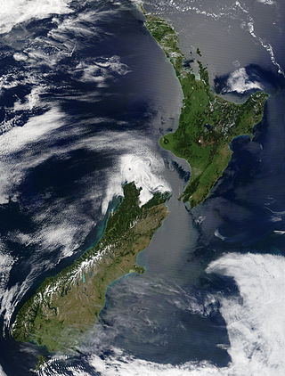
New Zealand is an island country located in the southwestern Pacific Ocean, near the centre of the water hemisphere. It consists of a large number of islands, estimated around 700, mainly remnants of a larger landmass now beneath the sea. The land masses by size are the South Island and the North Island, separated by the Cook Strait. The third-largest is Stewart Island / Rakiura, located 30 kilometres off the tip of the South Island across Foveaux Strait. Other islands are significantly smaller in area. The three largest islands stretch 1,600 kilometres across latitudes 35° to 47° south. New Zealand is the sixth-largest island country in the world, with a land size of 268,680 km2 (103,740 sq mi).

Canterbury is a region of New Zealand, located in the central-eastern South Island. The region covers an area of 44,503.88 square kilometres (17,183.04 sq mi), making it the largest region in the country by area. It is home to a population of 666,300.
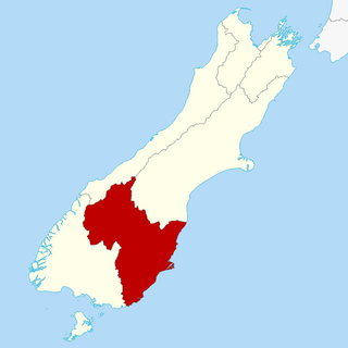
Otago is a region of New Zealand located in the southern half of the South Island administered by the Otago Regional Council. It has an area of approximately 32,000 square kilometres (12,000 sq mi), making it the country's second largest local government region. Its population was 254,600 in June 2023.

Banks Peninsula is a peninsula of volcanic origin on the east coast of the South Island of New Zealand. It has an area of approximately 1,200 square kilometres (450 sq mi) and encompasses two large harbours and many smaller bays and coves. The South Island's largest city, Christchurch, is immediately north of the peninsula.

Cheviot is a town in the Hurunui District of north Canterbury, on the east coast of the South Island of New Zealand. It is located on State Highway 1, approximately 112 kilometres (70 mi) north of Christchurch and 68 kilometres (42 mi) south of Kaikōura.

Christchurch is the largest city in the South Island and the second-largest city by urban area population in New Zealand, after Auckland. Christchurch lies in the Canterbury Region, near the centre of the east coast of the South Island, east of the Canterbury Plains. It is located near the southern end of Pegasus Bay, and is bounded to the east by the Pacific Ocean and to the south by Banks Peninsula. The Avon River / Ōtākaro flows through the centre of the city, with a large urban park along its banks. Christchurch has a reputation for being an 'English' city, with its architectural identity and common nickname the "Garden City" due to similarities with garden cities in England.

The Canterbury Plains are an area in New Zealand centred in the Mid Canterbury, to the south of the city of Christchurch in the Canterbury region. Their northern extremes are at the foot of the Hundalee Hills in the Hurunui District, and in the south they merge into the plains of North Otago beyond the Waitaki River. The smaller Amuri Plain forms a northern extension of the plains.

The Rakaia River is in the Canterbury Plains in New Zealand's South Island. The Rakaia River is one of the largest braided rivers in New Zealand. The Rakaia River has a mean flow of 203 cubic metres per second (7,200 cu ft/s) and a mean annual seven-day low flow of 87 m3/s (3,100 cu ft/s). In the 1850s, European settlers named it the Cholmondeley River, but this name lapsed into disuse. The name Rakaia comes from Māori "Ō Rakaia", meaning the place where people were arranged by ranks.
Medbury is a rural locality in the Canterbury region of New Zealand's South Island. It is located just off State Highway 7 near the Hurunui River. There is no longer a significant population base forming a township, just rural properties.

Culverden is a small town in the northern Canterbury region of New Zealand's South Island. It lies at the centre of the Amuri Plain. Culverden has traditionally been surrounded by sheep farms. Dairy farms have now become more common as a result of irrigation schemes in the area. The Waiau Plains Irrigation Scheme was completed in 1980. It provides irrigation to 17,000 hectares of farmland and the Balmoral Scheme provides irrigation to a further 5500 hectares.

Rotherham is a small village in the Hurunui District of the Canterbury region in New Zealand's South Island. It is between Culverden and Waiau on the Inland Kaikōura Road, on the northernmost part of the Amuri Plain. It lies near the south bank of the Waiau Uwha River, a popular location for trout and salmon fishing.

South Canterbury is the area of the Canterbury Region of the South Island of New Zealand bounded by the Rangitata River in the north and the Waitaki River to the south. The Pacific Ocean and ridge of the Southern Alps form natural boundaries to the east and west respectively. Though the exact boundaries of the region have never been formalised, the term is used for a variety of government agencies and other entities. It is one of four traditional sub-regions of Canterbury, along with Mid Canterbury, North Canterbury, and Christchurch city.

The Hurunui River is the fourth largest of the four principal rivers in north Canterbury, New Zealand, with a catchment area of 2,670 square kilometres (1,030 sq mi). The river flows from the eastern side of the Southern Alps, to the Pacific Ocean.
Mt Lyford (1590m) is the home of an alpine village and ski resort in the South Island of New Zealand. It is 146 kilometres by road north of Christchurch on the Inland Kaikōura Road (SH70) between Culverden and Kaikōura. The resort is a 40-minute drive to Hanmer Springs and a 45-minute drive to Kaikōura. The nearby township of Waiau, Canterbury has a small supermarket, DIY store and petrol station. The Inland Kaikōura Road is very scenic and windy from Waiau through to Kaikōura and forms part of the Alpine Pacific Touring Route.
Gladstone is a lightly populated locality in the Carterton District of New Zealand's North Island, located on the Mangahuia Stream near where the Tauweru River joins the Ruamahanga River. The nearest town is Carterton 15 kilometres to the northwest, and nearby settlements include Ponatahi to the west and Longbush to the south. It was named after British prime minister William Ewart Gladstone.

Amuri County is one of the former counties of New Zealand, in the area that is now the north of Canterbury region.
The Pahau River or Pahu River is a river of the north Canterbury region of New Zealand's South Island. It has its origins in the Tekoa Range, 25 kilometres (16 mi) northwest of Culverden, and flows initially north before turning south to flow down a long valley between two ridges. At the northern edge of the Canterbury Plains it turns southeast, flowing past the southern outskirts of Culverden to reach the Hurunui River 8 kilometres (5 mi) southeast of the town.

The Seaward River is a river in New Zealand's South Island. It flows northeast from its origins in north Canterbury's Puketeraki Range, reaching the Hurunui River 35 kilometres (22 mi) southwest of Culverden.

Southland is New Zealand's southernmost region. It consists of the southwestern portion of the South Island and includes Stewart Island. Southland is bordered by the culturally similar Otago Region to the north and east, and the West Coast Region in the extreme northwest. The region covers over 3.1 million hectares and spans 3,613 km of coastline. As of June 2023, Southland has a population of 103,900, making it the eleventh-most-populous New Zealand region, and the second-most sparsely populated. Approximately half of the region's population lives in Invercargill, Southland's only city.
References
- ↑ "Amuri Plain Archived 2022-02-18 at the Wayback Machine ," NZ Topo Map. Retrieved 19 February 2022.
- ↑ Wilson, J., "Canterbury region: Agriculture after 1900 Archived 2021-11-20 at the Wayback Machine ," Te Ara Encyclopedia of New Zealand , 6 July 2015. Retrieved 19 February 2022.
- ↑ Wilson, J., "Canterbury places: Amuri district Archived 2021-12-05 at the Wayback Machine ," Te Ara Encyclopedia of New Zealand , 17 August 2015. Retrieved 19 February 2022.
42°45′S172°55′E / 42.750°S 172.917°E
| | This Canterbury Region-related geography article is a stub. You can help Wikipedia by expanding it. |