
Kaikōura is a town on the east coast of the South Island of New Zealand. It is located on State Highway 1, 180 km north of Christchurch. The town has an estimated permanent resident population of 2,420.

Cheviot is a town in the Hurunui District of north Canterbury, on the east coast of the South Island of New Zealand. It is located on State Highway 1, approximately 112 kilometres (70 mi) north of Christchurch and 68 kilometres (42 mi) south of Kaikōura.

Murchison is a town in the Tasman Region of the South Island of New Zealand. It is near the western end of the "Four Rivers Plain", at the confluence of the Buller River and the Matakitaki River. The other two rivers are the Mangles River, and the Matiri River. It is a rural service town for the surrounding mixed farming district, approximately halfway between Westport and Nelson. Murchison was named after the Scottish geologist Roderick Murchison, one of the founders of the Royal Geographical Society.

Tuatapere is a small rural town in Southland, New Zealand. It is the self declared "Sausage Capital of New Zealand". Tuatapere is located eight kilometres from the southern coast. The Waiau River flows through the town before reaching Te Waewae Bay, where it has its outflow into Foveaux Strait. The main local industries are forestry and farming.

The Clarence River is a major river which flows through the Kaikōura Ranges in the northeast of New Zealand's South Island. At roughly 209 kilometres (130 mi) long, it is the longest river in Canterbury and the eighth longest in New Zealand.

The Kaikōura Ranges are two parallel ranges of mountains located in the northeast of the South Island of New Zealand. The two ranges are visible from a great distance, including from the southern coast of the North Island.

Waipara is a small town in north Canterbury, New Zealand, on the banks of the Waipara River. Its name translates to "Muddy Water", wai meaning water and para meaning mud.

Waihi Beach is a coastal town at the western end of the Bay of Plenty in New Zealand's North Island. It lies 10 kilometres to the east of the town of Waihi, at the foot of the Coromandel Peninsula. The main beach is 10 kilometres long. The town had a permanent population of 2,730 as of June 2021.
The Main North Line between Picton and Christchurch and the Main South Line between Lyttelton and Invercargill, running down the east coast of the South Island of New Zealand, are sometimes together referred to collectively as the South Island Main Trunk Railway (SIMT). Construction of a line running the length of the east coast began in the 1860s and was completed all the way from Picton to Invercargill in 1945; the last sections being on the Main North Line south of Picton. The designation "South Island Main Trunk" originally referred to only that line between Christchurch and Invercargill.

Waiau is a small town in north Canterbury, in the South Island of New Zealand. It lies 30 kilometres (19 mi) east of Hanmer Springs on the northern bank of the Waiau Uwha River, some 30 kilometres (19 mi) from the river's mouth. There is a small supermarket, a DIY store and a petrol station.
The Waiau Branch was a branch line railway in the northern Canterbury region of New Zealand's South Island. Known as the Great Northern Railway for its first few decades of life, the Waiau Branch was seen as part of a main line north but was ultimately superseded by a coastal route. Opened in stages from 1882 to 1919, the line closed in 1978 but a portion has been retained as the Weka Pass Railway.
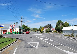
Hawarden is a small town in the Canterbury region of New Zealand's South Island. It is located near Waikari, just off State Highway 7.

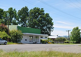
Medbury is a rural locality in the Canterbury region of New Zealand's South Island. It is located just off State Highway 7 near the Hurunui River. There is no longer a significant population base forming a township, just rural properties.

Culverden is a small town in the northern Canterbury region of New Zealand's South Island. It lies at the centre of the Amuri Plain. Culverden has traditionally been surrounded by sheep farms. Dairy farms have now become more common as a result of irrigation schemes in the area. The Waiau Plains Irrigation Scheme was completed in 1980. It provides irrigation to 17,000 hectares of farmland and the Balmoral Scheme provides irrigation to a further 5500 hectares. The Rutherford Reserve and the Culverden Recreation Reserve are on the southern side of Culverden and the Culverden Golf Course in on the northern entrance to Culverden. There is a memorial in the Rutherford Reserve to Dr Charles Little who died in November 1918 from the Spanish Flu. He was the county doctor providing medical services from Waikari to Waiau.
Parnassus is a locality in the Canterbury region's Hurunui District on the east coast of New Zealand's South Island. It is located on the north bank of the Waiau River.

The Main North Line, sometimes referred to as part of the South Island Main Trunk railway, is a railway line that runs north from Christchurch in New Zealand up the east coast of the South Island through Kaikōura and Blenheim to Picton. It is a major link in New Zealand's national rail network and offers a connection with roll-on roll-off ferries from Picton to Wellington. It was also the longest railway construction project in New Zealand's history, with the first stages built in the 1870s and not completed until 1945.
Mt Lyford (1590m) is the home of an alpine village and ski resort in the South Island of New Zealand. It is 146 kilometres by road north of Christchurch on the Inland Kaikōura Road (SH70) between Culverden and Kaikoura. The resort is a 40-minute drive to Hanmer Springs and a 45-minute drive to Kaikoura. The nearby township of Waiau, Canterbury has a small supermarket, DIY store and petrol station. The Inland Kaikōura Road is very scenic and windy from Waiau through to Kaikōura and forms part of the Alpine Pacific Touring Route.
Amuri County is one of the former counties of New Zealand, in the area that is now the north of Canterbury region.
The Inland Kaikōura Road, formerly designated State Highway 70, is a provincial highway in the South Island of New Zealand that runs from just south of Kaikōura to just north of Culverden via Waiau and Rotherham. White shields are used to signify this highway. It forms part of the Alpine Pacific Triangle tourist route. It also serves as an alternative inland route in cases where SH 1 is closed near the South Kaikōura Coast. Following the 14 November 2016 Kaikōura earthquake, all roads into Kaikōura were closed including SH70; after extensive regrading and clearance the Inland Road was the first road connection to Kaikōura to reopen and was a lifeline for the community.
The Amuri Plain is the northernmost extension of New Zealand's Canterbury Plains. It lies between the Waiau Uwha and Hurunui Rivers and is centred on the town of Culverden. Other population centres on the plain include Rotherham. The plains cover approximately 60,000 hectares.


