Ashley Forest

Last updated

Ashley Forest
Locality
Ashley Forest
Coordinates: 43°07′41″S172°29′46″E / 43.128°S 172.496°E / -43.128; 172.496
Country New Zealand
Region Canterbury
Territorial authority Hurunui District
WardSouth Ward
Electorates
Government
  Territorial Authority Hurunui District Council
  Regional council Environment Canterbury
   Mayor of Hurunui Marie Black
   Kaikoura MP Stuart Smith
   Te Tai Tonga MP Tākuta Ferris
Area
[1]
  Total340.57 km2 (131.49 sq mi)
Population
 (June 2023) [2]
  Total790
  Density2.3/km2 (6.0/sq mi)
Time zone UTC+12 (New Zealand Standard Time)
  Summer (DST) UTC+13 (New Zealand Daylight Time)

Ashley Forest is a forest and a statistical area in the Canterbury Region's Hurunui District on the east coast of New Zealand's South Island. It is located north of the Ashley River / Rakahuri and northeast of the Okuku River. [3]

Contents

The forest was planted from 1939. [4] It is managed by Rayonier Matariki and is only accessible by the public with a permit. [5]

Ashley Forest Village is a small settlement at the southern end of the forest.

Demographics

The Ashley Forest statistical area covers 340.57 km2 (131.49 sq mi). [1] It had an estimated population of 790 as of June 2023, [2] with a population density of 2.3 people per km2.

Historical population
YearPop.±% p.a.
2006522    
2013642+3.00%
2018669+0.83%
Source: [6]

Ashley Forest had a population of 669 at the 2018 New Zealand census, an increase of 27 people (4.2%) since the 2013 census, and an increase of 147 people (28.2%) since the 2006 census. There were 234 households, comprising 348 males and 324 females, giving a sex ratio of 1.07 males per female. The median age was 44.8 years (compared with 37.4 years nationally), with 138 people (20.6%) aged under 15 years, 105 (15.7%) aged 15 to 29, 327 (48.9%) aged 30 to 64, and 102 (15.2%) aged 65 or older.

Ethnicities were 97.3% European/Pākehā, 7.6% Māori, 0.4% Pasifika, 1.3% Asian, and 0.4% other ethnicities. People may identify with more than one ethnicity.

The percentage of people born overseas was 13.5, compared with 27.1% nationally.

Although some people chose not to answer the census's question about religious affiliation, 51.6% had no religion, 37.7% were Christian, 0.4% were Buddhist and 1.3% had other religions.

Of those at least 15 years old, 114 (21.5%) people had a bachelor's or higher degree, and 75 (14.1%) people had no formal qualifications. The median income was $36,400, compared with $31,800 nationally. 105 people (19.8%) earned over $70,000 compared to 17.2% nationally. The employment status of those at least 15 was that 297 (55.9%) people were employed full-time, 96 (18.1%) were part-time, and 21 (4.0%) were unemployed. [6]

Climate

Climate data for Ashley Forest (1991–2020)
MonthJanFebMarAprMayJunJulAugSepOctNovDecYear
Mean daily maximum °C (°F)21.6
(70.9)
21.3
(70.3)
19.9
(67.8)
17.3
(63.1)
14.0
(57.2)
11.7
(53.1)
10.9
(51.6)
12.0
(53.6)
14.5
(58.1)
16.3
(61.3)
17.9
(64.2)
20.1
(68.2)
16.5
(61.6)
Daily mean °C (°F)16.5
(61.7)
16.3
(61.3)
14.7
(58.5)
12.4
(54.3)
9.7
(49.5)
7.5
(45.5)
6.6
(43.9)
7.6
(45.7)
9.6
(49.3)
11.4
(52.5)
12.9
(55.2)
15.1
(59.2)
11.7
(53.1)
Mean daily minimum °C (°F)11.5
(52.7)
11.4
(52.5)
9.6
(49.3)
7.4
(45.3)
5.4
(41.7)
3.3
(37.9)
2.4
(36.3)
3.3
(37.9)
4.7
(40.5)
6.6
(43.9)
8.0
(46.4)
10.2
(50.4)
7.0
(44.6)
Average rainfall mm (inches)57.3
(2.26)
57.6
(2.27)
84.3
(3.32)
70.4
(2.77)
59.1
(2.33)
62.7
(2.47)
78.2
(3.08)
69.9
(2.75)
64.8
(2.55)
84.1
(3.31)
50.7
(2.00)
65.3
(2.57)
804.4
(31.68)
Source: NIWA [7]

Related Research Articles

The Ashley Gorge is a river gorge of the Ashley River / Rakahuri in Canterbury, New Zealand. The river is bridged at the mouth of the gorge by the Inland Scenic Route, formerly designated State Highway 72. A popular picnic ground and camping area is adjacent to the bridge. Upstream of the gorge the river flows through the Lees Valley.

Glenavy is a small town in the South Island of New Zealand. It is located at the southern extreme of the Canterbury region on the alluvial fan of the Waitaki River, three kilometres from the river's outflow into the Pacific Ocean.

<span class="mw-page-title-main">Opononi</span> Place in Northland Region, New Zealand

Opononi is a settlement on the south shore of Hokianga Harbour in Northland, New Zealand. State Highway 12 runs through Opononi. Ōmāpere is on the shore to the south of Opononi and Pakanae to the northeast.

<span class="mw-page-title-main">Spencerville, New Zealand</span> Suburb of Christchurch, New Zealand

Spencerville is a semi-rural town on the east coast of Canterbury, New Zealand north of Christchurch. The town backs on to Bottle Lake Forest and includes a large park and 80 hectare camping ground. These amenities, as well as wetlands and an animal and bird park make the town a popular camping area for Christchurch residents.

<span class="mw-page-title-main">Loburn</span> Rural community in Canterbury, New Zealand

Loburn is a rural community in North Canterbury, New Zealand. It is located ten kilometres northwest of Rangiora and nearly 50 kilometres north of Christchurch.

<span class="mw-page-title-main">Waikuku</span> Town in Canterbury, New Zealand

Waikuku is a small town in the Canterbury region of New Zealand, which sits 28 km north of central Christchurch. Waikuku lies 11.8 km (7.3 mi) south of Leithfield on state highway 1 and 3 km (1.9 mi) north of Woodend. In 1901 there were 86 people resident in Waikuku according to that year's census. Waikuku settlement had a population of 156 people at the time of the 2018 Census. It is popular with both those that commute into work in Christchurch each day and with owners of holiday houses. Waikuku was home to rope and twine works. This business started off using flax from local swamps. It closed in 1987. The nearby sandy beach and pine forests are popular with surfers, swimmers, campers and horse-riders, and the large estuary of the Ashley River hosts many species of birds.

Tautoro is a locality about 8 km south-southeast of Kaikohe in Northland, New Zealand. Further to the south is the Awarua rural community.

<span class="mw-page-title-main">The Pines Beach</span> Human settlement in Waimakariri District, Canterbury Region, New Zealand

The Pines Beach is a small town situated roughly 4 km east of Kaiapoi in the Canterbury region of the South Island of New Zealand. It is 1 km north of the mouth of the Waimakariri River. It takes its name from its close proximity to both a pine forest and the beach.

<span class="mw-page-title-main">Arundel, New Zealand</span> Rural village in Canterbury, New Zealand

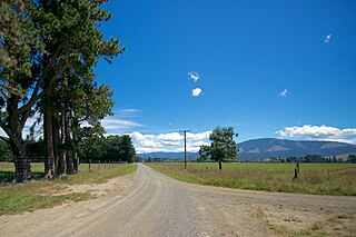
Arundel is a small rural village about 15 kilometres (9 mi) north of Geraldine, in the Canterbury region in the South Island of New Zealand. It is near the south bank of the Rangitata River, 3 kilometres (2 mi) from Peel Forest, an extensive podocarp forest with abundant birdlife. Arundel is flat and fertile, with fields and many mature trees.

<span class="mw-page-title-main">Saint Andrews, Canterbury</span> Rural settlement in Canterbury, New Zealand

St Andrews is a small town in the south Canterbury region of New Zealand's South Island. It is located on State Highway 1 five kilometres south of Pareora and 17 kilometres south of Timaru. It was linked to Timaru by rail in 1876, and grew after the subdivision of the Pareora Run. It remains a rural service town.

<span class="mw-page-title-main">Ashley, New Zealand</span> Settlement in Canterbury, New Zealand

Ashley is a small town in North Canterbury, in the South Island of New Zealand. It used to have a railway station on the Main North Line that runs through the village.

<span class="mw-page-title-main">Eyrewell Forest</span> Rural area in Canterbury, New Zealand

Eyrewell Forest is a small rural area in the Waimakariri District, New Zealand.

<span class="mw-page-title-main">Okuku, New Zealand</span> Locality in Canterbury, New Zealand

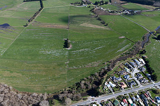
Okuku is a small farming community located in North Canterbury, New Zealand, lying 20 kilometres northwest of Rangiora. Okuku consists of a mix of flat and undulating farmland, and river beds that drain a catchment area in the foothills to the north. Okuku is bounded to the south by the Ashley River / Rakahuri, to the east by the Okuku River, and to the west by the Garry River. Mount Thomas is the highest point at a height of 1023m.

McLeans Island is a rural area north and northwest of Christchurch city, and south of Waimakariri River.

<span class="mw-page-title-main">Marshland, New Zealand</span> Suburb of Christchurch, New Zealand

Marshland is a semi-rural suburb on the northern side of Christchurch city. The land is primarily used for horticulture and dairy farming.

Broadfield, sometimes called Broadfields, is a rural locality in the Selwyn District of New Zealand. It is located between Rolleston, Prebbleton and Lincoln.

<span class="mw-page-title-main">Motukarara</span> Locality in South Island, New Zealand

Motukarara is a locality to the northeast of Lake Ellesmere / Te Waihora in the Selwyn District of New Zealand. State Highway 75 passes through the centre of the village, connecting Christchurch with Akaroa and the Banks Peninsula. The Little River Branch, which operated between 1886 and 1962, ran through Motukarara, and is now a shared walkway and cycleway.

Fairview is a rural community in the Timaru District, New Zealand. It is located southwest of Timaru.

Watlington is a suburb of Timaru, in the South Canterbury area and Canterbury region of New Zealand's South Island. It is located southwest of the town centre.

Makikihi is a small town in the Waimate District of south Canterbury region of New Zealand's South Island. It is located on State Highway 1 12.2 kilometres south of Saint Andrews, Canterbury, and 15.5 kilometres northeast of Waimate. It is close to the mouth of Makikihi River.

References

  1. 1 2 "ArcGIS Web Application". statsnz.maps.arcgis.com. Retrieved 26 August 2021.
  2. 1 2 "Population estimate tables - NZ.Stat". Statistics New Zealand . Retrieved 25 October 2023.
  3. "NZ Topo Map" (Map). Ashley Forest . Retrieved 26 August 2021.
  4. "Ashley". New Zealand Ministry for Culture and Heritage. Retrieved 26 August 2021.
  5. "Ashley Forest Access". North Canterbury Cycling Club. Retrieved 26 August 2021.
  6. 1 2 "Statistical area 1 dataset for 2018 Census". Statistics New Zealand. March 2020. Ashley Forest (312600). 2018 Census place summary: Ashley Forest
  7. "CliFlo – National Climate Database : Ashley Forest 1". NIWA. Retrieved 19 May 2024.