
Rangiora is the largest town and seat of the Waimakariri District, in Canterbury, New Zealand. It is 29 kilometres (18 mi) north of Christchurch, and is part of the Christchurch metropolitan area. With an estimated population of 19,600, Rangiora is the 30th largest urban area in New Zealand, and the fifth-largest in the Canterbury region.

The Canterbury Plains are an area in New Zealand centred in the Mid Canterbury, to the south of the city of Christchurch in the Canterbury region. Their northern extremes are at the foot of the Hundalee Hills in the Hurunui District, and in the south they merge into the plains of North Otago beyond the Waitaki River. The smaller Amuri Plain forms a northern extension of the plains.

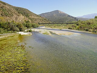
The Waimakariri River is one of the largest rivers in Canterbury, on the eastern coast of New Zealand's South Island. It flows for 151 kilometres (94 mi) in a generally southeastward direction from the Southern Alps across the Canterbury Plains to the Pacific Ocean.

The Weka Pass Railway is a New Zealand heritage railway based in Waipara, North Canterbury. It is operated on a 12.8 km length of the former Waiau Branch railway between Waipara and Waikari. The railway is operated by an incorporated society which consists solely of members and volunteers, and are largely resident in the city of Christchurch, 60 km to the south. The railway began carrying passengers in 1984 and is now well established locally and nationally.

The Conway River is part of the traditional boundary between the Canterbury and Marlborough regions in the South Island of New Zealand.
The Hundalee Hills are located close to the borders of Hurunui District and Kaikōura District in Canterbury in the South Island of New Zealand.

Waiau is a small town in north Canterbury, in the South Island of New Zealand. It lies 30 kilometres (19 mi) east of Hanmer Springs on the northern bank of the Waiau Uwha River, some 30 kilometres (19 mi) from the river's mouth. There is a small supermarket, a DIY store and a petrol station.
Medbury is a rural locality in the Canterbury region of New Zealand's South Island. It is located just off State Highway 7 near the Hurunui River. There is no longer a significant population base forming a township, just rural properties.

Weka Pass is a locality in the northern Canterbury region of New Zealand's South Island between the towns of Waipara and Waikari.
The Leader River is a river in the Hurunui District of the Canterbury region in New Zealand's South Island. It is a tributary of the Waiau River, which it meets near Parnassus. Numerous smaller watercourses join the Leader River, including the Hookhamsnyvy Creek.
The Charwell River is a river in the northeast of New Zealand's South Island. Its headwaters are in the Seaward Kaikōura Ranges and it feeds into the Conway River, the traditional boundary between Marlborough and Canterbury. Sheep farming has taken place in the Charwell River's valley.
The Hookhamsnyvy Creek is a natural watercourse in the northern Canterbury region of New Zealand's South Island.
Mokotua is a locality in the Southland region of New Zealand's South Island. It is situated in a rural area east of Invercargill, between Timpanys and Kapuka on the Southern Scenic Route. To the south are Toetoes Bay and Waituna Lagoon; Rimu is to the north.

Amuri County is one of the former counties of New Zealand, in the area that is now the north of Canterbury region.
The Chatterton River is a river of north Canterbury, New Zealand. It flows south through Hanmer Forest Park, immediately to the west of the town of Hanmer Springs, before flowing into the Percival River shortly before the latter itself flows into the Waiau River
The Kahutara River is a river of New Zealand's South Island. It flows southeast from the Seaward Kaikōura Range, reaching the Pacific Ocean at the tiny settlement of Peketā, 7 kilometres (4 mi) southwest of Kaikōura.

The Oaro River is a river of the north Canterbury region of New Zealand's South Island. It flows south from its sources in the Hundalee Hills, turning east shortly before reaching the coast at Oaro, 15 kilometres (9 mi) southwest of Kaikōura.
The Stanton River is a river of the Canterbury region of New Zealand's South Island. IUt flows southeast through the Hundalee Hills, turning southwest to reach the Waiau Uwha River 7 kilometres (4 mi) east of Waiau.
The Gelt River is a river in the Canterbury region of New Zealand. It arises near Mount Peter in the Black Hills and flows south, then east and north-east into Conway River.
The Hundalee Fault in northern coastal Canterbury, New Zealand had a significant rupture in the 7.8 2016 Kaikōura earthquake for a minimal length of 23 km (14 mi) and as such was a key linkage fault in this complex earthquake. It is located between Parnassus in the Hurunui District and runs off shore from near Oaro.

