
The South Island is the largest of the three major islands of New Zealand in surface area, the other being the smaller but more populous North Island and sparsely populated Stewart Island. It is bordered to the north by Cook Strait, to the west by the Tasman Sea, to the south by the Foveaux Strait and Southern Ocean, and to the east by the Pacific Ocean. The South Island covers 150,437 square kilometres (58,084 sq mi), making it the world's 12th-largest island, constituting 56% of New Zealand's land area. At low altitudes, it has an oceanic climate. The major centres are Christchurch, with a metropolitan population of 521,881, and the smaller Dunedin. The economy relies on agriculture, fishing, tourism, and general manufacturing and services.

Hanmer Springs is a small town in the Canterbury region of the South Island of New Zealand. The Māori name for Hanmer Springs is Te Whakatakanga o te Ngārahu o te ahi a Tamatea, which means “where the ashes of Tamate’s (sic) fire lay”, referring to Tamatea, the captain of the canoe Tākitimu.

Sir Frederick Aloysius Weld, was an English-born New Zealand politician and colonial administrator of various British colonies and territories located in Oceania and Southeast Asia. He was the sixth Prime Minister of New Zealand, and later served as Governor of Western Australia, Governor of Tasmania, and Governor of the Straits Settlements.

The Clarence River is a major river which flows through the Kaikōura Ranges in the northeast of New Zealand's South Island. At roughly 209 kilometres (130 mi) long, it is the longest river in Canterbury and the eighth longest in New Zealand.

Tasman Glacier is the largest glacier in New Zealand, and one of several large glaciers which flow south and east towards the Mackenzie Basin from the Southern Alps in New Zealand's South Island.

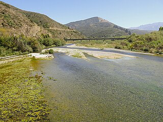
The Tasman River is an alpine braided river flowing through Canterbury, in New Zealand's South Island.

State Highway 1 is the longest and most significant road in the New Zealand road network, running the length of both main islands. It appears on road maps as SH 1 and on road signs as a white number 1 on a red shield, but it has the official designations SH 1N in the North Island, SH 1S in the South Island.

Thomas Brunner was an English-born surveyor and explorer remembered for his exploration of the West Coast of New Zealand's South Island.
The Waiau Branch was a branch line railway in the northern Canterbury region of New Zealand's South Island. Known as the Great Northern Railway for its first few decades of life, the Waiau Branch was seen as part of a main line north but was ultimately superseded by a coastal route. Opened in stages from 1882 to 1919, the line closed in 1978 but a portion has been retained as the Weka Pass Railway.

Tophouse, also known as Tophouse Settlement, is a rural locality in the Tasman District of New Zealand's South Island, some 8 km northeast of Saint Arnaud. It is named after a hotel established in the 19th century to service drovers transporting their sheep between Canterbury and Marlborough. The hotel is still in operation today and has an eventful history, including a double murder suicide in October 1894. For many years, "Tophouse" referred specifically to the hotel, but it has also been used to refer to the general vicinity, and on 20 February 2001, the New Zealand Geographic Board assigned the name "Tophouse Settlement" to the area.

The Main North Line, sometimes referred to as part of the South Island Main Trunk railway, is a railway line that runs north from Christchurch in New Zealand up the east coast of the South Island through Kaikōura and Blenheim to Picton. It is a major link in New Zealand's national rail network and offers a connection with roll-on roll-off ferries from Picton to Wellington. It was also the longest railway construction project in New Zealand's history, with the first stages built in the 1870s and not completed until 1945.

RNZAF Dip Flat is the field training facility and mountain flying training area of the Royal New Zealand Air Force.

State Highway 6 is a major New Zealand state highway. It extends from the Marlborough region in the northeastern corner of the South Island across the top of the island, then down the length of the island, initially along the West Coast and then across the Southern Alps through inland Otago and finally across the Southland Plains to the island's south coast. Distances are measured from north to south.
The Hinemoatū / Howard River is a river of the northern South Island of New Zealand. A tributary of the Buller River, the Hinemoatū/Howard starts at the confluence of the Hodgson and Tier Streams in the Travers Range of Nelson Lakes National Park, flowing north between Lakes Rotoroa and Rotoiti, before reaching the Buller between Kawatiri and Saint Arnaud. Close to its confluence with the Buller, the river is bridged by State Highway 63 and further up by Howard Valley Road.
The Kahutara River is a river of New Zealand's South Island. It flows southeast from the Seaward Kaikōura Range, reaching the Pacific Ocean at the tiny settlement of Peketā, 7 kilometres (4 mi) southwest of Kaikōura.

The Waiheke River is a river of the West Coast Region of New Zealand's South Island. It flows west from its origins on Mount Barron in the Southern Alps to reach the Ahaura River, which it forms where it joins the Tūtaekurī River, 20 kilometres northwest of Lake Sumner.
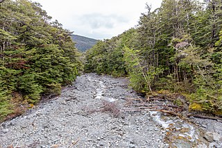
Styx River is in the north of the Canterbury region of New Zealand. It flows east for 7 kilometres (4 mi) into the Waiau Toa / Clarence River, 9 kilometres (6 mi) north west of Hanmer Springs.

Rainbow Road is an unsealed back-country road in New Zealand. It runs for 112 kilometres (70 mi) from Hanmer Springs in Canterbury to Saint Arnaud in the Nelson Region, but for much of its length it is located in the Marlborough Region. The official name of the road is Rainbow Valley–Hanmer Road.
Henry Lewis was a New Zealand surveyor.
Newton River in the Tasman District ), flows west and then south for about 20 km (12 mi) from Mount Newton to the Buller River, 17 km (11 mi) west of Murchison. Near its mouth it is crossed by SH6 on a steel truss bridge with a 120 ft (37 m) main span and two 30 ft (9.1 m) side spans.


