An-Nazla al-Wusta

Last updated

Contents

an-Nazla al-Wusta
Arabic transcription(s)
   Arabic النزله الوسطه
Palestine location map wide.png
Red pog.svg
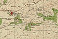
an-Nazla al-Wusta
Location of an-Nazla al-Wusta within Palestine
Coordinates: 32°24′31″N35°05′46″E / 32.40861°N 35.09611°E / 32.40861; 35.09611
Palestine grid 159/201
State State of Palestine
Governorate Tulkarm
Government
  Type Village council
Population
 (2017) [1]
  Total
437
Name meaningThe middle settlement [2]

An-Nazla al-Wusta (Arabic : النزله الوسطه) is a Palestinian village in the Tulkarm Governorate in the eastern West Bank, located 17 kilometers North-east of Tulkarm.

History

Ottoman era

Pottery remains from the Ottoman era have been found here. [3]

In 1882, the PEF's Survey of Western Palestine described Nuzlet el Wusta as a hamlet smaller than Nuzlet et Tinat, and located "on a spur, with a few trees." [4]

British Mandate era

In the 1945 statistics the population of Nazla el Wusta was 60 Muslims, [5] with 1,609 dunams of land according to an official land and population survey. [6] Of this, 264 dunams were plantations and irrigable land, 428 were used for cereals, [7] while 2 dunams were built-up (urban) land. [8]

Jordanian era

In the wake of the 1948 Arab–Israeli War, and after the 1949 Armistice Agreements, An-Nazla al-Wusta came under Jordanian rule. It was annexed by Jordan in 1950.

In 1961, the population of Nazla Wusta was 128. [9]

Post 1967

Since the Six-Day War in 1967, An-Nazla al-Wusta has been under Israeli occupation.

According to the Palestinian Central Bureau of Statistics, an-Nazla al-Wusta had a population of approximately 437 inhabitants in 2017. [1] 38.7% of the population of an-Nazla al-Wusta were refugees in 1997. [10] The healthcare facilities for an-Nazla al-Wusta are based in an-Nazla ash-Sharqiya, where the facilities are designated as MOH level 2. [11]

Related Research Articles

Kafr 'Abbush is a Palestinian town in the Tulkarm Governorate in the northwestern West Bank. According to the Palestinian Central Bureau of Statistics, Kafr 'Abbush had a population of approximately 1,488 inhabitants in mid-year 2006 and 1,739 by 2017. 24.8% of the population of Kafr 'Abbush were refugees in 1997. The healthcare facilities for Kafr 'Abbush are based in Kafr 'Abbush, where the facilities are designated as MOH level 2.

<span class="mw-page-title-main">Qaffin</span> Municipality type B in Tulkarm, State of Palestine

Qaffin is a Palestinian town located 22 kilometers (14 mi) northeast of Tulkarm in the Tulkarm Governorate in the northwestern West Bank. The town is an agricultural town. According to the Palestinian Central Bureau of Statistics, its population consisted over 8,387 inhabitants in 2007 and 10,690 in 2017. The built-up area of the town is 1,000 dunams.

Baqa ash-Sharqiyya is a Palestinian town in the northern West Bank, located 16 kilometers (9.9 mi) northeast of Tulkarm in the Tulkarm Governorate. According to the Palestinian Central Bureau of Statistics (PCBS), the town had a population of 4,892 inhabitants in 2017. Refugees made up 20.4% of the Baqa ash-Sharqiyya's population in 1997.

<span class="mw-page-title-main">Ramin, Tulkarm</span> Place in Tulkarm, State of Palestine

Ramin is a Palestinian village in the northeastern West Bank, located 15 kilometers east of Tulkarm in the Tulkarm Governorate of the State of Palestine. According to the Palestinian Central Bureau of Statistics, the village had a population of approximately 1,998 in 2017.

<span class="mw-page-title-main">Bal'a</span> Municipality type C in Tulkarm, State of Palestine

Bal'a is a Palestinian town in the Tulkarm Governorate, located approximately nine kilometers northeast of Tulkarm in the northern West Bank and three kilometers away from the highway connecting Tulkarm with Nablus.

<span class="mw-page-title-main">Bizzariya</span> Municipality type D in Nablus, State of Palestine

Bizzariya is a Palestinian village in the northern West Bank, located 13.3 kilometers northwest of Nablus at the northernmost point of the Nablus Governorate. It is situated in a valley, having an altitude of 460 meters above sea level. According to the Palestinian Central Bureau of Statistics, Bizzariya had a population of over 2,252 inhabitants in 2007 and 2,794 by 2017.

Attil is a Palestinian town in the Tulkarm Governorate in the eastern West Bank, 12 km (7.5 mi) northeast of Tulkarm. Attil is the connection point between the other villages and Tulkarm. It is bordered by Illar to the east; Baqa ash-Sharqiyya to the north; The Green Line to the west; and Deir al-Ghusun to the south. Mountains surrounding the town include the Nabhan, Aboora, Asad, and Shehadeh mountains. Attil has an elevation of 100 m (330 ft) above Sea level, and an area of 7.337 km2.

<span class="mw-page-title-main">Illar, Tulkarm</span> Municipality type C in Tulkarm, State of Palestine

'Illar is a Palestinian town in the Tulkarm Governorate in the northern West Bank, located 10 kilometers northeast of Tulkarm, and 25 kilometers east of the Israeli city of Netanya. It is bordered by Attil to the west, Kafr Ra'i to the east, and the Israeli settlement of Hermesh to the north. According to the Palestinian Central Bureau of Statistics, 'Illar had a population of approximately 7,456 inhabitants in 2017. 6.6% of the population of 'Illar were refugees in 1997. The healthcare facilities for the surrounding villages are based in 'Illar, the facilities are designated as MOH level 2.

<span class="mw-page-title-main">Kafr Rumman</span> Municipality type C in Tulkarm, State of Palestine

Kafr Rumman is a Palestinian town in the Tulkarm Governorate in the eastern West Bank, located 11 kilometers East of Tulkarm. According to the Palestinian Central Bureau of Statistics, Kafr Rumman had a population of approximately 869 inhabitants in mid-year 2007.

Seida is a Palestinian town in the Tulkarm Governorate in the eastern West Bank, located 20 kilometers northeast of Tulkarm. According to the Palestinian Central Bureau of Statistics, Seida had a population of 3,777 inhabitants in 2017.

<span class="mw-page-title-main">Araqah</span> Municipality type D in Jenin, State of Palestine

Araqah is a Palestinian village in the Jenin Governorate in the Northern area of the West Bank, located 15 kilometers West of Jenin. According to the Palestinian Central Bureau of Statistics, the village had a population of 2,667 inhabitants in 2017.

<span class="mw-page-title-main">Al-Attara</span> Municipality type D in Jenin, State of Palestine

Al-Attara is a Palestinian village in the Jenin Governorate of Palestine, in the northwestern area of the West Bank, located 15 kilometers southwest of Jenin. According to the Palestinian Central Bureau of Statistics, the village had a population of 1,072 inhabitants in mid-year 2006 and 1,244 by 2017.

Mirka is a Palestinian village in the West Bank, located 12 km (7.5 mi) Southwest of the city of Jenin in the northern West Bank. According to the Palestinian Central Bureau of Statistics, the town had a population of 1,555 inhabitants in mid-year 2006 and 2,203 by 2017.

An-Nazla al-Gharbiya is a Palestinian village in the Tulkarm Governorate in the eastern West Bank, located 16 kilometers North of Tulkarm.

An-Nazla ash-Sharqiya is a Palestinian village in the Tulkarm Governorate in the eastern West Bank, located 18 kilometers North-east of Tulkarm.

Nazlat 'Isa is a Palestinian village in the Tulkarm Governorate in the western West Bank, located 17 kilometres (11 mi) North of Tulkarm.

<span class="mw-page-title-main">Khirbat Bayt Lid</span> Village in Tulkarm, Mandatory Palestine

Khirbat Bayt Lid was a Palestinian Arab village in the Tulkarm Subdistrict. It was depopulated by its Arab inhabitants during the 1948 Arab–Israeli War.

Al-Judeida is a Palestinian village in the Jenin Governorate in the western area of the West Bank, located 14 kilometres (9 mi) south of Jenin. According to the Palestinian Central Bureau of Statistics, the town had a population of 4,738 in the 2007 census and 5,950 by 2017.

Siris is a Palestinian town in the Jenin Governorate in the western area of the West Bank, located 32 kilometers south of Jenin. According to the Palestinian Central Bureau of Statistics, the town had a population of 5400 inhabitants in mid-year 2006 and 6,020 by 2017. Siris has an area of about 12,495 dunums, including 2,500 dunums of state land, about 7,500 dunums planted with olive trees, about 1,500 dunums of land, and the rest used for construction.

Jarba is a Palestinian village in the Jenin Governorate.

References

  1. 1 2 Preliminary Results of the Population, Housing and Establishments Census, 2017 (PDF). Palestinian Central Bureau of Statistics (PCBS) (Report). State of Palestine. February 2018. pp. 64–82. Retrieved 2023-10-24.
  2. Palmer, 1881, p. 189
  3. Zertal, 2016, p. 356
  4. Conder and Kitchener, 1882, SWP II, p. 153
  5. Government of Palestine, Department of Statistics, 1945, p. 21
  6. Government of Palestine, Department of Statistics. Village Statistics, April, 1945. Quoted in Hadawi, 1970, p. 76 Archived 2017-08-08 at the Wayback Machine
  7. Government of Palestine, Department of Statistics. Village Statistics, April, 1945. Quoted in Hadawi, 1970, p. 127
  8. Government of Palestine, Department of Statistics. Village Statistics, April, 1945. Quoted in Hadawi, 1970, p. 177
  9. Government of Jordan, 1964, p. 27
  10. Palestinian Population by Locality and Refugee Status Archived 2012-02-07 at the Wayback Machine Palestinian Central Bureau of Statistics
  11. Health care Facilities Tulkarm Governorate

Bibliography