al-Ras | |
---|---|
Arabic transcription(s) | |
• Arabic | الرأس |
• Latin | ar-Ras (official) |
Location of al-Ras within Palestine | |
Coordinates: 32°15′06″N35°03′43″E / 32.25167°N 35.06194°E | |
Palestine grid | 155/184 |
State | State of Palestine |
Governorate | Tulkarm |
Government | |
• Type | Village council |
Population (2017) [1] | |
• Total | 650 |
Name meaning | The hill–top [2] |
al-Ras (Arabic : الراس) is a Palestinian village in the Tulkarm Governorate in the eastern West Bank, located 7 kilometers South-east of Tulkarm. According to the Palestinian Central Bureau of Statistics, al-Ras had a population of 650 inhabitants in 2017. [1] In 1997, refugees made up 11.1% of the population of al-Ras. [3] The healthcare facilities for al-Ras are based in Kafr Sur, where the facilities are designated as MOH level 2. [4]
Ceramics from the Byzantine era have been found here. [5]
Seven ruins are shown on the plan north of this village within about a mile. They are ancient watch towers, like those of Azzun. [6] One of them, known as Gasr Bint esh-Sheikh, dates from the late Hellenistic and early Roman periods. [7] [8]
Al-Ras was incorporated into the Ottoman Empire in 1517 with all of Palestine, and in 1596 it appeared in the tax registers as being in the Nahiya of Bani Sa'b of the Liwa of Nablus. It had a population of 25 households, all Muslim. The villagers paid a fixed tax-rate of 33,3% on various agricultural products, including wheat, barley, summer crops, olive trees, goats and/or beehives in addition to occasional revenues and a fixed tax for people of Nablus area; a total of 6,600 akçe. All the revenues went to a waqf. [9]
In 1838, Robinson noted er-Ras as a village in Beni Sa'ab district, west of Nablus. [10]
In 1870/1871 (1288 AH), an Ottoman census listed the village with 23 Household in the nahiya (sub-district) of Bani Sa'b. [11]
In 1882 the PEF's Survey of Western Palestine (SWP) described Er Ras as: "a small hamlet on a high knoll, supplied by cisterns, with olives below on the north." [12]
In the 1922 census of Palestine conducted by the British Mandate authorities, Ras had a population of 92 Muslims, [13] increasing in the 1931 census to 119 Muslims, living in 26 houses. [14]
In the 1945 statistics the population of Er Ras was 160 Muslims, [15] with 5,646 dunams of land according to an official land and population survey. [16] Of this, 1,029 dunams were plantations and irrigable land, 2,027 were used for cereals, [17] while 3 dunams were built-up (urban) land. [18]
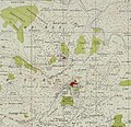
In the wake of the 1948 Arab–Israeli War, and after the 1949 Armistice Agreements, Al-Ras came under Jordanian rule.
In 1961, the population of Al-Ras was 269. [19]
Since the Six-Day War in 1967, Al-Ras has been under Israeli occupation.
Kafr Jammal, is a Palestinian town in the Tulkarm Governorate in the western edge of the West Bank. It is located about halfway between Qalqilyah and Tulkarm, and had a population of 2,855 in 2017. The village is mainly agricultural, and mostly raises olive and citrus crops. Kafr Jammal is at an altitude of 257 meters, and is bordered by Falamya in the west, Kafr Zibad in the east, Jayyous in the south, and Kafr Sur to the north.
Kafr 'Abbush is a Palestinian town in the Tulkarm Governorate in the northwestern West Bank. According to the Palestinian Central Bureau of Statistics, Kafr 'Abbush had a population of approximately 1,488 inhabitants in mid-year 2006 and 1,739 by 2017. 24.8% of the population of Kafr 'Abbush were refugees in 1997. The healthcare facilities for Kafr 'Abbush are based in Kafr 'Abbush, where the facilities are designated as MOH level 2.
Beit Lid is a Palestinian town in the Tulkarm Governorate in the northeastern West Bank, located a 10 kilometers southeast of Tulkarm and west of Nablus. According to the Palestinian Central Bureau of Statistics, the town had a population of 5,606 inhabitants in 2017. In 1922, it had 653 inhabitants, which rose to 1,807 in 1961.
Iktaba is a Palestinian town located four kilometers Northeast of the city of Tulkarm in the Tulkarm Governorate in the northern West Bank. According to the Palestinian Central Bureau of Statistics (PCBS), the town had a population of 2,665 inhabitants in 2007 and 2,997 by 2017. Refugees make-up 33% of the entire population in 1997.
Ramin is a Palestinian village in the northeastern West Bank, located 15 kilometers east of Tulkarm in the Tulkarm Governorate of the State of Palestine. According to the Palestinian Central Bureau of Statistics, the village had a population of approximately 1,998 in 2017.
Far'un is a Palestinian town in the Tulkarm Governorate in the northwestern West Bank, located four kilometers south of Tulkarm near the border with Israel. According to the Palestinian Central Bureau of Statistics, Far'un had a population of 3,100 inhabitants in 2007 and 4,131 by 2017.
Kafr al-Labad is a Palestinian village in the Tulkarm Governorate in the northeastern West Bank, located 9 kilometers east of Tulkarm and two kilometers south of Anabta. Its population in 2017 was 4,747 according to the Palestinian Central Bureau of Statistics. It has a total land area of 11,917 dunams, of which 25% is used for agricultural purposes. The town's main agricultural products are olives, fruits and wheat.
Kafr Rumman is a Palestinian town in the Tulkarm Governorate in the eastern West Bank, located 11 kilometers East of Tulkarm. According to the Palestinian Central Bureau of Statistics, Kafr Rumman had a population of approximately 869 inhabitants in mid-year 2007.
Kafr Sur is a Palestinian town in the Tulkarm Governorate in the eastern West Bank, located 12 kilometers Southeast of Tulkarm. According to the Palestinian Central Bureau of Statistics, Kafr Sur had a population of approximately 1,254 inhabitants in mid-year 2006, and 1,288 by 2017. 13.5% of the population of Kafr Sur were refugees in 1997.
Seida is a Palestinian town in the Tulkarm Governorate in the eastern West Bank, located 20 kilometers northeast of Tulkarm. According to the Palestinian Central Bureau of Statistics, Seida had a population of 3,777 inhabitants in 2017.
Qabalan is a Palestinian town in the Nablus Governorate in the eastern West Bank, located 19 kilometers (12 mi) southeast of Nablus. According to the Palestinian Central Bureau of Statistics (PCBS), the town had a population of 8,195 inhabitants in 2017.
Kafr Laqif is a Palestinian village in the Qalqilya Governorate in the western West Bank, located 22 kilometers southwest of Nablus. According to the Palestinian Central Bureau of Statistics, the village had a population of 1,039 inhabitants in 2017.
Al-Attara is a Palestinian village in the Jenin Governorate of Palestine, in the northwestern area of the West Bank, located 15 kilometers southwest of Jenin. According to the Palestinian Central Bureau of Statistics, the village had a population of 1,072 inhabitants in mid-year 2006 and 1,244 by 2017.
Kufeirit is a Palestinian village in the West Bank, located 16 km west of the city of Jenin in the northern West Bank. According to the Palestinian Central Bureau of Statistics, the town had a population of 2,446 inhabitants in mid-year 2006 and 3,068 by 2017.
Kafr Zibad is a Palestinian village in the Tulkarm Governorate in the western part of the West Bank, located 17 kilometers south of Tulkarm.
Kur is a Palestinian village in the Tulkarm Governorate of the State of Palestine, in the northeastern West Bank, located 19 kilometers southeast of Tulkarm.
Shufa is a Palestinian village in the Tulkarm Governorate in the eastern West Bank, located 6 kilometers South-east of Tulkarm. According to the Palestinian Central Bureau of Statistics, Shufa had a population of approximately 1,253 inhabitants in mid-year 2006 and 1,350 by 2017. 5.4% of the population of Shufa were refugees in 1997. The healthcare facilities for Shufa are at Kafr al-Labad or Saffarin where the facilities are designated as MOH level 2.
Jarisha was a Palestinian Arab village located 200 meters (660 ft) from the ancient site of Tell Jarisha, on the south bank of Al-Awja. After the establishment of Tel Aviv, it was one of five Arab villages to fall within its municipal boundaries. Jarisha was depopulated in the lead up to the 1948 Arab-Israeli war.
Azzun is a Palestinian town in Qalqilya Governorate in the northern West Bank, located 9 kilometers east of Qalqilya and 24 kilometers south of Tulkarm.
Rama is a Palestinian village in the West Bank located in the Jenin Governorate of the State of Palestine.