
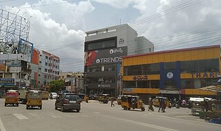
Nellore is a city located on the banks of Penna River, in Nellore district of the Indian state of Andhra Pradesh. It serves as the headquarters of the district, as well as Nellore mandal and Nellore revenue division. It is the fourth most populous city in the state. It is at a distance of 279 kilometres (173 mi) from Vijayawada and about 170 km (110 mi) north of Chennai, Tamil Nadu and also about 380 km (240 mi) east-northeast of Bangalore, Karnataka.

Nellore district, officially known as Sri Potti Sriramulu Nellore district in Coastal Andhra Region, is one of the 26 districts in the Indian state of Andhra Pradesh. According to the 2011 Census, the district's population was 2,469,712 of which 29.07% was urban. Its administrative headquarters are located in Nellore city. Located in the Coastal Andhra region, the district is bordered by the Bay of Bengal to the east, Kadapa district and Annamayya district to the west, Prakasam district to the north, and Tirupati district to the south.

Allur is a Town in Nellore district of the Indian state of Andhra Pradesh. It is the headquarters of Allur Mandal of Kavali revenue division.
Malkajgiri also known as Mallikarjuna Giri is a suburb of Hyderabad, Telangana, India. It is located in Medchal–Malkajgiri district and also Sub-District in Medchal District is the headquarters of Malkajgiri mandal in Malkajgiri revenue division. Erstwhile Malkajgiri Major Grampanchayat was upgraded to a municipality in 1965 and became a municipal corporation in 1985. It was merged into the Greater Hyderabad Municipal Corporation in 2007. It was a part of Ranga Reddy district before the re-organisation of districts in 2016.

Kovur is a village in Nellore district of the Indian state of Andhra Pradesh. The village is also the headquarters of the Kovur Mandal and Assembly Constituency. It is located in Kovur mandal of Nellore revenue division. It forms a part of Nellore Urban Development Authority. The poet "Thikkanna" was born in this place.

Gummidipoondi is an industrial town in Chennai Metropolitan Region of Thiruvallur district in the Indian state of Tamil Nadu. Notably, it is the northernmost assembly constituency and settlement in the state of Tamil Nadu.
Rajendranagar is a mandal in Ranga Reddy district of the Indian state of Telangana. and it is also Rajendranagar revenue division. Rajendranagar is being developed as an IT hub. Government of Telangana has planned to develop an IT cluster in Rajendra Nagar which will stretch across 350 acres of land from Budwel to Kismatpur. Budwel, Kismatpur, Sikanderguda and Sivarampalli are some of the nearby residential areas. Manasa Hills and Kothwalguda eco-hill park are tourist attractions in Rajendranagar.
Duttalur or Duthalur is a village and a mandal in Nellore district in the state of Andhra Pradesh in India.
Inkollu is a small town located in the Bapatla district of the Indian state of Andhra Pradesh. It serves as the seat of Inkollu Mandal, an administrative district and is part of the chirala revenue division of Bapatla district.The nearest Cities are Chirala,Bapatla,Guntur,Ongole,Addanki and chilakaliripeta.
Arambakkam is a village in the Tiruvallur district of Tamil Nadu, India. It is located in the Gummidipoondi taluk.
Bapatla mandal is one of the 25 mandals in Bapatla district of the state of Andhra Pradesh, India. It is under the administration of Bapatla revenue division and the headquarters are located at Bapatla. The mandal is bounded by Kakumanu, Ponnur, Karlapalem mandals of Guntur district. It also shares borders with Prakasam district and a portion of it lies on the coast of Bay of Bengal.
Nellore mandal is one of the 46 mandals in Nellore district of the state of Andhra Pradesh, India. Its headquarters are located at Nellore. The mandal is bounded by Sangam, Butchireddipalem, Indukurpet, Kovur, Podlakur, Thotapalligudur, Venkatachalam and Muthukur mandals.
Sullurpeta mandal is one of the mandals in Tirupati district of the state of Andhra Pradesh, India. It is the headquarters of the Sullurupeta revenue division. The mandal is situated on the coast of Bay of Bengal, bounded by Vakadu, Chittamur, Doravarisatram and Tada mandals.
Naidupeta mandal is one of the 34 mandals in Tirupati district of the state of Andhra Pradesh, India. Its headquarters are located at Naidupeta. The mandal is bounded by Balayapalle, Ojili, Pellakur, Doravarisatram and Chittamur mandals.
Gudur mandal is one of the 34 mandals in Tirupati district of the state of Andhra Pradesh, India. Its headquarters are located at Gudur. The mandal is situated on the coast of Bay of Bengal, bounded by Sydapuram, Manubolu, Balayapalle, Ojili and Chillakur mandals. It is a part of Gudur revenue division.
Kota mandal is one of the 34 mandals in Tirupati district of the state of Andhra Pradesh in India. Its headquarters are located at Kota. The mandal is bounded by Muthukur mandal, Chillakur, Ojili, Chittamur, Vakadu mandals and it also borders Nellore district.
Elavur is a village in the Tiruvallur district of Tamil Nadu, India. It is located in the Gummidipoondi taluk border between Tamil Nadu and Andhra pradesh. NH16 Chennai-Kolkata Highway. India's First modern Integrated Check post opened by Tamil Nadu chief minister and also located frontline medical village. ELR is and railway station code for Elavur.
Atmakur revenue division is an administrative division in the Nellore district of the Indian state of Andhra Pradesh. It is one of the four revenue divisions in the district with nine mandals under its administration. The divisional headquarters are located at Atmakur.
Vakadu mandal is one of the 34 mandals in Tirupati district in the Indian state of Andhra Pradesh. It is a part of Gudur revenue division.

