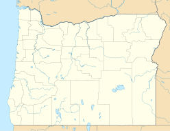
Wallowa County is a county in the U.S. state of Oregon. As of the 2010 census, the population was 7,008, making it Oregon's fourth-least populous county. Its county seat is Enterprise. According to Oregon Geographic Names, the origins of the county's name are uncertain, with the most likely explanation being it is derived from the Nez Perce term for a structure of stakes used in fishing. An alternative explanation is that Wallowa is derived from a Nez Perce word for "winding water". The journals of Lewis and Clark Expedition record the name of the Wallowa River as Wil-le-wah.

The Blue Mountains are a mountain range in the western United States, located largely in northeastern Oregon and stretching into southeastern Washington. The range has an area of 4,060 square miles (10,500 km2), stretching east and southeast of Pendleton, Oregon, to the Snake River along the Oregon-Idaho border. The Blue Mountains cover seven counties in Oregon and Washington; they are Union, Umatilla, Grant, Baker, and Wallowa counties in Oregon, and Walla Walla, Columbia and Garfield counties in Washington. They are home to the world's largest organism and fungal mycelial mat, the Armillaria ostoyae. The Blue Mountains were so named due to thick smoke from the fires which frequently engulf the area.

The Wallowa River is a tributary of the Grande Ronde River, approximately 55 miles (89 km) long, in northeastern Oregon in the United States. It drains a valley on the Columbia Plateau in the northeast corner of the state north of Wallowa Mountains.

Mount Howard is located in the Wallowa region of northeast Oregon. The mountain is home to Wallowa Lake Tramway, the steepest tram in North America. At the top of the mountain, there is a restaurant called the Summit Grill and Alpine Patio. Mount Howard was named for Civil War general Oliver O. Howard.

The Wallowa–Whitman National Forest is a United States National Forest in the U.S. states of Oregon and Idaho. Formed upon the merger of the Wallowa and Whitman national forests in 1954, it is located in the northeastern corner of the state, in Wallowa, Baker, Union, Grant, and Umatilla counties in Oregon, and includes small areas in Nez Perce and Idaho counties in Idaho. The forest is named for the Wallowa band of the Nez Perce people, who originally lived in the area, and Marcus and Narcissa Whitman, Presbyterian missionaries who settled just to the north in 1836. Forest headquarters are located in Baker City, Oregon.

The Wallowa Lake Tramway is an aerial cable gondola lift near Joseph, Oregon, in the Wallowa-Whitman National Forest of the United States, named for Wallowa Lake. The tram runs from the floor of the Wallowa Valley to the top of Mount Howard. It travels to an elevation of 8,000 feet (2,400 m) above sea level and allows for views of the Eagle Cap Wilderness area and the rest of the Wallowa Mountains.

Eagle Cap Wilderness is a wilderness area located in the Wallowa Mountains of northeastern Oregon, within the Wallowa–Whitman National Forest. The wilderness was established in 1940. In 1964, it was included in the National Wilderness Preservation System. A boundary revision in 1972 added 73,000 acres (30,000 ha) and the Wilderness Act of 1984 added 66,100 acres (26,700 ha) resulting in a current total of 361,446 acres, making Eagle Cap by far Oregon's largest wilderness area.

Wallowa Lake State Park is a state park located in northeast Oregon in the United States. It is at the southern shore of Wallowa Lake, near the city of Joseph in Wallowa County. The town of Wallowa Lake is situated next to the park.
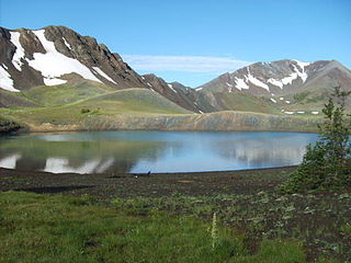
Dollar Lake is a small tarn located on Aneroid Mountain in the Eagle Cap Wilderness of Northeastern Oregon, United States. It is between Aneroid Lake and Bonny Lakes and lies 1 mile (1.6 km) southwest of Aneroid Peak. It likely received its name because of its size and its almost perfectly round shape, much like that of a silver dollar. It is the fifth-highest lake in the Eagle Cap Wilderness.

Bonny Lakes are two small, shallow, mountain ponds located in the Eagle Cap Wilderness of Northeastern Oregon, United States. They are positioned in a large meadow on Aneroid Mountain known as Bonny Lakes basin, which is about two miles east of Dollar Lake. Together they are listed as the 13th highest lake in the Eagle Cap Wilderness at 7,840 ft.

Aneroid Lake is a large tarn located on Aneroid Mountain in the Eagle Cap Wilderness of northeastern Oregon. It is situated in between Roger Lake and Dollar Lake. It is not accessible by any kind of motor vehicle. However, there is a popular hiking trail that leads to the lake. There is a small group of private cabins near the south end and Pete's Point is clearly visible from the lake. It ties with Laverty Lake as the twenty-third highest lake in the Eagle Cap Wilderness at 7,500 ft (2,300 m).

Roger Lake is a mountain pond located in a meadow on Aneroid Mountain in the Eagle Cap Wilderness of Northeastern Oregon, United States. It is 0.5 miles (0.8 km) from Aneroid Lake on trail 1804. It is listed as the 29th highest lake in the Eagle Cap Wilderness

Sacajawea Peak is a peak in the Wallowa Mountains, in the U.S. state of Oregon. It is in the Eagle Cap Wilderness and the Wallowa–Whitman National Forest.
Eagle Cap (9,577 feet is a mountain peak located in the Wallowa Mountains, Wallowa–Whitman National Forest, in the U.S. state of Oregon. The peak is in the Eagle Cap Wilderness and the Benson Glacier is along the east flank of the summit ridge. Its summit is the highest point in Union County
Rock Creek Butte is a 9,106-foot (2,776 m) summit in Baker County, Oregon in the United States. It is located in the Wallowa–Whitman National Forest, about 10 miles (16 km) northeast of Sumpter.
Twin Peaks is a 9,609-foot (2,929 m) summit of the Wallowa Mountains in Wallowa County, Oregon in the United States. It is located in the Eagle Cap Wilderness of the Wallowa National Forest.
Red Mountain is a 9,537-foot (2,907 m) summit of the Wallowa Mountains in Baker County, Oregon in the United States. It is located in the Eagle Cap Wilderness of the Wallowa National Forest.
Elkhorn Peak is an 8,963-foot (2,732 m) summit of the Wallowa Mountains in Wallowa County, Oregon in the United States. It is located in the Eagle Cap Wilderness of the Wallowa National Forest.