Demographics
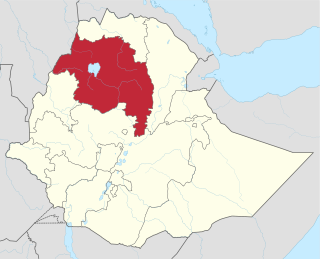
Based on figures published by the Central Statistical Agency in 2005, this woreda has an estimated total population of 120,283, of whom 60,288 are men and 59,995 are women; 7,308 or 6.08% of its population are urban dwellers, which is less than the Zone average of 11.8%. With an estimated area of 992.35 square kilometers, Angolalla Terana Asagirt has an estimated population density of 121.2 people per square kilometer, which is less than the Zone average of 134.37. [1]
The 1994 national census reported a total population for this woreda of 88,117 in 17,091 households, of whom 44,375 were men and 43,744 were women; 4,220 or 4.79% of its population were urban dwellers. The two largest ethnic groups reported in Angolalla Terana Asagirt were the Amhara (80.61%), and the Oromo (18.33%); all other ethnic groups made up 1.06% of the population. Amharic was spoken as a first language by 80.92%, and Oromiffa was spoken by 19.02%; the remaining 0.08% spoke all other primary languages reported. The majority of the inhabitants practiced Ethiopian Orthodox Christianity, with 98.43% reporting that as their religion, while 1.5% were Muslim. [2]

The Oromo people are an ethnic group inhabiting Ethiopia. They are one of the largest ethnic groups in Ethiopia and represent 34.5% of Ethiopia's population. Oromos speak the Oromo language as a mother tongue, which is part of the Cushitic branch of the Afro-Asiatic language family. The word Oromo appeared in European literature for the first time in 1893 and then slowly became common in the second half of the 20th century.

Oromo is an Afroasiatic macrolanguage which is primarily composed of four distinct languages: Southern Oromo which includes the Gabra and Sakuye dialects, Eastern Oromo, Orma which includes the Munyo, Orma, Waata/Sanye dialects, and West–Central Oromo. Like Arabic, Oromo is a dialect continuum so language varieties spoken in neighbouring regions differ only slightly, but the differences accumulate over distance so that widely separated varieties are not mutually intelligible.

Islam is the second largest religion in Ethiopia with over 33,9% of the population practicing it in 2007. The faith arrived in Ethiopia at an early date, shortly before the hijira. Islam is the religion of the overwhelming majority of the Somali, Afar, Argobba, Harari, Berta, Alaba, and Silt'e and also has many adherents among the Gurage and the Oromo, the largest ethnic group in Ethiopia, as well as a minority of Amhara, the second largest ethnic group in the country.

East Shewa Afaan Oromo: Shawaa Bahaa) is one of the Zones of the Ethiopian Region of Oromia. This zone takes its name from the kingdom or former province of Shewa. East Shewa is located in the middle of Oromia, connecting the western regions to the eastern ones. This zone is bordered on the south by the West Arsi Zone, on the southwest by the Southern Nations, Nationalities and Peoples Region, on the west by South west Shewa and Oromia Special Zone Surrounding Finfinne, on the northwest by North Shewa, on the north by the Amhara Region, on the northeast by the Afar Region, and on the southeast by Arsi; its westernmost reach is defined by the course of the Bilate River. Towns and cities in East Shewa include Bishoftu, Metehara, and Ziway. The town of Adama was separated from East Shewa and is a special zone now.
Basona Werana is one of the woredas in the Amhara Region of Ethiopia. Located at the eastern edge of the Ethiopian highlands in the Semien Shewa Zone, Basona Werana is bordered on the south by Angolalla Tera, on the southwest by the Oromia Region, on the west by Siyadebrina Wayu, on the northwest by Moretna Jiru, on the north by Mojana Wadera, on the northeast by Termaber, and on the east by Ankober. The town and woreda of Debre Berhan is an enclave inside this woreda. Towns in this woreda include Gudoberet.
Jama is one of the woredas in the Amhara Region of Ethiopia. Part of the Debub Wollo Zone, Jama is bordered on the southeast by the Qechene River which separates it from the Semien Shewa Zone, on the west by Kelala, on the north by Legahida, and on the northeast by Were Ilu. Towns in Jama include Degolo and Shul Afaf.
Moretna Jiru is one of the woredas in the Amhara Region of Ethiopia. It is named in part after the historic district of Shewa, Moret, which lay between the Jamma River and the district of Shewa Meda. Part of the Semien Shewa Zone, Moretna Jiru is bordered on the south by Siyadebrina Wayu, on the south west by Ensaro, on the northwest by Merhabiete, on the northeast by Menz Keya Gebreal, and on the east by Basona Werana. The administrative center of this woreda is Enewari; other towns in Moretna Jiru include Jihur.
Efratana Gidim is one of the woredas in the Amhara Region of Ethiopia. It is named after two historic districts that were part of the former autonomous kingdom of Shewa, Efrata and Gedem. Part of the Semien Shewa Zone, Efratana Gidim is bordered on the south by Kewet, on the southwest by Menz Mam Midir, on the west by Menz Gera Midir, on the north by Antsokiyana Gemza, and on the east by the Oromia Zone. The administrative center of this woreda is Ataye (Efeson); other towns in Efratana Gidim include Jewha and Karakore.
Ankober is one of the woredas in the Amhara Region of Ethiopia. Located at the eastern edge of the Ethiopian highlands in the Semien Shewa Zone, Ankober is bordered on the south by Asagirt, on the west by Basona Werana, on the north by Termaber, and on the east by the Afar Region. Towns in Ankober include Aliyu Amba, Ankober, Gorgo and Haramba.
Hagere Mariamna Kesem is one of the woredas in the Amhara Region of Ethiopia. Part of the Semien Shewa Zone, Hagere Mariamna Kesem is bordered on the south by the Germama river which separates it from Menjarna Shenkora, on the west by the Oromia Region, on the north by Angolalla Tera, on northeast by Asagirt, and on the east by Berehet. The administrative center of this woreda is Shola Gebeya; other towns include Kese Koremash.
Berehet is one of the woredas in the Amhara Region of Ethiopia. Part of the Semien Shewa Zone, Berehet is bordered on the south by the Germama River which separates it from Menjarna Shenkora, on the west by Hagere Mariamna Kesem, on the north by Asagirt, and on the east by the Afar Region. The major town in Berehet is Metiteh Bila.
Menjarna Shenkora is one of the woredas in the Amhara Region of Ethiopia. It is named in part after a historic district of Shewa, Menjar, which was the southernmost district of Shewa and near the location of the modern woreda. Located at the southern end of the Semien Shewa Zone, Menjarna Shenkora is bordered on the east, south and west by the Oromia Region, on the northwest by Hagere Mariamna Kesem, and on the northeast by Berehet; the Germama river forms the boundary between this woreda and Hagere Mariamna Kesem and Berehet. The administrative center of this woreda is Arerti; other towns in the woreda include Balchi and Eranbuti.
Dano is one of the woredas in the Oromia Region of Ethiopia. Part of the Mirab Shewa Zone, Dano is bordered on the southwest by the Jimma Zone, on the north by Cheliya, and on the southeast by Nono; part of the boundary with the Jimma Zone is defined by the Gibe River. The major town in Dano is Sayo.
Tikur Enchini is one of the woredas in the Oromia Region of Ethiopia. Part of the Mirab Shewa Zone, it is bordered on the southwest by Nono, on the northwest by Cheliya, on the northeast by Ambo, and on the southeast by the Debub Mirab (Southwest) Shewa Zone. The major town in Tikur Enchini is Tikur Enchini.
Alem Gena is one of the woredas in the Oromia Region of Ethiopia. Part of the Oromia Special Zone Surrounding Finfinne, Alem Gena is on the southwest by Debub Mirab Shewa Zone, on the northwest by Walmara, on the north by Burayu, on the northeast by the city of Addis Ababa, and on the east by the Akaki. The Awash River defines this woreda's boundary with Debub Mirab Shewa Zone. The towns in Sebeta Hawas include Alem Gena, Awash Melka, and Tefki. The town of Sebeta was separated from this woreda.
Bereh is one of the woredas in the Oromia Region of Ethiopia. It was part of former Berehna Aleltu woreda which was separated for Aleltu and Bereh woredas and Sendafa Town. Part of the Oromia Special Zone Surrounding Finfinne, Bereh is bordered on the south by the Akaki and Misraq Shewa Zone, on the southwest by the city of Addis Ababa, on the west by Sululta, on the north by Semien Shewa Zone, and on the east by the Amhara Region.
Kuyu is one of the woredas in Oromiya Region of Ethiopia. Part of Semien Shewa Zone, Kuyu is bordered on the south and west by Muger River which separates it from Misraq Welega Zone, on the north by Wara Jarso, on the northeast by Hidabu Abote, and on the east by Degem. The administrative center of Kuyu is Gebre Guracha.
Degem is one of the woredas in Semien Shewa Zone of Oromiya Region in Ethiopia. Degem is bordered on the south by Muger River which separates it from Misraq Welega Zone, on the west by Kuyu, on the northwest by Hidabu Abote, on the north by Jamma River which separates it from Amhara Region, on the northeast by Gerar Jarso, and on the east by Yaya Gulele and Debre Libanos. Towns in Degem include Alidoro and Anbiso.
Gerar Jarso is one of the woredas in the Oromia Region of Ethiopia. Part of the Semien Shewa Zone, Gerar Jarso is bordered on the south by Yaya Gulelena Debre Liban, on the west by Degem, and on the east by the Amhara Region.
Yaya Gulele is one of the woredas in the Oromia Region of Ethiopia. It was part of former Yaya Gulelena Debre Liban which was separated for Debre Libanos and Yaya Gulele woredas.. Part of the Semien Shewa Zone, Yaya Gulele is bordered on the south by Mulona Sululta, on the southwest by the Muger River which separates it from the Mirab Shewa Zone, on the west by Degem, on the north by Gerar Jarso, on the north east by the Debre Libanos, and on the east by Wuchale. Towns in Yaya Gulele include Fital.
Abichuna Gne'a is one of the woredas in the Oromia Region of Ethiopia. This woreda is named in part for the Abichu Oromo. Part of the Semien Shewa Zone, Abichuna Gne'a is bordered on the south by Kembibit, on the west by Wuchalena Jido, and on the north and east by the Amhara Region. The major town in Abichuna Gne'a is Mendida.
Angolalla Tera is one of the woredas in the Amhara Region of Ethiopia. It is named in part after one of the capitals of the former principality of Shewa, Angolalla. Located at the eastern edge of the Ethiopian highlands in the Semien Shewa Zone, Angolalla Tera is bordered on the south by Hagere Mariamna Kesem, on the west by the Oromia Region, on the north by Basona Werana, and on the southeast by Asagirt. The administrative center of this woreda is Chacha. Angolalla Tera was part of former Angolalla Terana Asagirt woreda.
Asagirt is one of the woredas in the Amhara Region of Ethiopia. Located at the eastern edge of the Ethiopian highlands in the Semien Shewa Zone, Asagirt is bordered on the southwest by Hagere Mariamna Kesem, on the northwest by Angolalla Tera, on the north by Basona Werana, on the northeast by Ankober, on the east by the Afar Region, and on the southeast by Berehet. The administrative center of this woreda is Gina Ager. Asagirt was part of former Angolalla Terana Asagirt woreda.