Annaglogh Lead Mines

Last updated

Annaglogh Lead Mines
Annaglogh.jpg
Annaglogh Lead Mines on the OS map
Location
Ireland adm location map.svg
Schlaegel und Eisen nach DIN 21800.svg
Annaglogh Lead Mines
Location Clontibret
County County Monaghan
Country Republic of Ireland
Coordinates 54°11′15″N6°45′42″W / 54.187615°N 6.761702°W / 54.187615; -6.761702
Production
Products lead
Greatest depth240 feet (73 m)
History
Opened1852 (1852)
Closed1867 (1867)

Annaglogh was one of the larger lead mines in the Clontibret area of County Monaghan in Ireland. [1] Annaglogh Mine is shown on the 1856 2nd edition OS map. [2] [3]

Contents

History

Collapsed shaft in July 2010 Annaglogh 1.jpg
Collapsed shaft in July 2010

There is information on the mining activities in the area recorded in the Geological Survey Of Ireland Memoirs by FW Egan. [4]

Production at Annaglogh is listed in Mineral Statistics from 1852 to 1855, though the mine continued to be listed up to 1865. There were four shafts and an engine house, which are shown on the 1870 GSI Map. [5]

The remains of the mine's chimney and old spoil heaps are evident, however the residence of the mining agent was demolished in circa 2007 and (as of 2016) there was development of a new residence on the same site.[ citation needed ]

The operation was run by Captain James Skimming (1817-1880), [6] who was also the Mining Agent for the North Eastern Mining Company of Ireland which also encompassed nearby Lisdrumgormley, Coolartragh (Bond Mine), Lemgare Mines, and Hope Mines near Castleblayney. [7] [8] [9] [10]

The North Eastern Mining Company of Ireland was formed on Monday 6 April 1846 at The Angel Hotel in Liverpool by way of a shareholders meeting. [11] The entire working capital of the company was £8000.

Captain Skimming and the Cornish mining engineer George Henwood, were also said to be involved in a project in the West of Ireland called the Galway & Mayo United Mining Company in and around 1859-1860. [12] They were said to have extensive mining licences in the area which amounted to 120 square miles.

Tasson Mine (1853-1867) was operated by under the direction of Captain Joseph Backhouse initially. [13] [14]

The Castleblayney Mining Company was the operator between (1862–65) and the mine was deemed to be closed by 1867.

Lisdrumgormley was recorded in 1922 as being under development by The Farney Development Company. [15]

Captain Skimming resided in Annaglogh Castleblayney during his time in Ireland, and died here in 1880. [16] He was predeceased by his wife Elizabeth who died in 1872. [17]

Individual mines

Coolartragh Mines

History: According to the GSI 6" Sheet and MSS notes, about seven shafts were opened on the vein that traverses the townland from south to north. Griffith (1861, p. 150) is the authority for identifying Coolartragh as also being known as the Bond Mine. The UK Department of Trade & Industry and the BGS .possesses a plan, and a section down to 35 fathoms, showing four levels, dated 1892 (AM 2986).

The Bond Mine operated by the Consolidated Mines of Bond, Lemgare and Lisdrumgormel (sic) Company of Liverpool under Captain John Skimming was reported in 1846 (Mining Journal) to have been developed at the 18, 25 and 30 fathom levels where the vein was large and productive with bunches of rich ore and that the vein had been explored for nearly "1 mile of length"

The engine shaft is said to have been vertical and cut the lode at 30 fathoms, and a large and valuable amount of ore is supposed to remain yet un-extracted. This lode is considered to be identical with the main Tassan Vein. It has an underlie to the east at 60o, and its course appears to have been proved beyond doubt both north and south of the main sinking. The matrix here is chiefly quartz, with some calcite; and a considerable quantity of sphalerite is said to occur along with the lead.

Tonagh Mine

Two small shafts were sunk close to the boundary of Coolartragh and Tonagh townlands. And some minor production ensued between 1859-61 when the vein showed a band of galena underlying to the east within a zone of brecciated slates above a footwall of Tertiary basalt. A landowner (Michael Hughes) proposed to dewater the shafts in Tonagh in 1953 but nothing came of this. No production is detailed.

Lemgare Mine

In the townland of Lemgare an adit and three shafts along a strike length of 50 fathoms (95m) were sunk to a depth of 18 fathoms (35m) below adit on a nearly vertical vein by the Consolidated Mines of Bond, Lemgare and Lisdrumgormel (sic) Company of Liverpool under Captain John Skimming commencing in July 1846. The vein is supposed to be the same as that at Annaglogh, located approximately 1 km to the SSE, which are marked on the MS. 6″ map of the Geological Survey. Griffith (1861, p. 150) gives Lemgare as a worked mine. Mem. 59, p. 28, regards it as on the continuation of the Annaglogh lode.

The Lemgare vein has been profitably worked at Annaglogh. It heads easterly at around 75o, and is joined from the north by another, also heading easterly at around 60o. A shaft at the junction reached rich ore at 17 fathoms (~30m). The lode is supposed to be thrown northwards by a cross-course about 1.2m wide which exists as indicated on the map, as all trace of it is lost farther to the east, it is believed to have been proved 150m farther north.

Lemgare Mine was re-opened by Billiton NV in the early 1950s as part of prospecting activities. The adit extended along an unmineralized fault zone for approximately 110m, being connected to surface by a short (4m) ventilation shaft near the portal. Upon entering sandstone wall-rocks the fault became mineralized and some stoping was seen to surface (20m) near the end of the drive which extended but was inaccessible but almost certainly extends below two surface shaft collapse located above. An inclined shaft or winze to indeterminate depth (presumably to 18 fathoms (~35m) was also located along the course of the adit with a 10 cm rib of galena on the fault plane.

Annaglogh Mine

This mine is known to have been in production in 1852 and features in the list of mines between 1860-65 when it was being worked by the Consolidated Mines of Bond, Lemgare and Lisdrumgormel (sic) Company of Liverpool under Captain John Skimming. During this period approximately 300-400 tonnes of ore was reported as being raised annually. The 1870 MSS 6″ map of the Geological Survey gives details of four shafts one of which was sunk as much as 40 fathoms (~75m) on the vein, and a pumping engine house. The sites of several of these, along with the base of the engine house and its associated chimney are still visible. The only output from Annaglogh is recorded in 1852 when 310 tons of lead was produced and "some lead sold" in 1853.

Tassan Mine

This was probably the most important mine of the district. The townland adjoins that of Tonagh on the south, and the vein is the same as that which passes northward into Coolartragh. The mine was commenced in the late 1840s by Joseph Backhouse as the Tassan Mining Company 1844-56, but the most significant period of working was by the Castleblayney Mining Company from 1856–61 and from 1862-5; but it seems to have been closed in 1867. There are five shafts marked on the 1857 6" OSI map although little trace remains of them at the present time.

Lisdrumgormley Mine

The 6″ Geological Survey MSS map marks two veins continuing northward from those of Annaglogh, and the western of these was reached at no great depth in Lisdrumgormley, just east of a basaltic dyke that is probably correlated with this fault / vein. In the north of the townland, close against the Armagh border, "Lead Mine" is engraved on the 6" Ordnance sheet. Lisdrumgormley was also under exploration by the Farney Development Company in 1922.

The lode in Lisdrumgormley is reported, on contemporary authority, to be still rich in argentiferous galena, embedded in a matrix of quartz and carbonate of lime in the deepest workings. so far as it is known, from 2 to 9 feet. This lode, which comes to the surface at the main working, is said to have realized a large profit at depths not exceeding 25 fathoms. A shaft located some 250m SSE along strike of the vein is reported to have attained 60m depth and returned 50 tonnes of lead concentrates.

Planning application (2016)

Report and hearing

EirGrid, a state-owned electric power transmission operator in Ireland, proposed a new electricity inter-connector between Counties Tyrone and Meath which crosses from Northern Ireland into the Republic of Ireland at Lemgare and runs through the townlands of Lisdrumgormley and Annaglogh - all of which had extensive mining operations in them.

On Day 34 of the Oral Hearing (13 May 2016) a report and research were presented to the hearing which was chaired by An Bord Pleanala inspectors.[ citation needed ]

Extent of Mine Workings

Because of a combination of the age of the mine workings for lead in this area coupled with the short-lived nature of the various formalised cost-book companies that operated the mines, the records of the extent of workings are obscure. Most of the cost-book companies were not floated on the London Stock Exchange as was common practice at this time and, as a result, did not return reports that were then published in the contemporary Mining Journal.

Dr Andrew claimed that in their assessment of the extent and impact of mine workings EirGrid had solely relied upon the information received from the GSI and EPA and did not appear to have conducted any detailed research. The GSI have admitted in correspondence concerning the extent of mine workings in the area that they “..do not necessarily capture the full extent of a feature, particularly if it is inaccessible and impractical..” and thus do not have information detailing the extent of mine workings such as shafts, trial pits, adits, stoped sections of veins and any lateral workings thereon.[ citation needed ]

EirGrid response to report

EirGrid stood by the accuracy and extent of the environmental impact statement and the basis on which they had carried out the research. They said none of the new information would change their assessment which had been done with the help of GSI information and LiDAR technology to provided details of the topography.

The assessment they had already made of the Lemgare area which showed the old mine workings extending away from the area where the pylons would be going. In their response document published in December 2015 the company noted that a number of submissions raised issues in respect of the potential of the proposed development to impact on specific mines.[ citation needed ]

Mine works collapses in area

There was extensive mining operations in the townlands of Coolartragh, [18] Lemgare and Lisdrumgormley. In recent years[ when? ] there have been several instances whereby the shaft/tunnel networks of some of these disused mine locations have collapsed.

  1. Whilst ongoing Quarry Operations were being carried out in Lemgare Quarry, uncharted underground mine shafts from that of Coolartragh Mines were uncovered in early 2000. [19] [ failed verification ]
  2. In 2010 in Annaglogh on the property of Philip McAdam there was an instance where 2 mine shafts collapsed and these were subsequently back-filled and made safe by the Department of Communications, Energy and Natural Resources. The actual works were carried out by the OPW (Office of Public Works). prior to this one of the same shafts collapsed in the late 1960s and was filled in by Monaghan County Council.[ citation needed ]
  3. In 2012 on the site of the disused Lisdrumgormley lead Mine, within property of James Watters there was also a shaft collapse whereby the Office of Public Works also made the area safe.[ citation needed ]
  4. There have been several instances where the shaft at the mine head location (as shown on the sketch in Annaglogh) where the actual Mine's Chimney was located has collapsed throughout the 1960s and 1970s, and each time the landowner, Patrick Morgan back-filled this himself as he was quite unaware of the role of the state in making sure these shafts were safe.[ citation needed ]

Other Information

James Skimming is mentioned in a number of articles including;

Related Research Articles

<span class="mw-page-title-main">Gunnies</span> Space left in a mine after the extraction of a vertical lode

A gunnies, gunnis, or gunniss is the space left in a mine after the extraction by stoping of a vertical or near vertical ore-bearing lode. The term is also used when this space breaks the surface of the ground, but it can then be known as a coffin or goffen. It can also be used to describe the deep trenches that were dug by early miners in following the ore-bearing lode downwards from the surface – in this case they are often called open-works; their existence can provide the earliest evidence of mining in an area. William Pryce, writing in 1778, also used the term as a measure of width, a single gunnies being equal to three feet.

<span class="mw-page-title-main">Adit</span> Horizontal entrance shaft to an underground mine

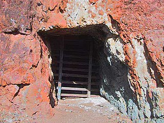
An adit or stulm is a horizontal or nearly horizontal passage to an underground mine. Miners can use adits for access, drainage, ventilation, and extracting minerals at the lowest convenient level. Adits are also used to explore for mineral veins.

<span class="mw-page-title-main">Dartmoor tin mining</span>

The tin mining industry on Dartmoor, Devon, England, is thought to have originated in pre-Roman times, and continued right through to the 20th century, when the last commercially worked mine closed in November 1930. From the 12th century onwards tin mining was regulated by a stannary parliament which had its own laws.

<span class="mw-page-title-main">Botallack Mine</span> Former mine in Cornwall, England

The Botallack Mine is a former mine in Botallack in the west of Cornwall, UK. Since 2006 it has been part of the UNESCO World Heritage Site – Cornwall and West Devon Mining Landscape. The mine is within the Aire Point to Carrick Du Site of Special Scientific Interest (SSSI) and the South West Coast Path passes along the cliff.

<span class="mw-page-title-main">Mine exploration</span> Hobby of visiting abandoned mines

Mine exploration is a hobby in which people visit abandoned mines, quarries, and sometimes operational mines. Enthusiasts usually engage in such activities for the purpose of exploration and documentation, sometimes through the use of surveying and photography. In this respect, mine exploration might be considered a type of amateur industrial archaeology. In many ways, however, it is closer to caving, with many participants actively interested in exploring both mines and caves. Mine exploration typically requires equipment such as helmets, head lamps, Wellington boots, and climbing gear.

<span class="mw-page-title-main">The Towans</span>

Towan is found in many placenames in Cornwall. However, The Towans usually refers to the three-mile (5 km) stretch of coastal dunes which extends north-east from the estuary of the River Hayle to Gwithian beach with a midpoint near Upton. The South West Coast Path crosses the towans.

Belowda is a village in Cornwall, England, UK. The village is just north of the A30 trunk road, about seven miles west-southwest of Bodmin. The village also gives its name to the nearby Belowda Beacon. It is in the civil parish of Roche.

The Milwr Tunnel is a mine drainage adit running some 10 miles from the hamlet of Cadole near Loggerheads, Denbighshire to Bagillt on the Dee Estuary in North Wales. It was originally built to drain the lead mines beneath Halkyn Mountain, which were plagued with flooding in their lower levels, but enabled the exploitation of new lodes and was variously used for the extraction of lead, zinc and limestone during its working history. It is part of a network of mines, lodes and natural cave systems – the Halkyn United Mines – that extends for up to 100 kilometres, the longest in the United Kingdom.

<span class="mw-page-title-main">East Wheal Rose</span> Former metalliferous mine in Cornwall, England

East Wheal Rose was a metalliferous mine around three-quarters of a mile (1.2 km) south east of the village of St Newlyn East and is around 4 miles (6.4 km) from Newquay on the north Cornwall coast, United Kingdom. The country rock at the mine was killas and its main produce was lead ore (galena), but as is usual when mining this mineral, commercial quantities of silver and zinc were also found and sold.

<span class="mw-page-title-main">East Pool mine</span> Former metalliferous mine in Cornwall, England

East Pool mine, was a metalliferous mine in the Camborne and Redruth mining area, just east of the village of Pool in Cornwall, England. Worked from the early 18th century until 1945, first for copper and later tin, it was very profitable for much of its life. Today the site has two preserved beam engines and is part of the Cornwall and West Devon Mining Landscape World Heritage Site. It is owned by the National Trust.

<span class="mw-page-title-main">Consolidated Mines</span> Former metalliferous mine in Cornwall, England

Consolidated Mines, also known as Great Consolidated mine, but most commonly called Consols or Great Consols was a metalliferous mine about a mile ESE of the village of St Day, Cornwall, England. Mainly active during the first half of the 19th century, its mining sett was about 600 yards north–south; and 2,700 yards east–west, to the east of Carharrack. Although always much troubled by underground water, the mine was at times highly profitable, and it was the largest single producer of copper ore in Cornwall. Today the mine is part of the Cornwall and West Devon Mining Landscape World Heritage Site.

<span class="mw-page-title-main">Mining in the Upper Harz</span> Historical German industry

Mining in the Upper Harz region of central Germany was a major industry for several centuries, especially for the production of silver, lead, copper, and, latterly, zinc as well. Great wealth was accumulated from the mining of silver from the 16th to the 19th centuries, as well as from important technical inventions. The centre of the mining industry was the group of seven Upper Harz mining towns of Clausthal, Zellerfeld, Sankt Andreasberg, Wildemann, Grund, Lautenthal und Altenau.

Wheal Fortune or Great Wheal Fortune is the site of a mine in the civil parishes of Breage and Sithney in west Cornwall. Part of the disused mine was designated as a Site of Special Scientific Interest (SSSI) for its geological interest in 1991 and is also a Geological Conservation Review site of national importance for the minerals on the site.

<span class="mw-page-title-main">Greenside Mine</span>

Greenside Mine was a successful lead mine in the Lake District of England. Between 1825 and 1961 the mine produced 156,000 long tons of lead and 1,600,000 ounces of silver, from around 2 million tons of ore. During the 1940s it was the largest producer of lead ore in the UK. Unusually for a 19th-century metalliferous mine in Britain there are very full records of its activities, dating back to 1825.

Tassan is a townland in the parish of Clontibret in County Monaghan, Ireland.

Lemgare Lead Mines is a mining company based in northeastern Ireland.

The Lisdrumgormley Lead Mines are a deposit in Ireland that was mined for lead as early as the 1840s. The underground workings consisted of narrow, 1.5m-wide slopes above a northwest–southeast-trending level. It was the subject of further exploration during the mid-1950s when the original shaft was reopened to a depth of 21 meters.

<span class="mw-page-title-main">Mining on the Brendon Hills</span>

The Brendon Hills are a range of hills in western Somerset, England. The hills merge level into the eastern side of Exmoor and are included within the Exmoor National Park. Iron ore and other minerals have been extracted for industrial purposes, primarily by the Brendon Hills Iron Ore Company in the later half of the 19th century.

<span class="mw-page-title-main">Snaefell Mine</span>

The Great Snaefell Mine, also referred to as the East Snaefell Mine, was a zinc mine located high in the Laxey Valley on the slopes of Snaefell Mountain, in the parish of Lonan, Isle of Man. The mine reached a depth of 1,188 ft (362 m) and is remembered as the scene of the Isle of Man's worst mining disaster in 1897.

<span class="mw-page-title-main">Foxdale Mines</span> Historic network of mines and shafts on the Isle of Man

The Foxdale Mines is a collective term for a series of mines and shafts which were situated in a highly mineralised zone on the Isle of Man, running east to west, from Elerslie mine in Crosby to Niarbyl on the coast near Dalby. In the 19th century the mines were widely regarded as amongst the richest ore mines in the British Isles.

References

  1. "www.genuki.org.uk".
  2. News Letter, Saunders' (20 March 1856). "To Mining Companies or parties requiring Mining Properties".
  3. Irish Mining Prospects, Belfast News-Letter (10 November 1851). "County Monaghan Mines".
  4. Egan, FW (1877). "Memoirs of the Geological Survey - EXPLANATORY MEMOIR TO ACCOMPANY SHEET 59 OF THE MAPS OF THE GEOLOGICAL SURVEY OF IRELAND" (PDF).
  5. "Home page | Irish historical geological maps | GSI - GSNI - BGS". www.geologicalmaps.net. Retrieved 27 January 2016.
  6. "familysearch.org". FamilySearch .
  7. Lead Mines, County Monaghan (8 October 1859). "Northern Standard".
  8. http://www.britishnewspaperarchive.co.uk/viewer/bl/0001223/18591008/023/0002 via British Newspaper Archive.{{cite news}}: Missing or empty |title= (help)
  9. "GSI" (PDF). Archived from the original (PDF) on 7 March 2016.
  10. "County Monaghan: Buildings of Ireland: National Inventory of Architectural Heritage". www.buildingsofireland.ie. Retrieved 27 January 2016.
  11. Standard, Northern (9 May 1846). "Mining in Co. Monaghan".(subscription required)
  12. Cork Commercial Courier, Southern Reporter and (17 October 1859). "The Mining Industry of Ireland".
  13. "www.gsi.ie" (PDF). Archived from the original (PDF) on 4 March 2016.
  14. Cole, Grenville A.J. (1922). "Memoir and Map of Localities of Minerals of Economic Importance and Mefalliferous Mines in Ireland" (PDF). Memoirs of the Geological Survey of Ireland.
  15. Cole, Grenville A. J. (1922). "DEPARTMENT OF AGRICULTURE AND TECHNICAL INSTRUCTION FOR IRELAND". Memoir and Map of Localities of Minerals of Economic Importance and Mefalliferous Mines in Ireland. THE STATIONERY OFFICE.
  16. "Family Search". FamilySearch .
  17. "familysearch.org". FamilySearch .
  18. Cole, Grenville A.J. (1922). "MINERAL RESOURCES. ' Memoir and Map of Localities of Minerals of Economic Importance and Metalliferous- Mines in Ireland" (PDF). Department of Agriculture and Technical Instruction for Ireland. Memoirs- of the Geological Survey of Ireland. The Stationery Office: 96–101.
  19. "Show Content 15658". www.biab.ac.uk. Retrieved 27 January 2016.
  20. Locke, John (1 January 1855). Ireland's recovery. J.W. Parker and Son. JSTOR   60248626.
  21. Hunt, Robert (1 January 1870). MINERAL STATISTICS OF THE UNITED KINGDOM OF GREAT BRITAIN AND IRELAND.
  22. "Jane's Genealogy Pages - Newspaper article - Tetley, George Greenwood - 23 Jan 1873". freepages.genealogy.rootsweb.ancestry.com. Retrieved 27 January 2016.
  23. Kroll, G.L. (12 December 1862). "The Pb Zn Deposits North of Castleblayney Ireland".{{cite journal}}: Cite journal requires |journal= (help)
  24. "Sign In". dub118.mail.live.com. Retrieved 27 January 2016.[ permanent dead link ]