Related Research Articles

Andhra Pradesh abbr. AP) is a state in the southern coastal region of India. It is the seventh-largest state with an area of 162,970 km2 (62,920 sq mi) and tenth-most-populous state, with 49,577,103 inhabitants. It has shared borders with Telangana, Chhattisgarh, Odisha, Tamil Nadu, Karnataka, and the Bay of Bengal. It has the second-longest coastline in India of about 974 km (605 mi). After existence as Andhra state and unified Andhra Pradesh, the state took its present form on 2 June 2014, when the new state Telangana was formed through bifurcation. Amaravati serves as the capital of the state with the largest city being Visakhapatnam. Water sharing disputes and assets division with Telangana are not yet resolved. Telugu, one of the classical languages of India used by the majority of people, is the first official language.
Vijayawada, formerly known as Bezawada, is the second largest city in the Indian state of Andhra Pradesh. It is the administrative headquarters of the NTR district and encompasses an urban agglomeration that spans across NTR, Krishna, and Guntur districts.

Rayalaseema is a geographic region in the Indian state of Andhra Pradesh. It comprises four southern districts of the State prior to districts reorganisation in 2022 namely Kurnool, Anantapur, YSR and Chittoor districts. Four new districts were created from these namely Sri Sathya Sai Nandyal, Annamayya and Tirupati The As of 2011 census of India, the western four districts of the region had a population of 15,184,908 and covers an area of 71,060 km2 (27,440 sq mi).

Rajahmundry, officially known as Rajamahendravaram, is a city in the Indian state of Andhra Pradesh and District headquarters of East Godavari district. It is the fifth most populated city in the state. During British rule, the District of Rajahmundry was created in the Madras Presidency in 1823. It was reorganised in 1859 and bifurcated into the Godavari and Krishna districts. Rajahmundry was the headquarters of Godavari district, which was further bifurcated into East Godavari and West Godavari districts in 1925. When the Godavari district was bifurcated, Kakinada became the headquarters of East Godavari and Eluru became the headquarters of West Godavari. It is administered under Rajahmundry revenue division of the East Godavari district. The city is known for its floriculture, history, culture, agriculture, economy, tourism, and its heritage. It is known as the "Cultural Capital of Andhra Pradesh".
Tenali is a city in Guntur district of the Indian state of Andhra Pradesh. It is a municipality and the headquarters of Tenali mandal and Tenali revenue division. The city is renowned for art, culture, drama and hence, it is called Andhra Paris. It is one of the twelve urban local bodies in Andhra Pradesh Capital Region and the twelfth most populous city in the state, with a population of 199,345 as of 2011. Tenali City is also part of Andhra Pradesh Capital Region Development Authority (APCRDA).

Tirupati is a city in the Indian state of Andhra Pradesh. It is the administrative headquarters of the Tirupati district. The city is home to the important Hindu shrine of Tirumala Venkateshwara Temple and other historic temples. It is located at a distance of 150 km from Chennai, 250 km from Bangalore,406 km from Amaravati. It is one of the eight Svayam vyakta kshetras dedicated to Vishnu. Tirupati is a municipal corporation and the headquarters of Tirupati (urban) mandal, Tirupati (rural) mandal, and the Tirupati revenue division.

Kadapa district is one of the twenty six districts in the Indian state of Andhra Pradesh. In 2022 reorganisation of Andhra Pradesh districts, the district boundary is largely restricted to Kadapa parliamentary constituency area. It is also one of the eight districts in the Rayalaseema region. Kadapa is the administrative headquarters for this district.

Nellore district, officially known as Sri Potti Sriramulu Nellore district or simply SPS Nellore district in Coastal Andhra Region, is one of the 26 districts in the Indian state of Andhra Pradesh. According to the 2011 Census, the district's population was 2,469,712 of which 29.07% was urban. Its administrative headquarters are located in Nellore city. Located in the Coastal Andhra region, the district is bordered by the Bay of Bengal to the east, Kadapa district and Annamayya district to the west, Prakasam district to the north, and Tirupati district to the south.
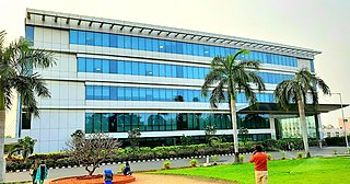
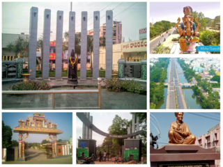
Rajampet is a Municipality in Annamayya district of the Indian state of Andhra Pradesh, located in the Rayalaseema Region formed on the banks of Cheyyeru River. The town has an average elevation of 139 meters (456 ft). Rajampet is a Grade II Municipality which upgraded in 2019 and has an area of 35.38 square kilometres (13.66 sq mi). It consists of 29 election wards.

Guntur is a city and the administrative headquarters of Guntur district in the Indian state of Andhra Pradesh. Guntur is a central part of the state and city is spread across 198.7 km square and is the third-largest city in the state. It is situated 64 kilometres (40 mi) to the west of the Bay of Bengal, on the Eastern Coastal Plains. The city is the heartland of the state, located in the centre of Andhra Pradesh and making it a central part connecting different regions. It serves as a major hub for exports chilli, cotton and tobacco and has the largest chili market yard in Asia. It is a major transportation, education and commercial hub for the state.

Kadapa is a city in the southern part of Andhra Pradesh, India. It is located in the Rayalaseema region, and is the district headquarters of YSR Kadapa district. As of the 2022 Census of India, the city had a population of 466,000, a 2.42% increase from 2021. It is located 8 kilometres (5.0 mi) south of the Penna River. The city is surrounded on three sides by the Nallamala and Palkonda Hills lying on the tectonic landscape between the Eastern and Western ghats. Black and Red ferrous soils occupy the region. The city is nicknamed "Gadapa" ('threshold') since it is the gateway from the west to the hills of Tirumala.

The Andhra Pradesh Capital Region Development Authority, Amaravati, ACT No. 27 of 2020. It was notified on 31 July 2020 by the Government of Andhra Pradesh as per The Andhra Pradesh Capital Region Development Authority Repeal Act, 2020, it replaced the Andhra Pradesh Capital Region Development Authority Act, 2014. The authority has a jurisdictional area of 8,352.69 km2, covering the districts of Guntur,Eluru, NTR, Krishna, Palnadu, and Bapatla.

Amaravati is the capital of the Indian state of Andhra Pradesh. It is located on the banks of the river Krishna in Guntur district.
The Nellore Urban Development Authority (NUDA) is an urban planning agency spread over the district of Nellore of the Indian state of Andhra Pradesh. It was constituted on 1 February 2016, under Andhra Pradesh Metropolitan Region and Urban Development Authority Act, 2016 with the headquarters located at Nellore.
The Kakinada Urban Development Authority (KAUDA) erstwhile Godavari Urban Development Authority (GUDA) is an urban planning agency spread over the district of East Godavari in the Indian state of Andhra Pradesh. It was constituted on 4 November 2016, under Andhra Pradesh Metropolitan Region and Urban Development Authority Act, 2020 with the headquarters located at Kakinada. R.C. Deepthi as Chairman
The Anantapuramu–Hindupur Urban Development Authority (AHUDA) is an urban planning agency in Anantapur district of the Indian state of Andhra Pradesh. It was constituted on 4 November 2017, under Andhra Pradesh Metropolitan Region and Urban Development Authority Act, 2016 with the headquarters located at Anantapuramu.
Palakollu Municipality is the local self-government in Palakollu of the Indian state of Andhra Pradesh. Palakollu Municipality merged five Grama panchayats of Seven village's on dated 7 January 2020. the Seven Village's population of 42,932 It around occupies 20.08 square kilometres (7.75 sq mi) and after merged palakollu municipality It around occupies 24.68 square kilometres (9.53 sq mi) with 35 election wards it is total population of 1,04,216 and making it the fourth most populous city in West Godavari District in Andhra Pradesh. It is classified as a Selection Grade Municipality.
The Srikakulam Urban Development Authority is an urban planning agency in Srikakulam district of the Indian state of Andhra Pradesh. It was constituted on 12 February 2019, under Andhra Pradesh Metropolitan Region and Urban Development Authorities Act, 2016 with the headquarters located at Srikakulam.
References
- ↑ Staff Reporter (2 January 2019). "Three new urban development authorities" [మరో మూడు నగరాభివృద్ధి సంస్థలు]. Eenadu (in Telugu). Archived from the original on 3 January 2019. Retrieved 2 January 2019.
- ↑ Staff Reporter (2 January 2019). "అన్నమయ్య దిశా.. కడపకు కొత్త దశ". Eenadu (in Telugu). Archived from the original on 3 January 2019. Retrieved 2 January 2019.
- ↑ "Andhra Pradesh Metropolitan Region and Urban Development Authorities Act, 2016" . Retrieved 27 November 2021.
| | This article about government in India is a stub. You can help Wikipedia by expanding it. |