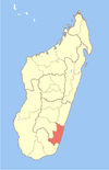
Madagascar, officially the Republic of Madagascar, is an island country comprising the island of Madagascar and numerous smaller peripheral islands. Lying off the southeastern coast of Africa, it is the world's fourth largest island, the second-largest island country and the 46th largest country in the world. Its capital and largest city is Antananarivo.

Antananarivo, also known by its colonial shorthand form Tana, is the capital and largest city of Madagascar. The administrative area of the city, known as Antananarivo-Renivohitra, is the capital of Analamanga region. The city sits at 1,280 m (4,199 ft) above sea level in the center of the island, the highest national capital by elevation among the island countries. It has been the country's largest population center since at least the 18th century. The presidency, National Assembly, Senate, and Supreme Court are located there, as are 21 diplomatic missions and the headquarters of many national and international businesses and NGOs. It has more universities, nightclubs, art venues, and medical services than any city on the island. Several national and local sports teams, including the championship-winning national rugby team, the Makis, are based here.

Toamasina, meaning "like salt" or "salty", unofficially and in French Tamatave, is the capital of the Atsinanana region on the east coast of Madagascar on the Indian Ocean. The city is the chief seaport of the country, situated 215 km (134 mi) northeast of its capital and biggest city Antananarivo. In 2018 Toamasina had a population of 325,857.

The Battle of Madagascar was an Allied campaign to capture the Vichy French-controlled island Madagascar during World War II. The seizure of the island by the British was to deny Madagascar's ports to the Imperial Japanese Navy and to prevent the loss or impairment of the Allied shipping routes to India, Australia and Southeast Asia. It began with Operation Ironclad, the seizure of the port of Diego-Suarez near the northern tip of the island, on 5 May 1942.

Nosy Be is an island off the northwest coast of Madagascar. Nosy Be is Madagascar's largest and busiest tourist destination. It has an area of 320.02 km2 (123.56 sq mi), and its population was 109,465 according to the provisional results of the 2018 Census.

Fianarantsoa is a city in south central Madagascar, and is the capital of Haute Matsiatra Region.

Nosy Boraha, also known as Sainte-Marie, main town Ambodifotatra, is an island off the east coast of Madagascar. The island forms an administrative district within Analanjirofo Region, and covers an area of 222 km2. It has a population estimated at 30,000.

Vatomandry is a town in and the administrative center of the Vatomandry District, Atsinanana Region, Madagascar. An airport serves the city.

Maroantsetra, formerly Louisbourg, is a market town and domestic seaport in Analanjirofo Region, Madagascar, at the northern end of the Bay of Antongil. In 2018, Maroantsetra counted 42,529 people. Even though it is a small city, Maroantsetra played an important role in the betsimisaraka history as the unification of this tribe by Ratsimilaho started there. Throughout the eighteenth century, Maroantsetra also actively participated in the piracy and the attack led collectively by the betsimisarakas against the islands of comoros and some east african countries.

The Sakalava are an ethnic group of Madagascar. They are found on the western and northwest region of the island, in a band along the coast. The Sakalava are one of the smallest ethnic groups, constituting about 6.2 percent of the total population, that is about 2,079,000 in 2018. Their name means "people of the long valleys." They occupy the western edge of the island from Toliara in the south to the Sambirano River in the north.

Montagne d'Ambre National Park is a national park in the Diana Region of northern Madagascar. The park is known for its endemic flora and fauna, water falls and crater lakes. It is 1,000 km (620 mi) north of the capital, Antananarivo, and is one of the most biologically diverse places in all of Madagascar with seventy-five species of birds, twenty-five species of mammals, and fifty-nine species of reptiles known to inhabit the park.
Betioky is a town in Atsimo-Andrefana Region, Madagascar and is crossed by the Route nationale 10. The population is 25,612 inhabitants in 2018.

Betafo is a town and urban municipality in Vakinankaratra Region in the Central Highlands of Madagascar. It is surrounded by volcanic peaks and is situated 22 km from Antsirabe. It is a typical Merina town in the Central Highlands.

Ambatondrazaka is a city in Madagascar

Saint Augustin is a rural municipality in Madagascar. It belongs to the district of Toliara II, which is a part of Atsimo-Andrefana Region. The population of the commune was estimated to be approximately 15,000 in 2001 commune census. The mouth of the Onilahy River is near the town.
Dusun Witu, or Witu, is a language spoken by the Dusun Witu people of Borneo specifically in Kalimantan Tengah Province, South Barito regency, near Pendang and Buntokecil towns; south of Muarateweh town in Indonesia. It is closely related to the Malagasy language spoken in Madagascar.

France–Madagascar relations are the diplomatic relations between the French Republic and the Republic of Madagascar. France controlled Madagascar beginning in 1895 until the islands nation's independence in 1960. Both nations are today members of the Francophonie and the United Nations.
Ambohidratrimo or Antakavana-Andranomiady is a town in Analamanga Region, in the Central Highlands of Madagascar, located north at 140 km from the capital of Antananarivo.

Mananjary is a city on the East coast of Madagascar with a population of 25,222 inhabitants in 2018. It is the chief town of the Mananjary district and the Vatovavy region.


