
Askham Richard is a village and civil parish in the unitary authority of City of York in the north of England, 6.5 miles (10.5 km) south-west of York, close to Copmanthorpe, Bilbrough and Askham Bryan. The population of the civil parish at the 2011 census was 351. The village became a Conservation Area in 1975. Nearby is Askham Bryan College of Agriculture.

Ryedale was a non-metropolitan district in North Yorkshire, England. It was in the Vale of Pickering, a low-lying flat area of land drained by the River Derwent. The Vale's landscape is rural with scattered villages and towns. It has been inhabited continuously from the Mesolithic period. The economy was largely agricultural with light industry and tourism playing an increasing role.

Acaster Selby is a village in the former Selby District of North Yorkshire, England. It is part of the joint civil parish with Appleton Roebuck. It is situated about 6 miles (9.7 km) south from York, on the west back of the River Ouse; near the opposite bank is the settlement of Stillingfleet, and 1.3 miles (2.1 km) to the north-west is Appleton Roebuck.

Angram Grange is a small civil parish in the Hambleton district of North Yorkshire, England, about 7 miles south-east of Thirsk. According to the 2001 census it had a population of 17. In 2015 the population was estimated at 20.

Appleton Roebuck is a village and civil parish in the former Selby District of North Yorkshire, England. It had a population of 692 according to the 2001 census, increasing to 871 in the 2021 census and including Acaster Selby. The village is about 9 miles (14 km) south-west of York. It covers an area of around 2,900 acres (1,200 ha).
Appleton-with-Eaton is a civil parish in the Vale of White Horse district of Oxfordshire, England, south west of Oxford. Historically it was part of Berkshire until the 1974 boundary changes transferred it to Oxfordshire. It consists of Appleton and Eaton, on the south bank of the River Thames. Its area is 8.38 km². According to the 2011 census the parish had a 915 residents, an increase of 18 over ten years.
Barmston is a village and civil parish in the East Riding of Yorkshire, England. It is situated on the Holderness coast, overlooking the North Sea and to the east of the A165 road. Barmston is approximately 6 miles (10 km) south of Bridlington town centre. The parish includes the village of Fraisthorpe, the former villages of Auburn and Hartburn have been abandoned due to coastal erosion. Barmston is mentioned in the Domesday Book as having eight ploughlands and belonging to Drogo of la Beuvrière. The name of the village derives from Beorn's Tūn. According to the 2011 UK census, Barmston and Fraisthorpe parish had a population of 275, a slight decrease on the 2001 UK census figure of 277. The parish covering an area of 1,765.014 hectares.
Bilsdale Midcable is a civil parish in North Yorkshire, England, which occupies the northern part of Bilsdale in the North York Moors National Park. According to the 2001 census it had a population of 293 increasing to 332 at the 2011 Census. Settlements in the parish are The Grange, Chop Gate, Seave Green and Urra. The parish also contains Bilsdale Moor, East and West.
Brandsby-cum-Stearsby is a civil parish in the Hambleton district of North Yorkshire, England, with a population of 234, increasing to 383 at the 2011 Census and including Dalby-cum-Skewsby and Yearsley. It includes the villages of Brandsby and Stearsby.
Caldbergh with East Scrafton is a civil parish in the Richmondshire district of North Yorkshire, England. The parish includes the settlements of Caldbergh and East Scrafton.

Conistone is a small village in the Craven district of North Yorkshire, England. It lies 3 miles (5 km) north of Grassington, 3 miles (5 km) south of Kettlewell and 12 miles (19 km) north of Skipton beside the River Wharfe, in Upper Wharfedale.
Gilling with Hartforth and Sedbury is a civil parish in North Yorkshire, England. It includes the villages of Gilling West and Hartforth. The civil parish population at the 2011 census was 534.

Cracoe is a small village and civil parish in the Craven district of North Yorkshire, England. It is situated near to Rylstone and about 6 miles south-west of Grassington. Cracoe has an estimated population of 160 residents, measured at 178 in the 2011 census. Cracoe is a village which is also situated near Rylstone beneath Barden Fell and the twin skyline landmarks of Rylstone Cross and Cracoe Pinnacle in the Yorkshire Dales.

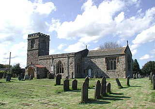
Thwing is a village and civil parish in the Yorkshire Wolds, in the East Riding of Yorkshire, England.
Lunedale is the dale, or valley, of the River Lune, on the east side of the Pennines in England, west of Middleton-in-Teesdale. Its principal settlements are Grassholme, Thringarth and Bowbank.

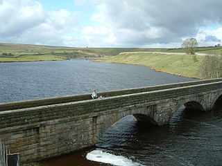
Laverton is a village and civil parish in the Harrogate district of North Yorkshire, England, about 7 miles (11 km) west of Ripon. The population of this parish as taken at the 2011 census was 260. The River Laver, from which the settlement derives its name, flows through the village. The parish includes the area of Dallowgill west of the village of Laverton.

Appleton-le-Street is a small village and in the Ryedale district of North Yorkshire, England. It is approximately 3 miles (5 km) west of Malton and in the parish of Appleton-le-Street with Easthorpe.
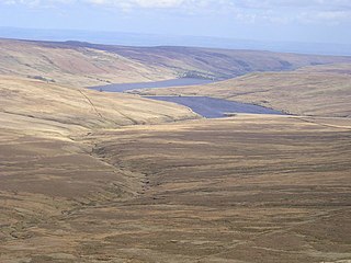
Stonebeck Up is a civil parish in Harrogate district, North Yorkshire, England. The only village in the parish is Middlesmoor. The population of the parish in the 2011 census was 119.

Stonebeck Down is a civil parish in Harrogate district, North Yorkshire, England. The main settlements in the parish are the village of Ramsgill and the hamlets of Stean and Heathfield. The population of the parish in the 2011 census was 192.
Hartwith cum Winsley is a civil parish in Harrogate district, North Yorkshire, England. Historically it was a township in the ancient parish of Kirkby Malzeard in the West Riding of Yorkshire, a detached part of that parish. It became a separate civil parish in 1866, and was transferred to North Yorkshire in 1974.
