East Cass is an unorganized territory in Cass County, Minnesota, United States. The population was 43 at the 2000 census. It is part of the Brainerd Micropolitan Statistical Area.

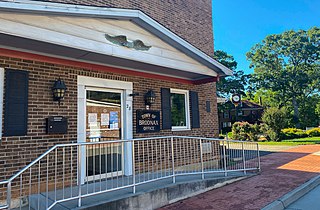
Brodnax is a town in Brunswick and Mecklenburg counties in the U.S. state of Virginia. The population was 283 at the 2020 census.
This is a list of the extreme points of the United Kingdom: the points that are farther north, south, east or west than any other location. Traditionally the extent of the island of Great Britain has stretched "from Land's End to John o' Groats".
Aspen Cove is a small fishing community in the province of Newfoundland and Labrador, Canada. Formerly called Aspey or Apsey Cove, Aspen Cove was named for the presence of aspen trees in the area. It first appears in the 1857 Census as Apsey Cove with a population of thirteen, all dependent on the salmon fishery. By the 1870s more families moved to Aspen Cove for the cod and lobster fisheries. In the 1921 census the population had reached 104 and the economy had changed from salmon, fur, and agriculture to cod, lobster, and lumbering.

Random Island is an island located off Canada's Atlantic coast. Part of the Province of Newfoundland and Labrador, it is located on the east coast of Newfoundland and partially surrounded by the Bonavista Peninsula on the north and within the confines of Trinity Bay. The island is approximately 35 km (22 mi) long, its width varies from 15 km (9.3 mi) on the eastern end, to 6 km (3.7 mi) in the middle, to 17 km (11 mi) on the western end, with a total area of around 310 km2 (120 sq mi). According to the 2016 census, the population of the island is 1,232.
Apsey Point was a farming and fishing settlement in the Trinity District. Banking was done at Harbor Grace. In 1911 the population was 180.

Tilt Cove is a town located southeast of Baie Verte on Notre Dame Bay and was founded in 1813. With an official population of 5 at the 2021 census, Tilt Cove is known as "Canada's smallest town." A source of gold, copper, and zinc ores, Tilt Cove was the site of the first mine in Newfoundland. The Tilt Cove mine opened in 1864 and "was soon employing several hundred men at good wages". Postal service was established in 1869.

Páez is a town and municipality in the Colombian Department of Boyacá, part of the subregion of the Lengupá Province.

Pouch Cove is a town in the Canadian province of Newfoundland and Labrador. The population is 2,063 according to the Canada 2021 Census. It is located on the northeast Avalon Peninsula, 27 kilometres north of St. John's, the province's capital city.
Noggin Cove is a local service district and designated place in the Canadian province of Newfoundland and Labrador. It is west of Carmanville on the south side of Hamilton Sound. It is said to be named after Noggin Island, about 5 km off its eastern point.
Ladle Cove is a designated place in the Canadian province of Newfoundland and Labrador. It is along the Straight Shore on the island of Newfoundland.
Uamh an Claonaite is the longest cave in Scotland. It consists of a series of dry passages and a series of at least six sumps which have been dived over the years.

Humber Arm South is a town in the Canadian province of Newfoundland and Labrador. The town consists of the communities of Halfway Point, Benoit's Cove, John's Beach, and Frenchman's Cove. The town had a population of 1,537 in the Canada 2021 Census. The Town's Post Office is located in Benoit's Cove. Humber Arm South is located in the Bay of Islands and is in the Humber-Bay of Islands electoral district. The town's residents are of Mi'kmaw, Innu, and European descent.
Seal Cove is a town in the Canadian province of Newfoundland and Labrador, located on Fortune Bay. The town had a population of 100 in the 2021 Census. The population of Seal Cove, Fortune Bay has fallen to approximately 100 largely due to outmigration for education and other work-related pursuits. The town was incorporated in 1972.
Eddies Cove West is a local service district and designated place in the Canadian province of Newfoundland and Labrador.
Chimney Cove is an abandoned community in Newfoundland and Labrador located to the south of Cape St. Gregory.
Victory Glacier is a gently sloping glacier, 8 nautical miles long, flowing east-southeast from the north end of Detroit Plateau on Trinity Peninsula to Prince Gustav Channel immediately north of Pitt Point. It is bounded by Trakiya Heights to the north and Kondofrey Heights to the south.

Division No. 1, Subdivision G is an unorganized subdivision on the Avalon Peninsula in Newfoundland and Labrador, Canada. It is in Division 1 and contains the unincorporated communities of Baccalieu Island, Besom Cove, Bradley's Cove, Burnt Point, Caplin Cove, Daniel's Cove, Grates Cove, Gull Island, Job's Cove, Kingston, Long Beach, Lower Island Cove, Low Point, Northern Bay, Ochre Pit Cove, Red Head Cove, Riverhead, Smooth Cove and Western Bay.
Chambersburg is an unincorporated community in Columbiana County, in the U.S. state of Ohio.


