Ghoti Budruk is a census town in Nashik district in the Indian state of Maharashtra.It is a special growth center in Nashik Metropolitan Region.Ghoti Budruk, khambale and Dahalewadi together forms a Growth Center.It is the biggest town and market place in Igatpuri.It is also called as mini Mumbai. It is situated on the bank of Darna River. This small town is having largest number of hospitals in Igatpuri. So it is also called as town of hospitals and medicals. Average rainfall of the town per year is 2998mm.
Nimbhore Budruk is a census town in Jalgaon district in the Indian state of Maharashtra.
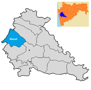
Maval taluka is a taluka in Mawal subdivision of Pune district of state of Maharashtra in India.

Kosbad is a village in the Palghar district of Maharashtra, India. It is located in the Dahanu taluka.
Dehane is a village in the Palghar district of Maharashtra, India. It is located in the Dahanu taluka.
Ghadane is a village in the Palghar district of Maharashtra, India. It is located in the Dahanu taluka.
Dabhon is a village in the Palghar district of Maharashtra, India. It is located in the Dahanu taluka.
Nikane is a village in the Palghar district of Maharashtra, India. It is located in the Dahanu taluka.
Asangaon Budruk is a village in the Palghar district of Maharashtra, India. It is located in the Dahanu taluka.
Chandranagar is a village in the Palghar district of Maharashtra, India. It is located in the Dahanu taluka.
Kolavali is a village in the Palghar district of Maharashtra, India. It is located in the Dahanu taluka.
Khambale is a village in the Palghar district of Maharashtra, India. It is located in the Dahanu taluka.
Chandigaon is a village in the Palghar district of Maharashtra, India. It is located in the Dahanu taluka.
Kosesari is a village in the Palghar district of Maharashtra, India. It is located in the Dahanu taluka. It is in rural part of Palghar, and it is one of the 173 villages of Dahanu Block of Palghar district.
Pimpalshet Budruk is a village in the Palghar district of Maharashtra, India. It is located in the Dahanu taluka.
Kasa Budruk is a village in the Palghar district of Maharashtra, India. It is located in the Vikramgad taluka. In 2015, Krishna Kakdya Bij, a Warli tribal from the village helped exposed a MGNREGA scam.
Dolhari Budruk is a village in the Palghar district of Maharashtra, India. It is located in the Vikramgad taluka.
Chari Budruk is a village in the Palghar district of Maharashtra, India. It is located in the Vikramgad taluka.
Shil is a village in the Palghar district of Maharashtra, India. It is located in the Vikramgad taluka. It comes under the administration of Moho Budruk panchayat.
Apti Khurd is a village in the Palghar district of Maharashtra, India. It is located in the Vikramgad taluka.

