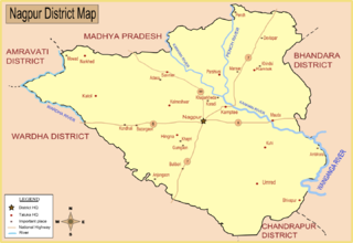
Saoner is a city and tehsil headquarters in north part of Nagpur district in state of Maharashtra, India. The town is governed by Savner municipal council. It is 36 kilometres (22 mi) from Nagpur city. Saoner is located on the bank of Kolar River. It is historically and mythologically important.
Waki is a village in the Palghar district of Maharashtra, India. It is located in the Dahanu taluka.
Zarali is a village in the Palghar district of Maharashtra, India. It is located in the Dahanu taluka.
Saravali is a village in the Palghar district of Maharashtra, India. It is located in the Dahanu taluka.

Kosbad is a village in the Palghar district of Maharashtra, India. It is located in the Dahanu taluka.
Sawata is a village in the Palghar district of Maharashtra, India. It is located in the Dahanu taluka.
Raipada is a village in the Palghar district of Maharashtra, India. It is located in the Dahanu taluka.
Rampur is a village in the Palghar district of Maharashtra, India. It is located in the Dahanu taluka. It lies along the Maharashtra State Highway 73.
Ghadane is a village in the Palghar district of Maharashtra, India. It is located in the Dahanu taluka.
Bodgaon is a village in the Palghar district of Maharashtra, India. It is located in the Dahanu taluka.
Deur is a village in the Palghar district of Maharashtra, India. It is located in the Dahanu taluka.
Sarani is a village in the Palghar district of Maharashtra, India. It is located in the Dahanu taluka.
Saiwan is a village in the Palghar district of Maharashtra, India. It is located in the Vasai taluka.
Naruli is a village in the Palghar district of Maharashtra, India. It is located in the Dahanu taluka.
Tadiyale is a village in the Palghar district of Maharashtra, India. It is located in the Dahanu taluka, on the shore of Arabian Sea.
Ranshet is a village in the Palghar district of Maharashtra, India. It is located in the Dahanu taluka.
Raitali is a village in the Palghar district of Maharashtra, India. It is located in the Dahanu taluka.
Sakhare is a village in the Palghar district of Maharashtra, India. It is located in the Dahanu taluka.
Kosesari is a village in the Palghar district of Maharashtra, India. It is located in the Dahanu taluka. It is in rural part of Palghar, and it is one of the 173 villages of Dahanu Block of Palghar district.
Vittalnagar is a village in the Palghar district of Maharashtra, India. It is located in the Vikramgad taluka.

