
The tropics are the region of the Earth surrounding the Equator. They are delimited in latitude by the Tropic of Cancer in the Northern Hemisphere at 23°26′12.3″ (or 23.43676°) N and the Tropic of Capricorn in the Southern Hemisphere at 23°26′12.3″ (or 23.43676°) S; these latitudes correspond to the axial tilt of the Earth. The tropics are also referred to as the tropical zone and the torrid zone. The tropics include all the areas on the Earth where the Sun contacts a point directly overhead at least once during the solar year - thus the latitude of the tropics is roughly equal to the angle of the Earth's axial tilt.

Mount Aberdeen is a national park in North Queensland, Australia, 961 km northwest of Brisbane, and 40 km south-west of Bowen. The Park is in 2 sections; the Mount Aberdeen section of 1840ha dedicated in 1952, and the Highlanders Bonnet section of 1370ha dedicated in 1967. The Park has no direct public access road or public facilities. Both Mount Aberdeen and Highlander's Bonnet are composed of granite, with Mount Aberdeen summit reaching 901 m and Highlander's Bonnet 624 m.

The Kimberley is the northernmost of the nine regions of Western Australia. It is bordered on the west by the Indian Ocean, on the north by the Timor Sea, on the south by the Great Sandy and Tanami Deserts in the region of the Pilbara, and on the east by the Northern Territory.

McLaren Vale is a wine region in the Australian state of South Australia located in the Adelaide metropolitan area and centred on the town of McLaren Vale about 38 kilometres (24 mi) south of the Adelaide city centre. It is internationally renowned for the wines it produces and included within the Great Wine Capitals of the World. The region was named after either David McLaren, the Colonial Manager of the South Australia Company or John McLaren (unrelated) who surveyed the area in 1839. Among the first settlers to the region in late 1839, were two English farmers from Devon, William Colton and Charles Thomas Hewett. William Colton established the Daringa Farm and Charles Thomas Hewett established Oxenberry Farm. Both men would be prominent in the early days of McLaren Vale. Although initially the region's main economic activity was the growing of cereal crops, John Reynell and Thomas Hardy planted grape vines in 1838 and the present-day Seaview and Hardy wineries were in operation as early as 1850. Grapes were first planted in the region in 1838 and some vines more than 100 years old are still producing. Today there are more than 88 cellar doors in McLaren Vale. The majority are small family-run operations and boutique wineries.

Roebuck Bay is a bay on the coast of the Kimberley region of Western Australia. Its entrance is bounded in the north by the town of Broome, and in the south by Bush Point and Sandy Point. It is named after HMS Roebuck, the ship captained by William Dampier when he explored the coast of north-western Australia in 1699. The Broome Bird Observatory lies on the northern coast of the bay.

Madayi. is a village near Pazhayangadi in Kannur district, Kerala. The famous Bhagavathy shrine, Madayi Kavu where devotees worship Bhadrakali is located here. The Goddess is one of the family deity of the Chirakkal Royal family, and the temple is known for the Koyikalasham. The temple was one of the few to survive desecration by the armies of Tippu Sultan, which devotees attribute to the grace of the Goddess. The Kolathiri Rajahs were the administrators of the temple, however recently the administration was transferred to the Malabar Devaswom Board. Nearby is the Vadukunnu Temple dedicated to Shiva. The temple was razed by followers of Tippu Sultan in the 18th century, but the temple has been rebuilt and is a vibrant centre of religion in the region.
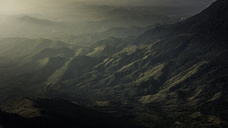
Phu Hin Rong Kla National Park is a national park located in the Loei, Phitsanulok and Phetchabun Provinces of Thailand. The protected area is located in the forested mountains of the Luang Prabang Range close to the border with Laos and is part of the Luang Prabang montane rain forests ecoregion.The park is the base of operations of the long fight of Thai combatant in communist war of Thailand.

The Gulf Country is the region of woodland and savanna grassland surrounding the Gulf of Carpentaria in north western Queensland and eastern Northern Territory on the north coast of Australia. The region is also called the Gulf Savannah. It contains large reserves of zinc, lead and silver. The Gulf Country is crossed by the Savannah Way highway.

Billardiera longiflora, the purple apple-berry, is a small Australian vine found in cool, moist forests from southern New South Wales to Tasmania, where it is native. It was described by French botanist Jacques Labillardière in 1805. The slender leafed vine has greenish-yellow flowers and shiny purple fruit. The fruit is edible.
The Arafura Swamp is a large inland freshwater wetland in Arnhem Land, in the Top End of the Northern Territory of Australia. It is a near pristine floodplain with an area of 700 square kilometres (270 sq mi) that may expand to 1,300 km2 (500 sq mi) by the end of the wet season, making it the largest wooded swamp in the Northern Territory and, possibly, in Australia. It has a strong seasonal variation in depth of water. The area is of great cultural significance to the Yolngu people, in particular the Ramingining community. It was the filming location for the film Ten Canoes.
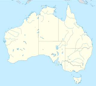
Mabi forests are a type of ecological community found in the Australian state of Queensland which is considered to be critically endangered and which consists of remnant patches found only either in North Queensland's Atherton Tablelands or at Shiptons Flat along the Annan River.
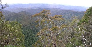
The Eastern Australian temperate forests, or temperate eucalypt forests, are an ecoregion of open forest on uplands starting from the east coast of New South Wales in the South Coast to southern Queensland, Australia. Four distinguishable communities are found within this ecoregion: subtropical rainforest, subtropical dry rainforest, warm temperate rainforest, and cool temperate rainforest, where they may also grade to other biomes, depending on the location.
The Ginini Flats Wetlands Ramsar Site, also known as the Ginini Flats Subalpine Bog Complex, is a wetland in the Australian Capital Territory (ACT) that has been recognised as being of international importance by designation under the Ramsar Convention. It was listed on 11 March 1996 as Ramsar site 793, and is the only such site in the ACT. It lies in the Australian Alps, close to the boundary of the ACT with New South Wales.

The Hunter Valley is one of Australia's best known wine regions. Located in the state of New South Wales, the region has played a pivotal role in the history of Australian wine as one of the first wine regions planted in the early 19th century. Hunter Valley Semillon is widely considered the iconic wine of the region but the Hunter produces wine from a variety of grapes including Shiraz, Chardonnay, Cabernet Sauvignon and Verdelho.
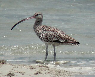
Buckingham Bay is a large, rectangular bay on the northern coast of Arnhem Land, in the Northern Territory of Australia. It lies 520 km east of Darwin and 120 km west of Nhulunbuy.

The Wollogorang Important Bird Area is a 726 km2 tract of land straddling the border between the Northern Territory and Queensland in northern Australia.

Lavinia State Reserve is a 68 km2 nature reserve on King Island, lying at the western end of Bass Strait and belonging to the Australian state of Tasmania.
Logan Lagoon is a 2172 ha wetland Conservation Area on Flinders Island, the largest of the Furneaux Group at the eastern end of Bass Strait, which is part of the Australian state of Tasmania.
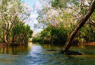
The Goyder River is a river in the Northern Territory, Australia.

The Black Jungle Conservation Reserve is a protected area in the Northern Territory of Australia near the territorial capital of Darwin. The rural area of Darwin and its development has a contrasting history to the more southern regions and their rural zones. The development of the rural area around Darwin occurred after 1950 as agricultural ventures were trialed. Prior to this the area was tropical savanna with pockets of monsoon rainforest and melaleuca swamps, unchanged for thousands of years, except by the traditional Aboriginal owners of the land who hunted and gathered and managed the landscape with fire. Black Jungle Conservation Reserve is a part of the Adelaide River Coastal Floodplain system which encompasses Black Jungle and Lambells Lagoon Conservation Reserves, Fogg Dam, Leaning Tree Lagoon Nature Park, Melacca Swamp and Djukbinj National Park. These Reserves encompass a range of wetland types and form part of the internationally significant Adelaide River floodplain.


