
The Belize Defence Force (BDF) is the military of Belize, and is responsible for protecting the sovereignty of the country. The BDF is under the Ministry of National Defence and Border Security, which is currently headed by Hon. Florencio Marin Jr.; the BDF itself is commanded by Brigadier General Azariel Loria. In 2012, the Belizean government spent about $17 million on the military, constituting 1.08% of the country's gross domestic product (GDP).

Purcellville is a town in Loudoun County, Virginia. The population was 8,929 according to the 2020 Census. Purcellville is the major population center for Western Loudoun and the Loudoun Valley. Many of the older structures remaining in Purcellville reflect the Victorian architecture popular during the early twentieth century.
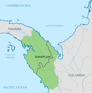
The Darién Gap is a geographic region in the Isthmus of Darién or Isthmus of Panama connecting the American continents within Central America, consisting of a large watershed, forest, and mountains in Panama's Darién Province and the northern portion of Colombia's Chocó Department.

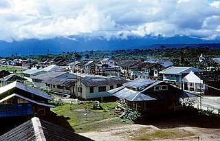
Rurrenabaque is a small town in the north of Bolivia, on the Beni River. It is the capital of Rurrenabaque Municipality. In recent years, it has become popular with international tourism as it is an easy gateway for visits to Madidi National Park, which is within the Bolivian rainforest. It also provides access to the surrounding pampas. Locals commonly refer to the town by its shortened nickname, "Rurre."

Orellana is an inland province of Ecuador. The capital is Puerto Francisco de Orellana. It was created on July 30, 1998, from part of Napo Province.

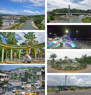
Pastaza is a province in the Oriente of Ecuador located in the eastern jungle. The capital is Puyo, founded on May 12, 1899, with a population of 33,325. The city is now accessible by paved roads, a recent development; the main road from Baños follows the Pastaza river into the province.
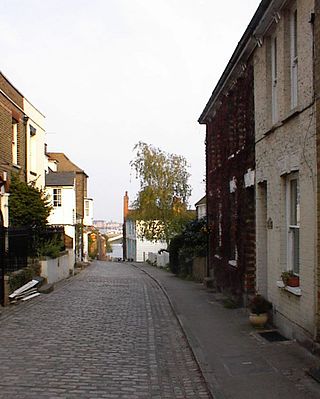
Lower Upnor and Upper Upnor are two small villages in Medway, Kent, England. They are in the parish of Frindsbury Extra on the western bank of the River Medway. Today the two villages are mainly residential and a centre for small craft moored on the river, but Upnor Castle is a preserved monument, part of the river defences from the sixteenth century.

Denham is the administrative town for the Shire of Shark Bay, Western Australia. At the 2016 census, Denham had a population of 754. Located on the western coast of the Peron Peninsula 831 kilometres (516 mi) north of Perth, Denham is the westernmost publicly accessible town in Australia, and is named in honour of Captain Henry Mangles Denham of the Royal Navy, who charted Shark Bay in 1858. Today, Denham survives as the gateway for the tourists who come to see the dolphins at Monkey Mia, which is located 23 kilometres (14 mi) northeast of the town. The town also has an attractive beach and a jetty popular with those interested in fishing and boating.
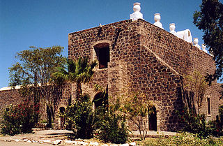
Mulegé is a city in Mulegé Municipality, Baja California Sur, situated on the Gulf of California. Located on the Gulf of California, the population was 3,834 according to the Mexican census of 2020.

The Connecticut Yankee Council of the Boy Scouts of America is located in Milford, Connecticut. It is council #072 and serves 37 towns and cities in Connecticut, including Fairfield, New Haven, and parts of Hartford counties. The present council was formed in 1998 by the merger of Quinnipiac Council (#074) and Fairfield County Council (#068).Owaneco Lodge is the Order of the Arrow lodge that serves this council.
Tabubil is a town located in the Star Mountains area of the North Fly District of Western Province, Papua New Guinea. The town, including the adjoining relocated village of Wangabin and the industrial area of Laydown, is the largest settlement in the province, although the provincial capital, Daru is a similar size. It had a recorded population of 10,270 at the 2011 census.
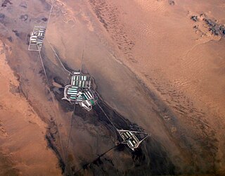
Cadiz is an unincorporated community in the Mojave Desert in San Bernardino County, California, United States. It is located just south of the Marble Mountains near the National Trails Highway. Cadiz was a water stop on the railroad.

The B68 is a bus route that constitutes a public transit line operating in Brooklyn, New York City. The B68 is operated by the MTA New York City Transit Authority. Its precursor was a streetcar line that began operation in June 1862, and was known as the Coney Island Avenue Line. The route became a bus line in 1955.

Bamaga is a small town and locality about 40 kilometres (25 mi) from the northern tip of Cape York in the north of Queensland, Australia. It is within the Northern Peninsula Area Region. It is one of the northernmost settlements in continental Australia and is the administrative centre for the Northern Peninsula Area Regional Council.
Tena is a city in the Amazon rainforest of Ecuador. It is the seat of Tena Canton, as well as the capital and largest city of Napo Province.
Shell is a city located on the western edge of the Ecuadorian Amazon and in the eastern foothills of the Andes. It is located about 94 miles (151 km) southeast of Quito, and roughly 4 miles (6.4 km) west of the provincial capital, Puyo. Its name comes from the Royal Dutch Shell corporation.

The Oriente is a region of eastern Ecuador, comprising the eastern slopes of the Ecuadorian Andes and the lowland areas of rainforest in the Amazon basin.
World Radio Missionary Fellowship, Inc., also known as Reach Beyond, is a corporate entity and nonprofit, noncommercial, interdenominational worldwide missionary organization with headquarters in Colorado Springs, Colorado.
Capurganá is a town of the municipality of Acandí on the northwestern coast of the Gulf of Urabá in the Colombian department of Chocó, adjacent to the border between Colombia and Panama. Previously a base site for eco-tourists, since 2010 the town's main source of income has been migrants preparing to hike into Panama, across the Darién Gap. In 2019 it was described as a "smugglers' town".
Noemí Gualinga, known as "mother of the jungle", is a community leader of and activist for the Sarayaku, a Amazonian Kichwa indigenous group from the Ecuadorian Amazon numbering roughly 1,200.
