Brooklyn is a borough of New York City, coextensive with Kings County, in the U.S. state of New York. Kings County is the most populous county in the State of New York, and the second-most densely populated county in the United States, behind New York County (Manhattan). Brooklyn is also New York City's most populous borough, with 2,736,074 residents in 2020.

East Williamsburg is a name for the area in the northwestern portion of Brooklyn, New York City. East Williamsburg consists roughly of what was the 3rd District of the Village of Williamsburgh and what is now called the East Williamsburg In-Place Industrial Park (EWIPIP), bounded by the neighborhoods of Northside and Southside Williamsburg to the west, Greenpoint to the north, Bushwick to the south and southeast, and both Maspeth and Ridgewood in Queens to the east. Much of this area is still referred to as either Bushwick, Williamsburg, or Greenpoint with the term East Williamsburg falling out of use since the 1990s.

Bushwick is a neighborhood in the northern part of the New York City borough of Brooklyn. It is bounded by the neighborhood of Ridgewood, Queens, to the northeast; Williamsburg to the northwest; East New York and the cemeteries of Highland Park to the southeast; Brownsville to the south; and Bedford–Stuyvesant to the southwest.

Newtown Creek, a 3.5-mile (6-kilometer) long tributary of the East River, is an estuary that forms part of the border between the boroughs of Brooklyn and Queens, in New York City. Channelization made it one of the most heavily-used bodies of water in the Port of New York and New Jersey and thus one of the most polluted industrial sites in the United States, containing years of discarded toxins, an estimated 30,000,000 US gallons of spilled oil, including the Greenpoint oil spill, raw sewage from New York City’s sewer system, and other accumulation from a total of 1,491 sites.

Ridgewood Park, also known as Wallace's Ridgewood Park or the Wallace Grounds, and frequently confused with Grauer's Ridgewood Park, was a baseball ground in Ridgewood, Queens, New York. Both Wallace's and Grauer's are shown in Belcher Hyde's Map of Newtown in 1915. The baseball field was part of a larger entertainment area bounded Wyckoff Avenue, Covert Street, Halsey Street, and Irving Avenue. The baseball field was southwest of the Long Island Rail Road's Montauk Branch tracks. Eldert Street, although depicted on the map as running through the baseball grounds, was not cut through southwest of the railroad tracks and the road remains interrupted there today. Originally the park was in Queens County, before its incorporation into New York City in 1899. This facilitated Sunday baseball playing, including the charging of admission, beyond the reach of Sabbath enforcers from the then-city of Brooklyn.

Glendale is a neighborhood in the west-central portion of the New York City borough of Queens. It is bounded by Forest Hills to the east, Ridgewood to the west, Woodhaven to the south, and Middle Village to the north.

The Brooklyn City Railroad (BCRR) was the oldest and one of the largest operators of streetcars in the City of Brooklyn, New York, continuing in that role when Brooklyn became a borough of New York City in 1898.

Ridgewood is a neighborhood in the New York City borough of Queens. It borders the Queens neighborhoods of Maspeth to the north, Middle Village to the east, and Glendale to the southeast, as well as the Brooklyn neighborhoods of Bushwick to the southwest and East Williamsburg to the west. Historically, the neighborhood straddled the Queens-Brooklyn boundary.
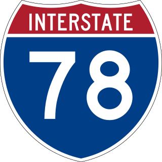
Interstate 78 (I-78) is a part of the Interstate Highway System that runs from Union Township, Lebanon County, Pennsylvania, to New York City. In the US state of New York, I-78 extends 0.5 miles (0.80 km). The entirety of I-78 consists of the Holland Tunnel, which crosses under the Hudson River from New Jersey and ends at an exit rotary in Lower Manhattan. The tunnel and its approaches are maintained by the Port Authority of New York and New Jersey (PANYNJ).

DeKalb Avenue is a thoroughfare in the New York City boroughs of Brooklyn and Queens, with the majority of its length in Brooklyn.

The Grand Street Line is a public transit line in Brooklyn and Queens, New York City, running mostly along the continuous Grand Street and Grand Avenue between Williamsburg, Brooklyn and Maspeth, Queens. It then continues down Queens Boulevard to the 63rd Drive–Rego Park station. Originally a streetcar line, it is now the Q59 bus route, operated by the New York City Transit Authority between Williamsburg and Rego Park, Queens.

Grand Street and Grand Avenue are the respective names of a street which runs through the boroughs of Brooklyn and Queens, New York City, United States. Originating in Williamsburg, Brooklyn, Grand Street runs roughly northeast until crossing Newtown Creek into Queens, whereupon Grand Street becomes Grand Avenue, continuing through Maspeth where it is a main shopping street, until reaching its northern end at Queens Boulevard in Elmhurst.

Flushing Avenue is a street running through northern Brooklyn and western Queens, beginning at Nassau Street in Fort Greene, Brooklyn, and ending at Grand Avenue in Maspeth. It divides the neighborhood of Williamsburg from Clinton Hill and East Williamsburg from Bushwick. After crossing the Queens border, the avenue serves as the dividing line between Ridgewood, Queens and West Maspeth. Flushing Avenue then terminates in Maspeth. Despite its name, however, the avenue does not extend to Flushing.

Fresh Pond was a small middle class neighborhood in the New York City borough of Queens, separated from Juniper Valley by the Lutheran and Mount Olivet cemeteries. In present day, it is now considered part of the surrounding neighborhoods of Maspeth, Middle Village, Glendale, and Ridgewood and is no longer referred to by the name "Fresh Pond." The area was originally named for two freshwater ponds that, in the early 1900s, were filled in. Other ponds were lower, and brackish due to Newtown Creek being estuarine.
Conduit Avenue is an arterial road in New York City, the vast majority of which is in Queens. The divided highway runs from Atlantic Avenue in Cypress Hills, Brooklyn to Hook Creek Boulevard in Rosedale, Queens at the Nassau County border. The thoroughfare is named after an aqueduct in its right-of-way.

Wyckoff Heights is an area within the New York City boroughs of Brooklyn and Queens, straddling the border between Bushwick, Brooklyn, and southwest Ridgewood, Queens. Wyckoff Heights was urbanized starting in the late 19th century, and took its name from the Wyckoff family, who owned the land. The area was home first to many German immigrants, later followed by Italian and more recently Latino and Eastern-European residents.

The Bushwick Branch, also called the Bushwick Lead Track, is a freight railroad branch in New York City. It runs from Bushwick in Brooklyn to Fresh Pond Junction in Glendale, Queens, where it connects with the Montauk Branch of the Long Island Rail Road. It is owned by the LIRR but operated under lease by the New York and Atlantic Railway, which took over LIRR freight operations in May 1997.

The Vander Ende–Onderdonk House, also known as the Van Nanda House, is a historic house at 1820 Flushing Avenue in Ridgewood, Queens, New York City. It is the oldest Dutch Colonial stone house in New York City.

Broadway is an avenue in the New York City borough of Brooklyn that extends from the East River in the neighborhood of Williamsburg in a southeasterly direction to East New York for a length of 4.32 miles (6.95 km). It was named for the Broadway in Manhattan. The East New York terminus is a complicated intersection with East New York Avenue, Fulton Street, Jamaica Avenue, and Alabama Avenue. The BMT Jamaica Line of the New York City Subway runs on elevated tracks over Broadway from the Williamsburg Bridge to East New York on its way to Queens. Broadway forms the boundary between the neighborhoods of Bushwick, which lies above Broadway to the northeast, and Bedford–Stuyvesant, which is to the southwest.