The South Yorkshire Supertram, sometimes referred to as the Sheffield Supertram, is a tram and tram-train network covering Sheffield and Rotherham in South Yorkshire, England. The network is owned and operated by the South Yorkshire Mayoral Combined Authority (SYMCA).

Sheffield station is a combined railway station and tram stop in Sheffield, England; it is the busiest station in South Yorkshire, and the second busiest in Yorkshire & the Humber, after Leeds. Adjacent is the Sheffield Supertram stop.

Meadowhall Interchange is a transport interchange located in north-east Sheffield, consisting of a combined heavy rail station, tram stop and bus and coach station. The second-busiest heavy rail station in the city in terms of passenger numbers, Meadowhall Interchange provides connections between National Rail services, the Sheffield Supertram light rail network, intercity coach services and the city bus network.

Rotherham Central railway station is in Rotherham, South Yorkshire, England. The station was originally named "Rotherham", becoming "Rotherham and Masborough" in January 1889 and finally "Rotherham Central" on 25 September 1950.

Transport in Sheffield, England is developed around the city's unusual topography and medieval street plan. Once an isolated town, the transport infrastructure changed dramatically in the 19th and 20th centuries. The city now has road and rail links with the rest of the country, and road, bus and trams for local transport.

South Yorkshire Passenger Transport Executive (SYPTE) was the passenger transport executive for South Yorkshire. It was responsible for implementing policies set by the South Yorkshire Passenger Transport Authority (SYPTA) and for operation of the Authority's bus fleet from its formation in 1974 until its dissolution in 2023, when its assets and duties were transferred to the South Yorkshire Mayoral Combined Authority.

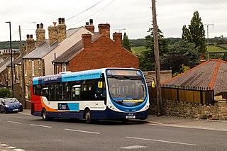
Stagecoach Yorkshire is a bus operator providing local and regional services across South Yorkshire and Derbyshire in England. It is a subsidiary of the Stagecoach Group and is headquartered in Barnsley. The subsidiary was formed in 2005 following the takeover of the Traction Group to run the operations of Yorkshire Traction, Yorkshire Terrier and Barnsley & District in South Yorkshire. Since then, the geographical coverage of the Stagecoach Yorkshire division has changed, with the divestment of services in the Huddersfield area and the transfer of Derbyshire operations from Stagecoach East Midlands.

The Siemens-Duewag Supertram is a fleet of 25 trams built by Siemens-Duewag of Düsseldorf, Germany in 1992 for use on the South Yorkshire Supertram light rail network in England. They were the only trams in use on the network until the entry into service of British Rail Class 399 tram-trains in 2017. As of May 2024, 24 of the fleet are operational, with one currently out of service. Tram 105 was involved in a road traffic collision (RTC) and has arrived back at the depot after repairs, but has not yet returned to service.

Rotherham Parkgate is a tram-train stop on the South Yorkshire Supertram network. It opened on 25 October 2018, following the opening of the extension from Meadowhall to Rotherham, and serves the suburb of Parkgate in South Yorkshire.

Herdings Park is a tram stop on the South Yorkshire Supertram network, opened on 3 April 1995. It is located north of Herdings Park. It is adjacent to Raeburn Road, and is the current terminus of the Herdings Park branch and the Purple Route.

Gleadless Townend is a tram stop on the South Yorkshire Supertram network, opened on 5 December 1994. It is located on Ridgeway Road, in Gleadless, north of the White Lane road junction. This stop used to be the terminus of the line before it was extended further to Halfway and Herdings Park in 1995.
Hollinsend is a tram stop on the South Yorkshire Supertram network, opened on 5 December 1994. It is located on Ridgeway Road. It is next to Hollinsend Park and Recreation Ground.

Manor Top is a tram stop on the South Yorkshire Supertram network, opened on 5 December 1994. It is located on Ridgeway Road, in Manor, near a small bus interchange with the same name. It is near Manor Top Medical Centre and Manor Library.

Spring Lane is a tram stop on the South Yorkshire Supertram network, opened on 22 August 1994. It is located on Park Grange Road, and was the terminus of the line before it was extended further to Gleadless Townend and Halfway later on.

Granville Road is a tram stop on the South Yorkshire Supertram network, opened on 22 August 1994. Each platform is located on opposite sides of Granville Road, the northbound platform on the north side, and vice versa. It is also near The Sheffield College and Granville Square.

Leppings Lane is a tram stop on the South Yorkshire Supertram network. It serves the surrounding areas of Wadsley, Wisewood, and Hillsborough around 3.4 km (2.1 mi) from the edge of Sheffield city centre. It is the last intermediate station on the Middlewood branch, opened on 23 October 1995. It is located on the A6102 road.

Middlewood is a tram stop on the South Yorkshire Supertram network. It serves the surrounding areas of Middlewood and Wadsley around 4 km (2.5 mi) from the edge of Sheffield city centre. It is the last station on the Middlewood branch, opened on 23 October 1995. It is located adjacent to the A6102 road.
Public transport in South Yorkshire, England mainly consists of three modes: bus, tram and train. Passengers can switch between these modes of transport at various interchanges operated by the South Yorkshire Combined Mayoral Authority.

Park Grange Road is a tram stop on the South Yorkshire Supertram network, opened on 22 August 1994.

Herdings Leighton Road is a tram stop on the South Yorkshire Supertram network, opened on 3 April 1995. It is located adjacent to Norton Avenue, and is the only intermediate stop on the Herdings Park branch.


