
Montana is a state in the Mountain West subregion of the Western United States. It is bordered by Idaho to the west; North Dakota and South Dakota to the east; Wyoming to the south; and by the Canadian provinces of Alberta, British Columbia, and Saskatchewan to the north. It is the fourth-largest state by area, the eighth-least populous state, and the third-least densely populated state. Its state capital is Helena. The western half of Montana contains numerous mountain ranges, while the eastern half is characterized by western prairie terrain and badlands, with smaller mountain ranges found throughout the state. In all, 77 named ranges are part of the Rocky Mountains.

The Yellowstone River is a tributary of the Missouri River, approximately 692 miles (1,114 km) long, in the Western United States. Considered the principal tributary of upper Missouri, via its tributaries, it drains an area with headwaters across the mountains and high plains of southern Montana and northern Wyoming, and stretching east from the Rocky Mountains in the vicinity of Yellowstone National Park. It flows northeast to its confluence with the Missouri River on the North Dakota side of the border, about 25 miles west of present-day Williston.

The Madison River is a headwater tributary of the Missouri River, approximately 183 miles (295 km) long, in Wyoming and Montana. Its confluence with the Jefferson and Gallatin rivers near Three Forks, Montana forms the Missouri River.

The Big Hole River is a tributary of the Jefferson River, approximately 153 miles (246 km) long, in Beaverhead County, in southwestern Montana, United States. It is the last habitat in the contiguous United States for native fluvial Arctic grayling and is a historically popular destination for fly fishing, especially for trout.
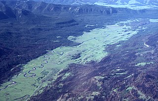
Slough Creek is a tributary of the Lamar River, approximately 25 mi (40 km) long, in Montana and Wyoming in the United States.

Henrys Lake is a small, shallow alpine lake in the western United States, in eastern Idaho. Approximately 8 square miles (21 km2) in area, at 4 miles (6.4 km) in length and 2 miles (3.2 km) in width, its surface elevation is 6,472 ft (1,973 m) above sea level.

The cutthroat trout(Oncorhynchus clarkii) is a fish species of the family Salmonidae native to cold-water tributaries of the Pacific Ocean, Rocky Mountains, and Great Basin in North America. As a member of the genus Oncorhynchus, it is one of the Pacific trout, a group that includes the widely distributed rainbow trout. Cutthroat trout are popular gamefish, especially among anglers who enjoy fly fishing. The common name "cutthroat" refers to the distinctive red coloration on the underside of the lower jaw. The specific name clarkii was given to honor explorer William Clark, coleader of the Lewis and Clark Expedition.

Flathead Lake is a large natural lake in northwest Montana.

The Yellowstone cutthroat trout is a subspecies of the cutthroat trout. It is a freshwater fish in the salmon family. Native only to a few U.S. states, their original range was upstream of Shoshone Falls on the Snake River and tributaries in Wyoming, also across the Continental Divide in Yellowstone Lake and in the Yellowstone River as well as its tributaries downstream to the Tongue River in Montana. The species is also found in Idaho, Utah and Nevada.
Spring Meadow Lake State Park is a public recreation area covering 61 acres (25 ha) just west of Helena, Montana. Once the site of a gravel pit and factory, the state park centers around a man-made, spring-fed lake, which is used for swimming, fishing, non-motorized boating, and scuba diving. The park also offers picnicking, a mile-long trail around the lake, and ice fishing and ice skating in winter. Largemouth bass, westslope cutthroat trout, yellow perch, and pumpkinseed are the main catches. A fishing pier was added to 30-acre (12 ha) lake in 2011.

The following articles relate to the history, geography, geology, flora, fauna, structures and recreation in Yellowstone National Park.

Holter Dam is a hydroelectric straight gravity dam on the Missouri River about 45 miles (72 km) northeast of Helena, Montana, in the United States. The dam, which was built between 1908 and 1918, is 1,364 feet (416 m) long and 124 feet (38 m) high. The reservoir formed by the dam, Holter Lake is 25 miles (40 km) long and has a storage capacity of 243,000 acre-feet (300,000,000 m3) of water when full. The dam is a "run-of-the-river" dam because it can generate electricity without needing to store additional water supplies behind the dam.

The Montana Department of Fish, Wildlife and Parks (MFWP) is a government agency in the executive branch state of Montana in the United States with responsibility for protecting sustainable fish, wildlife, and state-owned park resources in Montana for the purpose of providing recreational activities. The agency engages in law enforcement activities to enforce laws and regulations regarding fish, wildlife, and state parks, and encourages safe recreational use of these resources.

Lake Elmo State Park is a public recreation area located on the northeast side of Billings, Montana. The state park occupies 123 acres (50 ha) and is at an elevation of 3,199 feet (975 m). It offers non-motorized boating on a 64-acre (26 ha) reservoir, three beach-front areas, fishing pier, grassed multi-use areas, two group-use shelters, playground, and fenced-in dog park on the lake's west side.

Whitefish Lake State Park is a 10-acre (4.0 ha) public recreation area on Whitefish Lake off of U.S. Highway 93, two miles northwest of Whitefish, Montana. It offers boating, swimming, tent and RV camping, and fishing. Sites for hike-in and bike-in camping were added in 2016.
Ackley Lake State Park is a public recreation area located four miles southwest of Hobson, Montana. The state park covers 290 acres (120 ha) centered around 160-acre (65 ha) Ackley Lake. The Little Belt Mountains and Snowy Mountains are visible on the horizon. The park is operated by the Montana Department of Fish, Wildlife and Parks on land leased from the Montana Department of Natural Resources and Conservation.
Big Arm State Park is a Montana state park that is a unit of Flathead Lake State Park near Big Arm, Montana. Big Arm State Park is located on the western shores of Flathead Lake, the largest natural freshwater lake in the western United States. The park's recreational activities include fishing, boating, RV and tent camping, and swimming.

West Shore State Park is a public recreation area occupying 129 acres on the western shore of Flathead Lake five miles south of Lakeside in Lake County, Montana. The state park offers boating, fishing, camping, swimming, hiking, and wildlife viewing.

Lake Mary Ronan State Park is a public recreation area located seven miles (11 km) northwest of the Flathead Lake community of Dayton, Montana. The state park occupies 120 acres (49 ha) on the east side of 1,500-acre (610 ha) Lake Mary Ronan. The lake is 47 feet deep at its deepest spot and is known for kokanee salmon and yellow perch. Twenty-five campsites and a boat ramp are found in the park.

Yellow Bay State Park is a public recreation area occupying fifteen acres (6.1 ha) on the eastern shore of Flathead Lake twelve miles (19 km) south of Bigfork in Lake County, Montana. The state park offers boating, fishing, camping, swimming, and wildlife viewing.

