
Poole Harbour is a large natural harbour in Dorset, southern England, with the town of Poole on its shores. The harbour is a drowned valley (ria) formed at the end of the last ice age and is the estuary of several rivers, the largest being the Frome. The harbour has a long history of human settlement stretching to pre-Roman times. The harbour is extremely shallow, with one main dredged channel through the harbour, from the mouth to Holes Bay.
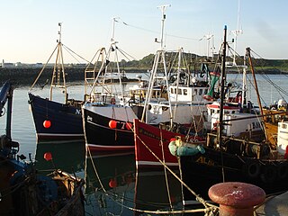
Ardglass is a coastal fishing village, townland and civil parish in County Down, Northern Ireland, in the historic barony of Lecale Lower. It is still a relatively important fishing harbour. It is situated on the B1 Ardglass to Downpatrick road, about 6 miles to the south east of Downpatrick, in the Lecale peninsula on the Irish Sea. It had a population of 1,668 in the 2001 Census, and is located within the Newry, Mourne and Down area.

Kilkeel is a small town, civil parish and townland in County Down, Northern Ireland. It is the southernmost town in Northern Ireland. It lies within the historic barony of Mourne. Kilkeel town is the main fishing port on the Down coast, and its harbour is home to the largest fishing fleet in Northern Ireland. It had a population of 6,541 people at the 2011 Census. The town contains the ruins of a 14th-century church and fort, winding streets and terraced shops. It lies just south of the Mourne Mountains.
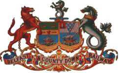
The Belfast and County Down Railway (BCDR) was an Irish gauge railway in Ireland linking Belfast with County Down. It was built in the 19th century and absorbed into the Ulster Transport Authority in 1948. All but the line between Belfast and Bangor was closed in the 1950s, although some of it has been restored near Downpatrick by a heritage line, the Downpatrick and County Down Railway.

Cork Harbour is a natural harbour and river estuary at the mouth of the River Lee in County Cork, Ireland. It is one of several which lay claim to the title of "second largest natural harbour in the world by navigational area". Other contenders include Halifax Harbour in Canada, Trincomalee Harbour in Sri Lanka and Poole Harbour in England.
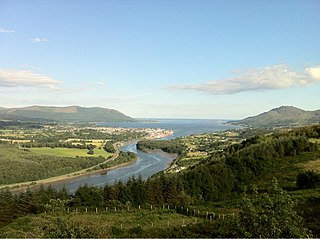
Carlingford Lough is a glacial fjord or sea inlet in northeastern Ireland, forming part of the border between Northern Ireland to the north and the Republic of Ireland to the south. On its northern shore is County Down, the Mourne Mountains, and the town of Warrenpoint; on its southern shore is County Louth, the Cooley Mountains and the village of Carlingford. The Newry River flows into the loch from the northwest.

Belfast Lough is a large, intertidal sea inlet on the east coast of Northern Ireland. At its head is the city and port of Belfast, which sits at the mouth of the River Lagan. The lough opens into the North Channel and connects Belfast to the Irish Sea.
The Tullaghmurray Lass was a prawn fishing boat based in Kilkeel, County Down, Northern Ireland.

Bangor Marina is the largest marina in Northern Ireland. It opened in 1989 on the southern shores of Belfast Lough, close to the Irish Sea cruising routes. The marina has become well known for providing a berth in the centre of Bangor. It has also been awarded Five Anchors by the Yachting Harbour Association.
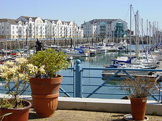
Carrickfergus Waterfront is an area of Carrickfergus situated on the north shore of Belfast Lough, which includes two harbour facilities, several restaurants and bars and promenade areas.

Portaferry Marina is situated in Portaferry, on the east shore of The Narrows, the gateway to Strangford Lough, County Down, Northern Ireland. It is owned and managed by Portaferry Regeneration, is sited 100 metres south of the ferry slipway in Portaferry and can accommodate up to 50 boats. Some 12 berths are reserved purely for visitor use and there is on-site water and electricity. Portaferry village centre is two minutes from the marina. The marina pontoon is chain fixed and provides good shelter, although the current can reach up to 11 knots.

Halifax Harbour is a large natural harbour on the Atlantic coast of Nova Scotia, Canada, located in the Halifax Regional Municipality. Halifax largely owes its existence to the harbour, being one of the largest and deepest ice-free natural harbours in the world. Before Confederation it was one of the most important commercial ports on the Atlantic seaboard. In 1917, it was the site of the world's largest man-made accidental explosion, when the SS Mont-Blanc blew up in the Halifax Explosion of December 6.
The Crom Estate is a nature reserve located in the south of County Fermanagh, Northern Ireland, along the shores of Upper Lough Erne. It is one of three estates owned and managed by the National Trust in County Fermanagh, the others being Florence Court and Castle Coole mansions. The estate comprises 1,350 acres (5.5 km2), composed primarily of riparian forest. Some trees are so ancient that physical access is restricted.
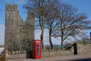
Jordan's Castle is a castle situated in Ardglass, County Down, Northern Ireland. The tower house known as Jordan's Castle is a State Care Historic Monument sited in the townland of Ardglass, in the Newry, Mourne and Down District Council area, at grid ref: J5601 3713. It stands close to the junction of Kildare and Quay Streets in Ardglass and commands the harbour.

Ardglass Castle is situated in Ardglass, County Down, Northern Ireland. It was originally a row of 15th century warehouses by the harbour. Large sections of the original building can still be seen within the modern club house of Ardglass Golf Club.
Carrickfergus Sailing Club is located in Carrickfergus, Northern Ireland on the north shore of Belfast Lough. The club was founded in 1866. The clubhouse moved from the building on stilts beside Carrickfergus Harbour to its current location beside Carrickfergus Marina in 1984.
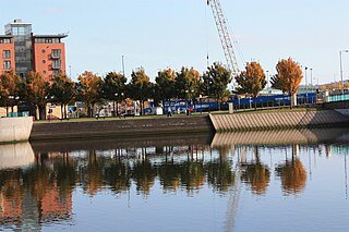
Queen's Quay is a section of the River Lagan, in the western Titanic Quarter of the city of Belfast, Northern Ireland.

Lecale is a peninsula in the east of County Down, Northern Ireland. It lies between Strangford Lough and Dundrum Bay. In the Middle Ages it was a district or túath in the Gaelic Irish kingdom of Ulaid, then became a county in the Anglo-Norman Earldom of Ulster. Later it became a barony, which was split into Lecale Lower and Lecale Upper by 1851. Its largest settlement is the town of Downpatrick. Other settlements include Ardglass, Killough and Strangford. The peninsula has a high concentration of tower houses. Much of it is part of the 'Strangford and Lecale' Area of Outstanding Natural Beauty.

Sutton Harbour, formerly known as Sutton Pool, is the original port of Plymouth in Devon, England. It is still a busy fishing port and marina and is bounded on one side by the historic Barbican district. It is famous as the last departure point in England of the Mayflower, the ship that carried the Pilgrim Fathers to the New World.
