This article uses abbreviations that may be confusing or ambiguous.(December 2011) |
An Aviation Area Forecast (FA or ARFOR) is a message product of the National Weather Service (NWS) in the United States. There are also weather charts forecast like SIGWX. FA encompasses the weather conditions over a large regional area and is considered one of the better sources of information for en-route weather. It is also beneficial in verifying airport conditions at airports that do not have terminal aerodrome forecasts. FA's are issued three times daily in all 48 contiguous states of the United States, and modified as required. The NWS offices also issue FA's for Alaska and Hawaii, but Alaska uses a slightly different format.
The National Weather Service (NWS) is an agency of the United States federal government that is tasked with providing weather forecasts, warnings of hazardous weather, and other weather-related products to organizations and the public for the purposes of protection, safety, and general information. It is a part of the National Oceanic and Atmospheric Administration (NOAA) branch of the Department of Commerce, and is headquartered in Silver Spring, Maryland, within the Washington metropolitan area. The agency was known as the United States Weather Bureau from 1890 until it adopted its current name in 1970.

The United States of America (USA), commonly known as the United States or America, is a country composed of 50 states, a federal district, five major self-governing territories, and various possessions. At 3.8 million square miles, the United States is the world's third or fourth largest country by total area and is slightly smaller than the entire continent of Europe's 3.9 million square miles. With a population of over 327 million people, the U.S. is the third most populous country. The capital is Washington, D.C., and the largest city by population is New York City. Forty-eight states and the capital's federal district are contiguous in North America between Canada and Mexico. The State of Alaska is in the northwest corner of North America, bordered by Canada to the east and across the Bering Strait from Russia to the west. The State of Hawaii is an archipelago in the mid-Pacific Ocean. The U.S. territories are scattered about the Pacific Ocean and the Caribbean Sea, stretching across nine official time zones. The extremely diverse geography, climate, and wildlife of the United States make it one of the world's 17 megadiverse countries.
SIGWX is a Significant Weather Chart defined by ICAO.
Area forecasts (FA's):
- Issued 3 times daily
- Valid for 18 hours (12-hour forecast, plus 6-hour categorical outlook)
- Cover an area the size of several states
- Visibility is always stated in statute miles (SM)
- Times are issued in UTC (Coordinated Universal Time)
- Comprise four sections
- a. A communications and header section
- i. Issue time of forecast
- ii. Valid times of the synopsis and the visual flight rules (VFR) CLOUDS/WX sections
- iii. Area of coverage
- b. A precautionary statement section
- c. A synopsis section
- i. Brief summary of the location and movement of fronts, pressure systems and circulation patterns for an 18-hour period
- ii. References to low ceilings, reduced visibility and/or strong winds may be included
- d. A VFR CLOUDS/WX section
- i. Contains a 12-hour specific forecast, followed by a 6-hour categorical outlook
- ii. Broken down into geographical areas, and/or states
- iii. Describes cloud and weather affecting VFR flight operations, including precipitation, thunderstorms, and sustained surface winds 20 Kts or greater. Also includes visibility when the forecast to visibility is between 3 and 6 SM and/or obstructions to visibility
With respect to aircraft performance, a ceiling is the maximum density altitude an aircraft can reach under a set of conditions, as determined by its flight envelope.
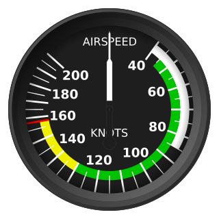
The knot is a unit of speed equal to one nautical mile per hour, exactly 1.852 km/h. The ISO standard symbol for the knot is kn. The same symbol is preferred by the Institute of Electrical and Electronics Engineers (IEEE); kt is also common, especially in aviation where it is the form recommended by the International Civil Aviation Organization (ICAO). The knot is a non-SI unit. Worldwide, the knot is used in meteorology, and in maritime and air navigation—for example, a vessel travelling at 1 knot along a meridian travels approximately one minute of geographic latitude in one hour.
- a. A communications and header section
Visual flight rules (VFR) are a set of regulations under which a pilot operates an aircraft in weather conditions generally clear enough to allow the pilot to see where the aircraft is going. Specifically, the weather must be better than basic VFR weather minima, i.e. in visual meteorological conditions (VMC), as specified in the rules of the relevant aviation authority. The pilot must be able to operate the aircraft with visual reference to the ground, and by visually avoiding obstructions and other aircraft.
An AIRMET, or Airmen's Meteorological Information, is a concise description of weather phenomena that are occurring or may occur (forecast) along an air route that may affect aircraft safety. Compared to SIGMETs, AIRMETs cover less severe weather: moderate turbulence and icing, sustained surface winds of 30 knots or more, or widespread restricted visibility.

Instrument flight rules (IFR) is one of two sets of regulations governing all aspects of civil aviation aircraft operations; the other is visual flight rules (VFR).
Some abbreviations that are used in FA's include:
- OCNL Occasional >50% chance for <1/2 of the forecast period
- ISOLD Isolated Single cells
- WDLY SCT Widely scattered <25% of the area affected
- SCT Scattered Areas of 25% to 54% of the area affected
- NMRS Numerous >55% of the area affected
- WDSPRD Widespread >55% of the area affected
Status of an FA can be:


