In aviation, instrument flight rules (IFR) is one of two sets of regulations governing all aspects of civil aviation aircraft operations; the other is visual flight rules (VFR).

The National Weather Service (NWS) is an agency of the United States federal government that is tasked with providing weather forecasts, warnings of hazardous weather, and other weather-related products to organizations and the public for the purposes of protection, safety, and general information. It is a part of the National Oceanic and Atmospheric Administration (NOAA) branch of the Department of Commerce, and is headquartered in Silver Spring, Maryland, within the Washington metropolitan area. The agency was known as the United States Weather Bureau from 1891 until it adopted its current name in 1970.

METAR is a format for reporting weather information. A METAR weather report is predominantly used by aircraft pilots, and by meteorologists, who use aggregated METAR information to assist in weather forecasting.
In meteorology and aviation, terminal aerodrome forecast (TAF) is a format for reporting weather forecast information, particularly as it relates to aviation.
A pilot report or PIREP is a report of actual flight or ground conditions encountered by an aircraft. Reports commonly include information about atmospheric conditions or airport conditions. This information is usually relayed by radio to the nearest ground station, but other options also exist in some regions. The message would then be encoded and relayed to other weather offices and air traffic service units.
Direct User Access Terminal Service (DUATS) was a weather information and flight plan processing service contracted by the Federal Aviation Administration (FAA) in 1989 for use by United States civil pilots and other authorized users. The DUAT Service was a telephone- and Internet-based system which allowed the pilot to use a personal computer for access to a Federal Aviation Administration (FAA) database to obtain weather and aeronautical information and to file, amend, and cancel domestic IFR and VFR flight plans. DUATS provided direct access to weather information via a National Airspace System (NAS) Data Interchange Network II (NADIN-II) interface to the Weather Message Switching Center Replacement (WMSCR) System and the Air traffic control (ATC) Facilities for filing flight plans. The pilot users could interface DUAT Services via the FTS-2001 toll free telephone numbers or via an Internet Interface into the Contractor's Facility. The service could be accessed by direct dial, and the Internet via Telnet or HTTP.

SIGMET, or Significant Meteorological Information, is a severe weather advisory that contains meteorological information concerning the safety of all aircraft. Compared to AIRMETs, SIGMETs cover more severe weather. Today, according to the advancement of technology in civil aviation, the SIGMET is sent as IWXXM model.

A flight dispatcher assists in planning flight paths, taking into account aircraft performance and loading, enroute winds, thunderstorm and turbulence forecasts, airspace restrictions, and airport conditions. Dispatchers also provide a flight following service and advise pilots if conditions change. They usually work in the operations center of the airline. In the United States and Canada, the flight dispatcher shares legal responsibility with the commander of the aircraft.
TAMDAR is a weather monitoring system that consists of an in situ atmospheric sensor mounted on commercial aircraft for data gathering. It collects information similar to that collected by radiosondes carried aloft by weather balloons. It was developed by AirDat LLC, which was acquired by Panasonic Avionics Corporation in April 2013 and was operated until October 2018 under the name Panasonic Weather Solutions. It is now owned by FLYHT Aerospace Solutions Ltd.
System Wide Information Management (SWIM) is a global Air Traffic Management (ATM) industry initiative to harmonize the exchange of Aeronautical, Weather and Flight information for all Airspace Users and Stakeholders. SWIM is an integral part of the International Civil Aviation Organization (ICAO) Global Air Navigation Plan (GANP). The GANP defines 4 Performance Improvement Areas (PIA), SWIM resides in PIA 2: Globally interoperable systems and data, where its implementation is further defined in Aviation System Block Upgrades (ASBU) B1-SWIM and B2-SWIM. ASBU B1-SWIM defines SWIM as a “a net-centric operation where the air traffic management (ATM) network is considered as a series of nodes, including the aircraft, providing or using information.” it goes on to say “The sharing of information of the required quality and timeliness in a secure environment is an essential enabler to the ATM target concept.”
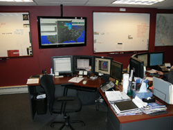
A Center Weather Service Unit (CWSU) is a National Weather Service (NWS) unit located inside each of the Federal Aviation Administration's 22 Air Route Traffic Control Centers (ARTCC).

An Aviation Area Forecast was a message product of the National Weather Service (NWS) in the United States. It has been replaced by Graphic Area Forecasts, or GFA, in 2017.

Airport weather stations are automated sensor suites which are designed to serve aviation and meteorological operations, weather forecasting and climatology. Automated airport weather stations have become part of the backbone of weather observing in the United States and Canada and are becoming increasingly more prevalent worldwide due to their efficiency and cost-savings.

Surface weather observations are the fundamental data used for safety as well as climatological reasons to forecast weather and issue warnings worldwide. They can be taken manually, by a weather observer, by computer through the use of automated weather stations, or in a hybrid scheme using weather observers to augment the otherwise automated weather station. The ICAO defines the International Standard Atmosphere (ISA), which is the model of the standard variation of pressure, temperature, density, and viscosity with altitude in the Earth's atmosphere, and is used to reduce a station pressure to sea level pressure. Airport observations can be transmitted worldwide through the use of the METAR observing code. Personal weather stations taking automated observations can transmit their data to the United States mesonet through the Citizen Weather Observer Program (CWOP), the UK Met Office through their Weather Observations Website (WOW), or internationally through the Weather Underground Internet site. A thirty-year average of a location's weather observations is traditionally used to determine the station's climate. In the US a network of Cooperative Observers make a daily record of summary weather and sometimes water level information.
A Volcanic Ash Advisory Center (VAAC) is a group of experts responsible for coordinating and disseminating information on atmospheric volcanic ash clouds that may endanger aviation. As at 2019, there are nine Volcanic Ash Advisory Centers located around the world, each one focusing on a particular geographical region. Their analyses are made public in the form of volcanic ash advisories (VAAs), involving expertise analysis of satellite observations, ground and pilot observations and interpretation of ash dispersion models.

Swiss International Air Lines Flight 850 was an international scheduled passenger flight from Basel, Switzerland, to Hamburg, Germany. On 10 July 2002, the flight was unable to land at Fuhlsbüttel Airport due to weather. Attempts were made to divert to other airports at Berlin and Eberswalde before the crew decided to land at Werneuchen. On landing, the aircraft struck an earth bank which ripped off all three undercarriage legs, and came to rest on its belly with an engine on fire. One of the sixteen passengers suffered minor injuries. The aircraft was written off.
ICAO Meteorological Information Exchange Model (IWXXM) is a format for reporting weather information in XML/GML. IWXXM includes XML/GML-based representations for products standardized in International Civil Aviation Organization (ICAO) Annex III, such as METAR/SPECI, TAF, SIGMET, AIRMET, Tropical Cyclone Advisory (TCA), Volcanic Ash Advisory (VAA), Space Weather Advisory and World Area Forecast System (WAFS) Significant Weather (SIGWX) Forecast. IWXXM products are used for operational exchanges of meteorological information for use in aviation.
The Weather Information Exchange Model (WXXM) is designed to enable the management and distribution of weather data in digital format (XML). WXXM version 2.0, set to be finalized in 2014, is based on Geography Markup Language (GML) and is one of the GML Application Schemas. It is being developed by the US Federal Aviation Administration (FAA) and the European Organisation for the Safety of Air Navigation (EUROCONTROL). WXXM is a member of a family of data models designed for use in aviation safety, notably Aeronautical Information Exchange Model (AIXM) and the Flight Information Exchange Model (FIXM).

Ryan International Airlines Flight 590 was a cargo flight carrying mail for the United States Postal Service from Greater Buffalo International Airport (BUF) in Buffalo, New York, to Indianapolis International Airport (IND) in Indiana, with a stopover at Cleveland Hopkins International Airport (CLE) in Cleveland, Ohio. On February 17, 1991, the McDonnell Douglas DC-9-15RC operating the flight crashed on takeoff from Cleveland during icing conditions. Both pilots, the aircraft's only occupants, were killed. The National Transportation Safety Board (NTSB) determined that the causes of the crash were the flight crew failing to deice their aircraft, and the inexperience of the Federal Aviation Administration (FAA), McDonnell Douglas, and Ryan International Airlines with icing condition on DC-9-10 aircraft.

The Aviation Weather Center (AWC) provides weather information and forecasts for air flights over United States territory and at certain altitudes for global traffic. It works with customers, such as commercial airlines, and international partners to improve flight safety and efficiency. It is one of the components of the National Centers for Environmental Prediction of the National Weather Service (NWS) of the United States.


