
Swaledale is a valley in North Yorkshire, England. It is one of the Yorkshire Dales, which are part of the Pennines, and within the Yorkshire Dales National Park. It is named after the River Swale, which runs through it. Swaledale is the most northerly of the major dales.
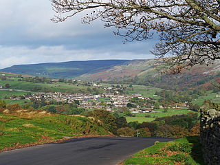
Reeth is a village 11 miles (18 km) west of Richmond in North Yorkshire, England, in the civil parish of Reeth, Fremington and Healaugh. Historically part of the North Riding of Yorkshire, it is the principal settlement of upper Swaledale.

Arkengarthdale is a dale, or valley, on the east side of the Pennines in North Yorkshire, England. Running roughly north-west to south-east, it is the valley of the Arkle Beck, and is the northernmost of the Yorkshire Dales. It is a subsidiary dale to Swaledale, which it joins at Reeth. The history of the dale, its people, and farming, lead mining, and local crafts is displayed and documented in the Swaledale Museum in Reeth.

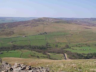
Fremington Edge is a 3-mile (5 km) long wall of crags and scree slopes that is situated to the north of the village of Reeth in Swaledale in the Yorkshire Dales National Park, England. Fremington Edge forms the south-eastern edge of Arkengarthdale, extending to the point where the dale meets Swaledale. Throughout its full length the Edge stays above the height of 1,300 feet (400 m) and reaches a highest point of 1,552 feet (473 m) at the northern end of the escarpment.

Marrick is a village and civil parish in the Richmondshire district of North Yorkshire, England, situated in lower Swaledale in the Yorkshire Dales National Park, the village is approximately 9 miles (14 km) west of Richmond. The parish of Marrick also includes the hamlets of Hurst and Washfold, according to the UK 2011 Census, the population of the parish was 148.
Calver Hill is a fell in the Yorkshire Dales National Park in North Yorkshire, England. It is composed of limestone and is situated at grid reference NZ012003, near where the valleys of Swaledale and Arkengarthdale meet, the village of Reeth is located on its lower south-eastern slopes, it reaches an altitude of 487 metres (1,598 ft) and is a distinguished feature in mid Swaledale. Calver Hill is an area of grouse shooting and the fell is dotted with grouse butts. Most of the drainage from the fell goes north and easterly to join the Arkle Beck in lower Arkengarthdale which eventually joins the River Swale just south of Reeth.

Ivelet is a hamlet in the Yorkshire Dales, North Yorkshire, England about a mile west of Gunnerside in Swaledale.

Satron is a hamlet in Swaledale, North Yorkshire, England. It lies 0.6 miles (1 km) south west of Gunnerside on the opposite bank of the River Swale. It is in the civil parish of Muker, but used to be in the ancient parish of Grinton.

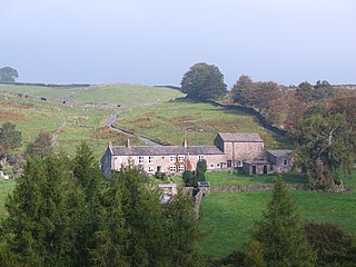
Kearton is a hamlet in the Yorkshire Dales, North Yorkshire, England. Kearton is situated near Low Row and Reeth.

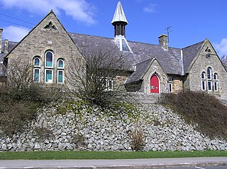
Healaugh is a small village in the civil parish of Reeth, Fremington and Healaugh, in Swaledale in the Yorkshire Dales. It is in the Richmondshire district of North Yorkshire, England and lies about 1 mile west of Reeth.

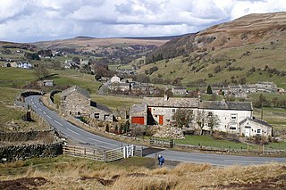
Fremington is a hamlet in the Yorkshire Dales in North Yorkshire, England. The hamlet is almost joined to Reeth and Grinton. It is split into Low Fremington which is built along the B6270 and High Fremington which is a scattering of houses running up towards Fremington Edge.
Whaw is a hamlet in Arkengarthdale in North Yorkshire, England. It is one of few settlements in the dale and is one of the smallest. Its name derives from the Old Norse of Kvi and Hagi, which means the enclosure of the sheep. It is about 2 miles (3.2 km) north of Langthwaite and 5 miles (8 km) north west of Reeth. The adjacent Arkle Beck Meadows form a Site of Special Scientific Interest.
Arkle Town is a hamlet in Arkengarthdale in the Richmondshire district of North Yorkshire, England. It is situated 0.4 miles (0.64 km) to the south of Langthwaite and 2.7 miles (4.3 km) north-west of Reeth.
Reeth, Fremington and Healaugh is a civil parish in North Yorkshire, England. It consists of the three villages of Reeth, Fremington and Healaugh.
Eskeleth is a hamlet in Arkengarthdale in North Yorkshire, England. It is in the Yorkshire Dales National Park. Eskeleth sits 4 miles (6.4 km) from the village of Reeth.
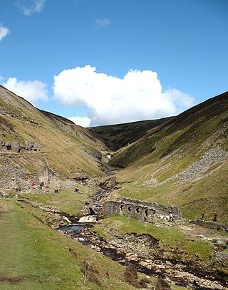
Gunnerside Gill is a small valley in the Yorkshire Dales, England, which branches off Swaledale into moorland to the north of Gunnerside.

Arkle Beck is the stream running through the valley of Arkengarthdale in the Yorkshire Dales, England. It is a tributary of the River Swale, which it joins just past Reeth at Grinton Bridge. The beck itself has several tributaries which include:

Ling Gill is a gill in the Yorkshire Dales in North Yorkshire, England. Cam Beck, a tributary of the River Ribble, flows through the gill.

New Forest is a civil parish in North Yorkshire, England. It lies 6 miles (10 km) west of Richmond.

Melbecks is a civil parish in North Yorkshire, England. It is located in upper Swaledale and covers the settlements of Gunnerside, Low Row, Feetham and Kearton.

