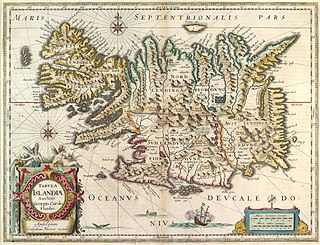
The recorded history of Iceland began with the settlement by Viking explorers and the people they enslaved from Western Europe, particularly in modern-day Norway and the British Isles, in the late ninth century. Iceland was still uninhabited long after the rest of Western Europe had been settled. Recorded settlement has conventionally been dated back to 874, although archaeological evidence indicates Gaelic monks from Ireland, known as papar according to sagas, may have settled Iceland earlier.
The Cod Wars were a series of 20th-century confrontations between the United Kingdom and Iceland about fishing rights in the North Atlantic. Each of the disputes ended with an Icelandic victory.

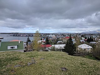
Hafnarfjörður, officially Hafnarfjarðarkaupstaður, is a port town and municipality in Iceland, located about 10 km (6 mi) south of Reykjavík. The municipality consists of two non-contiguous areas in the Capital Region, on the southwest coast of the country. At about 30,000 inhabitants, Hafnarfjörður is the third-most populous city in Iceland after Reykjavík and Kópavogur. It has established local industry and a variety of urban activities, with annual festival events.

Eldfell is a volcanic cone just over 200 metres (660 ft) high on the Icelandic island of Heimaey. It formed in a volcanic eruption which began without warning on the eastern side of Heimaey, in the Westman Islands, on 23 January 1973. The name means Hill of Fire in Icelandic.

Þingvellir was the site of the Alþing, the annual parliament of Iceland from the year 930 until the last session held at Þingvellir in 1798. Since 1881, the parliament has been located within Alþingishúsið in Reykjavík.

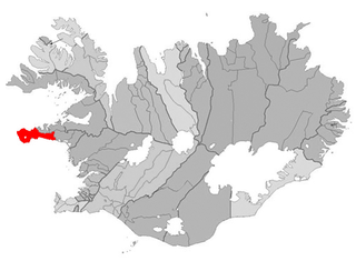
Stykkishólmur is a town and municipality situated in the western part of Iceland, in the northern part of the Snæfellsnes peninsula. It is a center of services and commerce for the area. Most of the people make their living from fishing and tourism. A ferry called Baldur goes over the Breiðafjörður fjord to the Westfjords. It also is the gateway to Flatey. The origin of Stykkishólmur can be traced to its natural harbor. The location became an important trading post early in Iceland's history: the first trading post in Stykkishólmur is traced back to the mid-16th century, even before Denmark implemented the Danish–Icelandic Trade Monopoly. From that time trading has been at the heart of the settlement's history. In 1828 Árni Thorlacius built a large house for his home and companies, the Norwegian house, which has been renovated and accommodates the local museum.

Ólafsvík is a small town in Iceland on the northern side of the Snæfellsnes Peninsula. At one point in the 17th and 18th centuries, commercial vessels sailed between Ólafsvík and Denmark, and the village was one of the larger trading ports in Iceland. Ólafsvík became certified trading place, authorized by the Danish King and Danish authorities, in 1687.

Grundarfjörður is a town in the north of the Snæfellsnes peninsula in the west of Iceland. It is situated between a mountain range and the sea. The nearby mountain Kirkjufell forms a small peninsula.

Fuglafjørður is a village on Eysturoy's east coast in the Faroe Islands. Its name means "fjord of birds".

Eyrarbakki is a fishing village on the south coast of Iceland with a population of about 570 people, not including inhabitants of the prison located there. The village is founded on the Great Þjórsá Lava.

Bíldudalur is a village situated on the coast of Arnarfjörður, one of the Westfjords in Iceland.

The cuisine of Iceland has a long history. Important parts of Icelandic cuisine are lamb, dairy, and fish, the latter due to the fact that Iceland has traditionally been inhabited only near its coastline. Popular foods in Iceland include skyr, hangikjöt, kleinur, laufabrauð, and bollur. Þorramatur is a traditional buffet served at midwinter festivals called Þorrablót; it includes a selection of traditionally cured meat and fish products served with rúgbrauð and brennivín. The flavors of this traditional country food originate in its preservation methods: pickling in fermented whey or brine, drying, and smoking.

Hofsós is one of the oldest trading ports in northern Iceland dating back to the 16th century. The tiny village Hofsós in the Northern Region in Iceland was a rather busy trading post in the 17th and 18th century, but despite the merchant activities this small village did not develop into a larger village or a town in the 20th century. Hofsós had all the historical prerequisites to become a large town. It was a trading post for the Danish Trade Monopoly, it was not far away from the fishing grounds, it was central in the region, and it had a relatively good landing spot for boats. The Drangey Exhibition is in Pakkhús, the Hofsós warehouse built in 1777, during the time of the trading monopoly. Massacre hill farm (Mannskaðaholl) at the south end of Lake Höfðavatn, is named for the massacre of English marauders, which took place there in 1431. Other services offered are accommodation in guesthouses, a restaurant, coffee-house, and a camping site. There are also pleasant walks along the shore with good examples of hexagonal basalt columns. Thorðarhöfði headland rises like an island some distance from the main shore. It is connected to land by low sandpits impounding a considerable lake with rich bird life and good trout fishing.

Kollafjørður is a village in the Faroe Islands, located on the island of Streymoy. As of 1. January 2024, the village had a population of 813. Its postal code is FO 410. Until 2001 it was a municipality in its own right but is now part of the Tórshavn Municipality. It is located 21.8 kilometres (13.5 mi) by road north of Tórshavn, and stretches 7 km (4.3 mi) along the fjord of the same name.

Búðir is a small hamlet in Búðahraun lava fields in Staðarsveit, which is in the western region of Iceland, on the westernmost tip of the Snaefellsnes peninsula where Hraunhafnará falls to the sea, the original old name of Búðir having been Hraunhöfn.

Brennisteinsfjöll is a minor volcanic system, with crater rows and small shield volcanoes on the Reykjanes Peninsula in southwest Iceland.

Hellnar is an ancient fishing village, a cluster of old houses and buildings situated close to Arnarstapi on the westernmost part of the Snæfellsnes peninsula, Iceland.

The Lóndrangar are a pair of rock pinnacles in Iceland. They are volcanic plugs of basalt, that have been hewn out from softer surrounding rock by erosion. At 75 and 61 m tall, they are a singular sight, rising above and outside the ocean front due east across from Malarrif and some 10 km from Hellnar, on the southern coast of Snæfellsnes peninsula. History has it that the taller of the cliffs was ascended in 1735, while the smaller one was not climbed until 1938.

The Reykjavik Maritime Museum, formerly Víkin Maritime Museum, is a maritime museum located by the old harbour in the capital of Iceland, Reykjavík and run by Reykjavik City. The museum was established in 2005, and it is now one of five sites belonging to Reykjavik City Museum. There are seven exhibitions at the museum displaying Icelandic maritime history from the early settlements to the late 20th century. An important part of the museum is the Coast Guard and rescue vessel Óðinn. In 2008, the ship was transformed into a museum exhibit about the cod wars in the 1950s and 1970s. The ship also tells about its own history. The museum focuses on the history of fishing in Iceland but also displays temporary exhibitions related to the sea.

Stóra-Eldborg undir Geitahlíð is a small Holocene volcano in Iceland, on Reykjanes peninsula, 50 m high, with a 30 m deep crater. It is located at about 5 km from Krýsuvík and as the name says at the foot of a bigger mountain, the tuya of Geitahlíð.


