Arorae Airport | |||||||||||
|---|---|---|---|---|---|---|---|---|---|---|---|
 | |||||||||||
| Summary | |||||||||||
| Airport type | Public | ||||||||||
| Serves | Arorae | ||||||||||
| Location | Tamaroa | ||||||||||
| Elevation AMSL | 6 ft / 2 m | ||||||||||
| Coordinates | 2°36′58.54″S176°48′7.56″E / 2.6162611°S 176.8021000°E | ||||||||||
| Map | |||||||||||
 AIS Location of the airport in Kiribati | |||||||||||
| Runways | |||||||||||
| |||||||||||
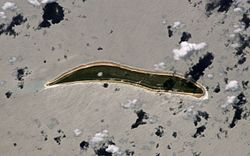
Arorae Airport( IATA : AIS, ICAO : NGTR) is the airport serving Arorae, Kiribati. It is located in the north of the island, north of the village of Tamaroa. [1]
Contents
The airport is served by Air Kiribati from Tabiteuea North Airport, which is connected with the international airport at South Tarawa, but lands at Tamana on its way from Arorae back to Tabiteuea North.