Recent events
On 10 July 2014 a group of soldiers who had deserted laid siege to the compound of the African Kongdai construction company between Aroyo and Awoda. They looted food and medicine from the clinics. The affected communities took refuge near government buildings. The soldiers looted food and other household items from the compound and from villages around Aroyo and Awoda, loading what they had taken into a stolen vehicle. The displaced people, numbering 270 households, made temporary settlements in land provided by the local government in Aroyo centre. Some are unable to return to their homes due to flooding and concerns that other rebel groups were coming and might attack them. They planned to stay until the end of the rainy season in November / December. Concerns included malaria and diarrhoea, lack of staff, food and plastic sheets to cover the temporary grass shelters, and poor latrines.
Aroyo was part of Aweil Center County, but in 2015 became the headquarter of Aroyo County in the new Aweil State. In August 2016 it was reported that the Commissioner of Arroyo County had no vehicle. The 2015 presidential decree that had divided up the states and counties in South Sudan had left many of the local governments without budgets and equipment. Some had no offices or vehicles.
In January 2017 Aroyo County received a shipment of 3-months supply of medicines from the health ministry in Juba. River blindness continued to be a concern, and had not been controlled by the state authorities or health non-governmental organizations.
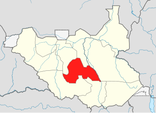
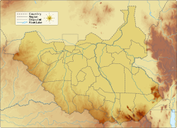
Lakes State is a state in South Sudan. It has an area of 43,595.08 km2. Rumbek is the capital of the state. Lakes is in the Bahr el Ghazal region of South Sudan, in addition to Northern Bahr el Ghazal, Western Bahr el Ghazal, and Warrap states. Bahr el Ghazal itself was a former province which was split from the Anglo-Egyptian mudiriyat, or province of Equatoria in 1948. The eastern border was the White Nile with Jonglei State on the opposite bank. To the northeast lied the Unity State. Other borders included Warrap State towards the northwest, Western Equatoria to the south and west, and Central Equatoria to the south.

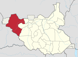
Northern Bahr el Ghazal(Arabic: ولاية شمال بحر الغزال) is a state in South Sudan. It has an area of 30,543 km2 and is part of the Bahr el Ghazal region. It borders East Darfur in Sudan to the north, Western Bahr el Ghazal to the west and south, and Warrap and the disputed region of Abyei to the east. Aweil is the capital of the state.

Wau is a city in northwestern South Sudan, on the western bank of the Jur River, that serves as capital for Western Bahr el Ghazal. It lies approximately 650 kilometres (400 mi) northwest of the capital Juba. A culturally, ethnically and linguistically diverse urban center and trading hub, Wau is also the former headquarters of Western Bahr el Ghazal. The city is a municipality since 2012 and is being govern by a mayor who is usually appointed by the governor of the state.

Aweil is a city in South Sudan and the capital of the Northern Bahr el Ghazal.
Raga is a town in South Sudan.
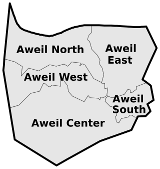
Aweil East County is a county in South Sudan.
Aweil West County is an administrative area in Northern Bahr el Ghazal, South Sudan.
University of Northern Bahr el Ghazal (UNBEG) is a university in South Sudan.
University of Bahr El-Ghazal (UBG) is a university in South Sudan located in Wau, the capital of Western Bahr El Ghazal State.
Rumbek University is a university in South Sudan.

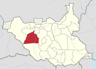
Aweil State was a state in South Sudan that existed between 2 October 2015 and 22 February 2020. It was located in the Bahr el Ghazal region and it borders Gogrial to the east, Lol to the west, Aweil East to the north, and Wau to the south. Its capital and largest city was Aweil.

Aweil East also known as Abiem, was a state in South Sudan that existed between 2 October 2015 and 22 February 2020. It had an estimated population of 571,728 people and an area of 6,172.23 KM square. It was located in northern-western South Sudan. Its capital and largest city was Wanyjok. The state is located in the Bahr el Ghazal region and it bordered Twic State and Gogrial State to the east, Aweil State to the south, Lol State to the west, the disputed Abyei State region to the northeast, and Sudan to the north.
The Lol State was a state of South Sudan with the capital in Raga, that existed between 2 October 2015 and 22 February 2020. It was located in the Bahr el Ghazal region, which is in the northwest section of the country. Lol state bordered Haut-Mbomou and Haute-Kotto in the Central African Republic to the west, South Darfur and East Darfur in Sudan to the north, the disputed region of Kafia Kingi to the northwest, Aweil East State to the northeast, Aweil State to the east, Gbudwe State to the south, and Wau State to the southeast. The state was created alongside 27 other states after a decree issuing the creation of 28 states took place. It was dissolved at the conclusion of the South Sudanese Civil War.
Wau State was a state in South Sudan that existed between 2 October 2015 and 22 February 2020. It was located in the Bahr el Ghazal region, and was part of the former state of Western Bahr el Ghazal. Wau State bordered Aweil State, Gbudwe State, Gogrial State, Lol State, and Tonj State.
The 2014 retreat from Western Bahr el Ghazal, also called the long march north, was an unorganized withdrawal by hundreds of Nuer Sudan People's Liberation Army (SPLA) deserters who sought to flee from Bahr el Ghazal to Sudan during the South Sudanese Civil War. After longstanding tensions between SPLA soldiers belonging to the Dinka and Nuer ethnic groups escalated on 25 April 2014, leading to a massacre of Nuer soldiers at Mapel in Western Bahr el Ghazal, a large number of Nuer SPLA soldiers deserted to escape ethnic prosecution and loyalist SPLA forces. Though some deserters joined SPLM-IO rebels or surrendered to the government, a large number of them marched northward, joined by other SPLA defectors from Northern Bahr el Ghazal. After covering over 400 kilometres (250 mi), this trek eventually arrived in Sudan on 4 August 2014, where they were disarmed.
Aweil South County, sometimes called Paliet, is an administrative area in Northern Bahr el Ghazal state, in the Bahr el Ghazal region of South Sudan, bordering Warrap State to the south. It is located in the southeastern part of NBGs. It is also known by the name Paliet, and one of the counties consisting of three major Dinka tribal groups: Ajak, Boncuai and Kongdeer. It was founded in 2000 and headquartered in Boncuai in a place called Mangar-Gier. In 2004, the headquarters were shifted to Malek Alel in Ajak. It is bordered to the north by Aweil East and to the west by Aweil Centre, to the south east by Gogrial State, and to the southwest by Western Barh el Ghazal state respectively.
This article lists events from the year 2019 in South Sudan
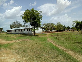
Awoda is a town in Northern Bahr el Ghazal, South Sudan.
Malualbaai Payam is one of the administrative payam of Aweil East County of South Sudan. It is located at the Eastern part of Wanyjok town.