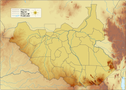
Western Bahr el Ghazal is a state in South Sudan. It has an area of 93,900 km2 (36,255 sq mi) and is the least populous state in South Sudan, according to the controversial Sudanese census conducted in 2008. It is part of the Bahr el Ghazal region. Its capital is Wau. The state shared international borders with Sudan to the north and the Central African Republic to the west. The portion now occupied by Raga County is the southern part of the historical region known as "Dar Fertit".

Northern Bahr el Ghazal(Arabic: ولاية شمال بحر الغزال) is a state in South Sudan. It has an area of 30,543 km2 and is part of the Bahr el Ghazal region. It borders East Darfur in Sudan to the north, Western Bahr el Ghazal to the west and south, and Warrap and the disputed region of Abyei to the east. Aweil is the capital of the state.
The Dinka people are a Nilotic ethnic group native to South Sudan. The Dinka mostly live along the Nile, from Mangalla-Bor to Renk, in the region of Bahr el Ghazal, Upper Nile, and the Abyei Area of the Ngok Dinka in South Sudan.

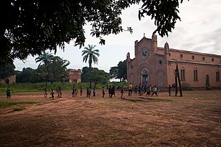
Wau is a city in northwestern South Sudan, on the western bank of the Jur River, that serves as capital for Western Bahr el Ghazal. It lies approximately 650 kilometres (400 mi) northwest of the capital Juba. A culturally, ethnically and linguistically diverse urban center and trading hub, Wau is also the former headquarters of Western Bahr el Ghazal. The city is a municipality since 2012 and is being govern by a mayor who is usually appointed by the governor of the state.
The famine in Sudan in 1998 was a humanitarian disaster caused mainly by human rights abuses, as well as drought and the failure of the international community to react to the famine risk with adequate speed. The worst affected area was Bahr el Ghazal in southwestern Sudan. In this region over 70,000 people died during the famine.
Deim Zubeir, from the Arabic ديم الزبير ["Daim az-Zubayr"], commonly translated as the "Camp of Zubeir", is the historically established but highly controversial name of Uyujuku town in the Western Bahr el Ghazal of the Republic of South Sudan, located in the Western Bahr El Ghazal part of the country, some 70 km from the border with the Central African Republic (CAR), near the Biri tributary of the River Chel.

Aweil is a city in South Sudan and the capital of the Northern Bahr el Ghazal.
Raga is a town in South Sudan.
Yulu is a Central Sudanic language spoken by the Yulu people of South Sudan and the Central African Republic (CAR). It has an estimated 7,000–13,000 speakers.
Ethnic violence in South Sudan has a long history among South Sudan's varied ethnic groups. South Sudan has 64 tribes with the largest being the Dinka, who constitute about 35% of the population and predominate in government. The second largest are the Nuers. Conflict is often aggravated among nomadic groups over the issue of cattle and grazing land and is part of the wider Sudanese nomadic conflicts.
The 2014 Bentiu massacre occurred on 15 April 2014 in the town of Bentiu, in the north of South Sudan, during the South Sudanese Civil War. The attack was described by The Economist as the "worst massacre" of the civil war.

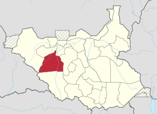
Raga County is a county in Western Bahr el Ghazal state, in the Bahr el Ghazal region of South Sudan. It is the largest county in the nation. In Arabic, Raga County can be known as "Raja".

Aweil State was a state in South Sudan that existed between 2 October 2015 and 22 February 2020. It was located in the Bahr el Ghazal region and it borders Gogrial to the east, Lol to the west, Aweil East to the north, and Wau to the south. Its capital and largest city was Aweil.
Wau State was a state in South Sudan that existed between 2 October 2015 and 22 February 2020. It was located in the Bahr el Ghazal region, and was part of the former state of Western Bahr el Ghazal. Wau State bordered Aweil State, Gbudwe State, Gogrial State, Lol State, and Tonj State.

Wau County is a county in Western Bahr el Ghazal state, in the Bahr el Ghazal region of South Sudan. Wau County was home to the state's capital, Wau. It is the most populous county in the state with over 232,910 people.

In the early months of 2017, parts of South Sudan experienced a famine following several years of instability in the country's food supply caused by war and drought. The famine, largely focused in the northern part of the country, affected an estimated five million people. In May 2017, the famine was officially declared to have weakened to a state of severe food insecurity.
The 2014 retreat from Western Bahr el Ghazal, also called the long march north, was an unorganized withdrawal by hundreds of Nuer Sudan People's Liberation Army (SPLA) deserters who sought to flee from Bahr el Ghazal to Sudan during the South Sudanese Civil War. After longstanding tensions between SPLA soldiers belonging to the Dinka and Nuer ethnic groups escalated on 25 April 2014, leading to a massacre of Nuer soldiers at Mapel in Western Bahr el Ghazal, a large number of Nuer SPLA soldiers deserted to escape ethnic prosecution and loyalist SPLA forces. Though some deserters joined SPLM-IO rebels or surrendered to the government, a large number of them marched northward, joined by other SPLA defectors from Northern Bahr el Ghazal. After covering over 400 kilometres (250 mi), this trek eventually arrived in Sudan on 4 August 2014, where they were disarmed.
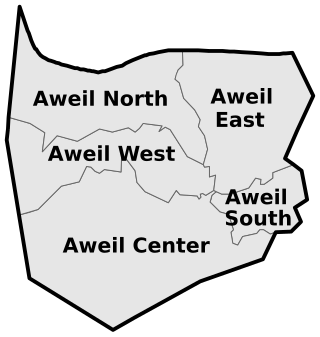
Aweil South County, sometimes called Paliet, is an administrative area in Northern Bahr el Ghazal state, in the Bahr el Ghazal region of South Sudan, bordering Warrap State to the south. It is located in the southeastern part of NBGs. It is also known by the name Paliet, and one of the counties consisting of three major Dinka tribal groups: Ajak, Boncuai and Kongdeer. It was founded in 2000 and headquartered in Boncuai in a place called Mangar-Gier. In 2004, the headquarters were shifted to Malek Alel in Ajak. It is bordered to the north by Aweil East and to the west by Aweil Centre, to the south east by Gogrial State, and to the southwest by Western Barh el Ghazal state respectively.
Areya is a town in Northern Bahr el Ghazal, South Sudan.
The Muraheleen, also known as al-Maraheel, were tribal militias primarily composed of Rizeigat and Messiria tribes from western Sudan. They were armed since 1983 by successive Sudanese government to suppress the insurgency of the Sudan People's Liberation Army (SPLA) during the Second Sudanese Civil War. Their activities included raiding Dinka villages, looting cattle, abducting women and children, scorched earth, and causing widespread destruction. The Muraheleen were notorious for their brutal tactics, which contributed to famine and displacement among the affected populations.