Kingston upon Thames is a town in the Royal Borough of Kingston upon Thames, South West London, England. It is situated on the River Thames and 10 miles (16 km) southwest of Charing Cross. It is notable as the ancient market town in which Saxon kings were crowned and today is the administrative centre of the Royal Borough.
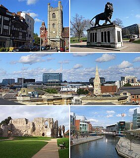
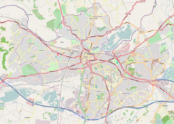
Reading is a town and borough in Berkshire, South-East England. Located in the Thames Valley at the confluence of the rivers Thames and Kennet, the Great Western Main Line railway and the M4 motorway serve the town. Reading is 40 miles (64 km) east of Swindon, 28 miles (45 km) south of Oxford, 40 miles (64 km) west of London, 15 miles (24 km) north of Basingstoke, 13 miles (21 km) southwest of Maidenhead and 15 miles (24 km) east of Newbury.

Berkshire is a historic county in South East England. One of the home counties, Berkshire was recognised by Queen Elizabeth II as the Royal County of Berkshire in 1957 because of the presence of Windsor Castle, and letters patent were issued in 1974. Berkshire is a county of historic origin, a ceremonial county and a non-metropolitan county without a county council. The county town is Reading.

Caversham is a suburb of Reading, England. Originally a village founded in the Middle Ages, it lies on the north bank of the River Thames, opposite the rest of Reading. Caversham Bridge, Reading Bridge, Christchurch Bridge, and Caversham Lock provide crossing points, with Sonning Bridge also available a few miles east of Caversham. Caversham has at Caversham Court foundations of a medieval house, a herb garden and tree-lined park open to the public at no charge. Caversham Lakes and marking its south and south-east border the Thames Path National Trail. Caversham rises from the River Thames, lying on flood plain and the lowest reaches of the Chiltern Hills.
Earley is a town and civil parish in the Borough of Wokingham, Berkshire, England. Along with the neighbouring town of Woodley. The Office for National Statistics places Earley within the Reading/Wokingham Urban Area; for the purposes of local government it falls within the Borough of Wokingham, outside the area of Reading Borough Council. The name is sometimes spelt Erleigh or Erlegh. The town consists of a number of smaller areas, including Maiden Erlegh and Lower Earley, and lies some 3 miles (5 km) south and east of the centre of Reading, and some 4 miles (6 km) northwest of Wokingham. It had a population of 32,036 at the 2011 Census.
Tilehurst is a suburb of the town of Reading in the English county of Berkshire. It lies to the west of the centre of Reading, and extends from the River Thames in the north to the A4 road in the south. The suburb is partly within the boundaries of the Borough of Reading and partly in the district of West Berkshire. The part within West Berkshire forms part of the civil parish of Tilehurst, which also includes the northern part of Calcot and a small rural area west of the suburb. The part within the Borough of Reading includes the Reading electoral ward of Tilehurst, together with parts of Kentwood and Norcot wards.

Reading Buses is a bus operator serving the towns of Reading, Bracknell, Newbury, Slough, Windsor, Maidenhead, Wokingham, Fleet, Henley-on-Thames and the surrounding areas in the counties of Berkshire, Oxfordshire, and Hampshire, England, as well as parts of Greater London. The operating company is officially known as Reading Transport Limited, and is owned by Reading Borough Council.

Theale is a large village and civil parish in West Berkshire, England, 5 miles (8 km) southwest of Reading and 10 miles (16 km) east of Thatcham. The compact parish is bounded to the south and south-east by the Kennet & Avon Canal, to the north by a golf course, to the east by the M4 motorway and to the west by the A340 road. The village's history is a good example of how different modes of transport have achieved dominance in England over the last three centuries, from road to canal to railway and back to road again.

Purley on Thames is a village and civil parish in Berkshire, England. Purley is centred 3 miles (4.8 km) north-west of Reading, 1 mile (1.6 km) east of Pangbourne, and 22 miles (35 km) south-east of Oxford. Consequently, Reading is the principal social, economic and cultural centre for the people of Purley. Historically, Purley comprised three separate manors and associated settlements. In the centre there is an historic area named variously Lething or Burley (Domesday) which accommodated traders and craftsmen alongside the main Reading to Oxford road.

Southcote is a suburb of Reading in the English county of Berkshire. Located to the south-west of Reading town centre, Southcote has a population of about 8,500. The settlement lies primarily between the London-to-Bath road and the River Kennet.

Reading Borough Council is the local authority for the Borough of Reading in the English county of Berkshire. It is a unitary authority, having the powers of a non-metropolitan county and district council combined. Berkshire is purely a ceremonial county, with no administrative responsibilities.

Norcot is an area of the suburb of Tilehurst in the town of Reading, in the English county of Berkshire. It is also an electoral ward of the Borough of Reading.

West Reading is a locality or informal subdivision of the town of Reading in the English county of Berkshire, with its own railway station which opened in 1906, by which time its main roads were an established housing area. West Reading is one of multiple suburbs of Reading such as Tilehurst and Whitley.
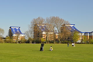
King's Meadow is a park in Reading, Berkshire, England, located next to the River Thames. It stretches from the Coal Woodland to King's Meadow Road near Reading Bridge. The Thames Path long distance footpath runs through the length of King's Meadow, which is visible from the railway when entering or leaving Reading railway station from the eastern side.

Bath Road Reservoir is an underground reservoir complex in the town of Reading in the English county of Berkshire. Located to the North-West of the Bath Road in West Reading, the complex covers 5.38 acres (2.18 ha). It comprises two underground reservoirs, covered entirely by vegetation, together with a water tower that is listed as a grade II listed building.

Tilehurst Water Tower, is a distinctive water tower in Tilehurst, a suburb of the English town of Reading. People from Reading know they are near home when they are coming eastbound along the M4 and they can see the top of the tower. Although in recent years with the growth of trees this has become more difficult. It is a prominent landmark in the vicinity and, located on the Tilehurst ridge line, can be seen from a considerable distance, especially when approaching Reading from the west along the M4 motorway.
Kentwood is an electoral ward of the Borough of Reading, in the English county of Berkshire. It consists of the northern part of the suburb of Tilehurst, in the west of Reading, south of the River Thames. The ward is bordered by Caversham Heights and Battle wards to the east, and Norcot and Tilehurst wards to the south. To the west the ward is bordered by the reduced civil parish of Tilehurst in the district of West Berkshire which is the remainder of the larger ancient parish, before the expansion of the Borough of Reading. The ward has schools and churches bearing a Tilehurst, rather than Reading name.

Coley is an electoral ward of the Borough of Reading, in the English county of Berkshire. Until the 2022 Reading Borough Council election, it was known as Minster ward and had slightly different boundaries.

The following is a timeline of the history of Reading, the county town of Berkshire in England.

Christchurch Meadows is a park in Reading, Berkshire, England, located next to the River Thames. It stretches along the north (Caversham) side of the river, between Caversham Bridge and Reading Bridge, and is linked to the south (Reading) bank by the Christchurch Bridge, a pedestrian and cycle bridge built in 2015. The name of the meadow derives from Christ Church in Oxford, whose dean owned 25 acres (10 ha) of farmland in Reading.