Ashgrove Loch | |
---|---|
Stevenston Loch | |
Location | Scottish Lowlands |
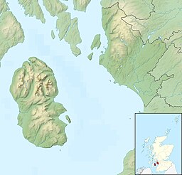
Coordinates | 55°39′42″N4°44′38″W / 55.66167°N 4.74389°W |
Primary outflows | Loch Canal |
Basin countries | Scotland, United Kingdom |
Max. length | 540 m (1,770 ft) |
Max. width | 300 m (980 ft) |
Surface elevation | 54 m (177 ft) |
Ashgrove Loch, also known as Stevenston Loch, is a mesotrophic lochan [1] (small loch) in North Ayrshire, Scotland, approximately 2 km northeast of the town of Stevenston.
Due to artificial drains, known as cunnels, [2] approximately 90% of the lochan's surface is covered by floating vegetation and is classed as a fen. The lochan sustains rich plant life, including two rare species, Lysimachia thyrsiflora and Cicuta virosa . [1]
Many bird species also use the lochan, including the grass and sedge warblers. [1]
Ashgrove Loch sits on a bed of Carboniferous limestone [3] and thus has a high mineral content. [1]
The lochan's primary outflow, Loch Canal, is an artificial burn regulated by a sluice at Lochend, having previously powered a watermill there. [4]
In 1868, archaeologist John Smith discovered a crannog on the loch's east shore, roughly 22 m in diameter. Several tools were found within the site, which were transferred to the National Museum of Antiquities. Since its initial excavation in the 19th century, the crannog has fallen into disrepair and no longer resembles its original state. [5]
While Smith claimed to have found evidence of five more crannogs at the lochan's south end in 1894, aerial surveys in 1982 revealed nothing of significance. [5]
A crannog is typically a partially or entirely artificial island, usually built in lakes and estuarine waters of Scotland, Wales, and Ireland. Unlike the prehistoric pile dwellings around the Alps, which were built on the shores and not inundated until later, crannogs were built in the water, thus forming artificial islands.
Stevenston is a town and parish in North Ayrshire, Scotland. Along with Ardrossan and Saltcoats it is one of the "Three Towns", all of similar size, on the Firth of Clyde coast; the easternmost parts of Stevenston are about 1⁄2 mile from western parts of Kilwinning, the A78 trunk road runs between the settlements.
Kenmore is a small village in Perthshire, in the Highlands of Scotland, located where Loch Tay drains into the River Tay.
Mochrum is a coastal civil and Church of Scotland parish situated to the east of Luce Bay on the Machars peninsula and 8 miles (13 km) southwest of Wigtown and in the historical county of Wigtownshire in Galloway, Scotland. It covers 22,000 acres (8,900 ha) and is approximately 10 miles (16 km) in length and 5 miles (8.0 km) in breadth. The parish contains the eponymous village of Mochrum, as well as Port William and the clachan of Elrig.
Gateside is a small village in North Ayrshire, Scotland about 1⁄2 mile east of Beith on the B777.
Loch Kinord is a small, freshwater loch at Muir of Dinnet, Aberdeenshire, Scotland just north of the River Dee and 5 mi (8 km) east of Ballater. The loch is also known as Loch Ceander and Loch Cannor. It is approximately 1 mi (1.6 km) in length and was formed from a glacial kettle hole. The loch sits within the Muir of Dinnet National Nature Reserve and is immediately south of Loch Davan.
Clairinsh or Clairinch is an island in Loch Lomond, central Scotland.
Ardeer was a small town now officially incorporated into Stevenston on the Ardeer peninsula, in the parish of Stevenston, North Ayrshire, originally an island and later its extensive sand dune system became the site of Nobel Explosives, a dominant global supplier of explosives to the mining and quarrying industries and a major player in the design and development of products for the chemical and defence industries during the 20th century. The peninsula is now part of North Ayrshire's most important area for Biodiversity.
Lochlea or Lochlie was situated in a low-lying area between the farms and dwellings of Lochlea and Lochside in the Parish of Tarbolton, South Ayrshire, Scotland. The loch was natural, sitting in a hollow created by glaciation. The loch waters ultimately drained via Fail Loch, the Mill Burn, and the Water of Fail. It is well-documented due to the presence of a crannog that was excavated and documented circa 1878, and its association with the poet Robert Burns, who lived here for several years whilst his father was the tenant. Lochlea lies 2+1⁄2 miles northeast of Tarbolton, and just over three miles northwest of Mauchline.
Buiston Loch, also known as Buston, Biston and Mid Buiston, was situated in the mid-Ayrshire clayland at an altitude of 90 m OD. The loch was natural, sitting in a hollow created by glaciation. The loch waters drained via the Garrier Burn that joins the Bracken and Lochridge Burns before joining the River Irvine.
The Lands of Ashgrove, previously known as Ashenyards, formed a small estate in the Parish of Kilwinning, North Ayrshire, lying between Kilwinning and Stevenston. The Georgian mansion house was demolished in 1960, the substantial walled garden survives.
Lochspouts Loch or Lochspouts was situated in a hollow, surrounded by hilly ground on three sides and bounded by a narrow trap dyke to the north. The land was once held by the Ferguson family of Kilkerran and lies in the Parish of Kirkoswald, South Ayrshire, Scotland. The loch became a reservoir in the 19th century.
Lowes Loch, The Lochs or Loch of Hill is now a small natural freshwater loch in the North Ayrshire Council Areas, Scotland, lying in a glacial kettle hole, once of greater extent, lying below Brownmuir and Lochland Hills on the Threepwood Road, near Beith, in the Parish of Beith. The loch may once have had a small island within it.
Inch is a civil parish in Dumfries and Galloway, southwest Scotland. It lies on the shore of Loch Ryan, in the traditional county of Wigtownshire.
Old Luce is a civil parish in Dumfries and Galloway, Scotland. It lies in the Machars peninsula, in the traditional county of Wigtownshire. The parish is around 10 miles (16 km) long and 8 miles (13 km) broad, and contains 40,350 acres (16,330 ha).
Loch Calder is a lowland freshwater loch lying approximately 5 mi (8.0 km) south west of Thurso in the Scottish Highlands. The loch is large with an irregular shape and has perimeter of 12.8 km (8.0 mi). It is approximately 2.33 mi (3.75 km) long, has an average depth of 21 ft (6.4 m) and is 85 ft (26 m) at its deepest. The loch was surveyed on 6 October 1902 by John Parsons and T.R.H. Garrett and later charted as part of Sir John Murray's Bathymetrical Survey of Fresh-Water Lochs of Scotland 1897-1909.
Milton Loch is an alkaline freshwater loch located in Dumfries and Galloway, Scotland. In the loch and nearby are archaeological sites including three crannogs.
Loch Airigh an Eilein is a lochan in Wester Ross, Scotland roughly 4 km northwest of the scattered crofting settlement of Inverasdale.
Akermoor Loch is a remote upland lochan in Selkirkshire, Scotland, approximately 6.5 kilometres (4.0 mi) west of the village of Ashkirk.